Manchester in Coffee County, Tennessee — The American South (East South Central)
The "Moat" is an Adandoned River Channel
| — | The Old Stone Fort State Archaeological Park | — |
Photographed by Darren Jefferson Clay, June 28, 2025
1. The "Moat" is an Adandoned River Channel Marker
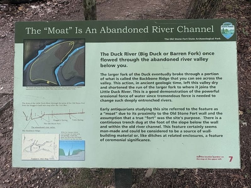
The larger fork of the Duck eventually broke through a portion of what is called the Backbone Ridge that you can see across the valley. This action, in ancient geologic time, left this valley dry and shortened the run of the larger fork to where it joins the Little Duck River. This is a good demonstration of the powerful erosional force of water since tremendous force is needed to change such deeply entrenched rivers.
Early antiquarians studying this site referred to the feature as a "moat" due to its proximity to the Old Stone Fort wall and the assumption that a true "fort" was the site's purpose. There is a continuous trench dug at the foot of the slope below the wall and within the old river channel. This feature certainly seems man-made and could be considered to be a source of wall-building material or, like ditches at related enclosures, a feature of ceremonial significance.
Erected by Tennessee State Parks. (Marker Number 7.)
Topics. This historical marker is listed in these topic lists: Environment •
this page online
Location. 35° 29.359′ N, 86° 6.729′ W. Marker is in Manchester, Tennessee, in Coffee County. It can be reached from Stone Fort Dr south of U.S. 41, on the right when traveling west. Touch for map. Marker is in this post office area: Manchester TN 37355, United States of America. Touch for directions.

Regionally, this marker is in Middle Tennessee and in the Highland Rim. It is also in the American South and specifically in the Upper South. Globally, it is in North America, the Western Hemisphere, the Western World, and the Anglosphere. Historically, it finds itself in what was once the territory of the Mississippian Culture, one of the Confederate States of America, and the Antebellum South.
Other nearby markers. At least 8 other markers are within walking distance of this marker: The Escarpment (about 400 feet away, measured in a direct line); Granny Hickerson Cemetery (approx. 0.3 miles away); The Uses of Water in Different Cultures (approx. 0.4 miles away); The Old Stone Fort and the Stone Fort Paper Co. (approx.
Photographed by Darren Jefferson Clay, June 28, 2025
2. The "Moat" is an Adandoned River Channel Marker
Credits. This page was last revised on July 8, 2025. It was originally submitted on July 6, 2025, by Darren Jefferson Clay of Duluth, Georgia. This page has been viewed 84 times since then and 24 times this year. Photos: 1, 2. submitted on July 6, 2025, by Darren Jefferson Clay of Duluth, Georgia. • James Hulse was the editor who published this page.
