Crow Wing in Crow Wing County, Minnesota — The American Midwest (Upper Plains)
Land in the Middle
Photographed by McGhiever, June 28, 2025
1. Land in the Middle Marker
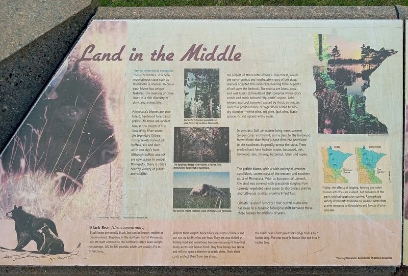
Having three major ecological zones, or biomes, in a non-mountainous state such as Minnesota is unusual. Because each biome has unique features, the meeting of three leads to a rich diversity of plant and animal life.
Minnesota's biomes are pine forest, hardwood forest and prairie. All three are evident here at the mouth of the Crow Wing River where the legendary Ojibwe hunter No-Ka harvested buffalo, elk and deer all in one day's hunt. Although buffalo and elk are now scarce in central Minnesota, there is still a healthy variety of plants and wildlife.
Red and white pines populate the pine forests of northern Minnesota. The hardwood forest biome forms a ribbon from Minnesota's northwest to southeast.
The prairie region contains most of Minnesota's farmland.
The largest of Minnesota's biomes, pine forest, covers the north-central and northeastern part of the state. Glaciers sculpted this landscape, leaving thick deposits of soil over the bedrock. The results are lakes, bogs and vast tracts of forestland that comprise Minnesota's scenic and much beloved "Up North" region. Cold winters and cool summers caused
this page online
In contrast, Gulf air masses bring warm summer temperatures and humid, sunny days to the hardwood forest biome that forms a band from the northwest to the southeast diagonally across the state. Trees predominant here include maple, basswood, oak, ironwood, elm, hickory, butternut, birch and aspen.
The prairie biome, with a wide variety of weather conditions, covers most of the western and southern parts of Minnesota. Prior to European settlement, the land was covered with grasslands ranging from sparsely vegetated sand dunes to short-grass prairies and tall-grass prairies growing 8 feet tall.
Climatic research indicates that central Minnesota has been in a dynamic biological shift between these three biomes for millions of years.
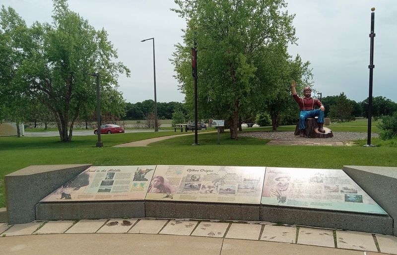
Today, the effects of logging, farming and other human activities are evident, but remnants of the area's original vegetation survive. A remarkable variety of habitats favorable to wildlife exists from prairie remnants to floodplains andforests of pine and oak.Photographed by McGhiever, June 28, 20252. Land in the Middle Marker (left) at the Brainerd Lakes Welcome Center
Black Bear (Ursus americanus)
Black bears are usually black, but can be brown, reddish or cream-colored. They live in the northern half of Minnesota but re most common in the northeast. Black bears weigh, on average, 100 to 300 pounds; adults are usually 4½ to 5 feet long.
Despite their weight, black bears are skillful climbers and can run up to 25 miles per hour. They are also skilled at finding food and sometimes become nuisances if they find easily accessible human food. They love honey bee larvae and will rip open a beehive to reach them. Their thick coats protect them from bee stings.
The black bear's front paw tracks range from 4 to 5 inches long. The rear track is human-like and 6 to 9 inches long.
Topics. This historical marker is listed in these topic lists: Environment • Indigenous Peoples and Communities.
Location. 46° 15.626′ N, 94° 19.157′ W. Marker is in Crow Wing, Minnesota, in Crow Wing County. It can be reached from the intersection of N. Koering Road and Minnesota Highway 371. The marker is at the Explore Brainerd Lakes Welcome Center and Rest Area. Touch for map. Marker is at or near this postal address: 7053 N Koering Road, Brainerd MN 56401, United States of America. Touch for directions.

Regionally, this marker is in the Northland. It is also in the American Midwest, in the Corn Belt, and in the Great River Road Region. Globally, it is in North America, the Great North Woods, the Western Hemisphere, the Western World, and the Anglosphere. Historically, it finds itself in what was once Rupert’s Land, the territory of the Mississippian Culture, and the Northwest Territory.
Other nearby markers. At least 8 other markers are within walking distance of this marker: Ojibwe Origins (here, next to this marker); Roughnecks and River Pigs (here, next to this marker); Paul Bunyan Statue (a few steps from this marker); Lakes on the Plains (a few steps from this marker); Hunting Hospitality (a few steps from this marker); Lumberjack Legend (a few steps from this marker); Entrepreneurs and Upstarts (a few steps from this marker); Mississippi Crossings (within shouting distance of this marker). Touch for a list and map of all markers in Crow Wing.
Credits. This page was last revised on July 6, 2025. It was originally submitted on July 6, 2025, by McGhiever of Minneapolis, Minnesota. This page has been viewed 95 times since then and 13 times this year. Photos: 1, 2. submitted on July 6, 2025, by McGhiever of Minneapolis, Minnesota.
