Eden in Weber County, Utah — The American Mountains (Southwest)
Indian Trails Monument
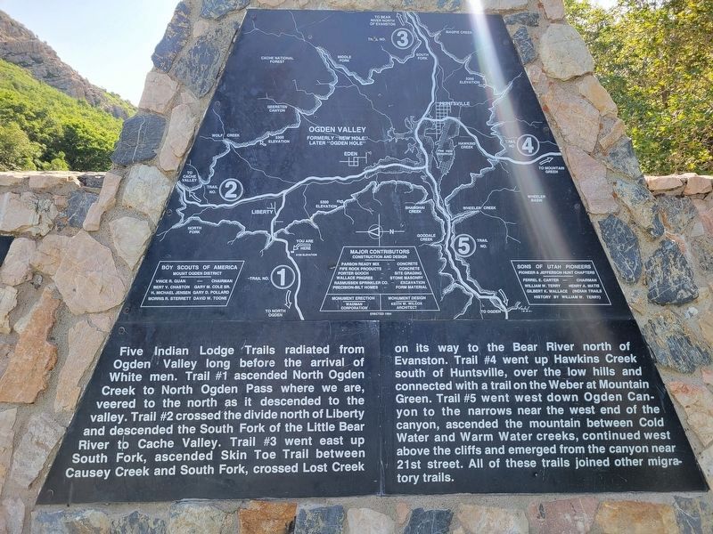
Photographed by Jeremy Snow, June 21, 2025
1. Indian Trails Monument Marker, Panel 1
Early Explorations
Indian bands of the Shoshone Tribe were located throughout northern Utah, southern Idaho and western Wyoming long before the advent of the white men. Northern Utah was inhabited by hunting and wild berry-pinenuts-roots gathering bands of the Northwest Shoshones and some Ute Indians. The Indians wandered from area to area on a network
this page online
Pathfinders, trappers and explorers followed the well worn Indian trails through Utah Territory. In May 1825 Peter Skene Ogden of the Hudson's Bay Company led a party of trappers south from Cache Valley on Trail #2 and in seven days the party took 585 beaver pelts in New Hole as Ogden called the valley. The Ogden party left New Hole and followed Trail #4 south to the Weber River. After a skirmish with some American trappers at Mountain Green Ogden retraced his steps north, never descending to the lower valley. Mountain men called the valley Ogden Hole, such men as Smith, Fitzpatrick, Weber, Sublette, Bridger, Russell, Clyman and Goodyear. In 1843 John C. Fremont and his expedition traveled south on an Indian trail from Fort Hall, arriving at the Weber River they launched a boat and visited the island in the Great Salt Lake which now bears his name. In 1849 Capt. J. Howard Stansbury led an expedition of Topographical Engineers of the U.S. Army to the west. He left the Donner Trail I south of Evanston and descended the Bear River until he found "an Indian lodge trail” going west (Trail #3). "We soon arrived at the headwaters of Pumbar (Lost) Creek, a tributary of the Weber". The party took Trail #1 west
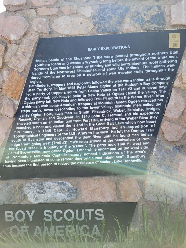
Photographed by Jeremy Snow, June 21, 2025
2. Indian Trails Monument Marker, Panel 2
Pioneer Settlements
Brigham Young learned much about the geography of the region near the Great Salt Lake from the writings of a few of the mountain men and from interviews with others. Soon after the arrival of the first company of Mormon Pioneers in the "valley" in July 1847 Brigham Young sent exploring parties north and south along the Indian trails west of the Wasatch Mountains to locate places for settlements. One of these parties contacted Miles Goodyear ar Fort Buenaventura. In 1848 Brigham Young sent a party to explore the country around Bear Lake. Trail #3 up South Fork on their way to Bear Lake. In 1854 Brigham Young sent an expedition over Trail #1 to find a shorter route to Fort Bridger for the settlers near Ogden so that they would not need to go via Salt Lake City. This expedition took the first wagon into the valley (Ogden Hole) Carles F. Middleton wrote, "The first wagon that was taken into the valley was taken by hand of man.
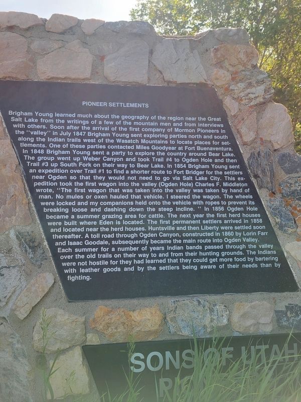
Photographed by Jeremy Snow, June 21, 2025
3. Indian Trails Monument Marker, Panel 3
Topics. This historical marker and monument is listed in these topic lists: Exploration • Indigenous Peoples and Communities • Roads & Vehicles • Settlements & Settlers.
Location. 41° 19.231′ N, 111° 53.916′ W. Marker is in Eden, Utah, in Weber County. It is on East North Ogden Canyon
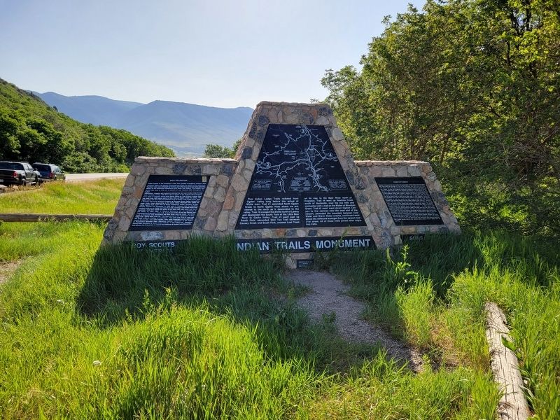
Photographed by Jeremy Snow, June 21, 2025
4. Indian Trails Monument

Regionally, this marker and monument is in the Wasatch Front and in Greater Salt Lake. It is also in the American Mountain West and on the Colorado Plateau. Globally, it is in North America, the Rocky Mountains, the Western Hemisphere, the Western World, and the Anglosphere. Historically, it finds itself in what was once New Spain and also Mexico’s Alta California.
Other nearby markers. At least 8 other markers are within 5 miles of this marker, measured as the crow flies: Liberty (approx. 2 miles away); North Ogden (approx. 3.4 miles away); J.M. Wilbur Company Blacksmith Shop (approx. 4.6 miles away); Settlement of Eden (approx. 4.6 miles away); Eden World War II Memorial (approx. 4.6 miles away); Early Life in Eden (approx. 4.6 miles away); David Eccles / Northwestern Shoshone--Early Sojourners of Ogden Valley (approx. 4.6 miles away); Eden's Founding (approx. 4.6 miles away). Touch for a list and map of all markers in Eden.
Credits. This page was last revised on July 23, 2025. It was originally submitted on July 6, 2025, by Jeremy Snow of Cedar City, Utah. This page has been viewed 370 times since then and 160 times this year. Photos: 1, 2, 3, 4. submitted on July 6, 2025, by Jeremy Snow of Cedar City, Utah. • Andrew Ruppenstein was the editor who published this page.
