Leesburg in Loudoun County, Virginia — The American South (Mid-Atlantic)
Leesburg Potter's Field
Established 1839 - Reburials 1983 & 2022
Photographed by Craig Swain, June 2, 2025
1. Leesburg Potter's Field Marker
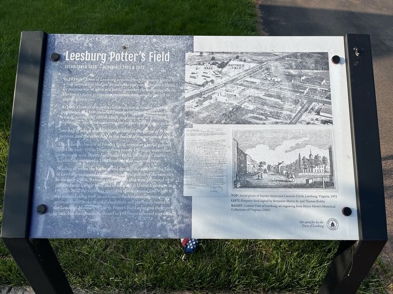
In 1839 the Town of Leesburg acquired from Benjamin Shreve Sr. a half-acre tract of land on the turnpike just east of the town limits. Its purpose was to serve as a public cemetery for indigent citizens. The town's more prosperous residents were usually buried in church cemeteries.
As both a county seat and a crossroads town, Leesburg's 1840 population of 1,600 included a number of poorer white residents, a small community of free black residents, and an enslaved population. The deed conveying the property made clear its use.
"one half of which shall be appropriated to the burial of White persons, and the other half to the burial of free persons of color."
The cemetery, known as Potter's Field, served as a burial ground until the early 1950s. During those nearly 130 years, more than 300 people were interred at Potter's Field, including Charles Craven, the victim of a 1902 lynching that occurred there.
Needing to widen the highway and develop the property, the Town of Leesburg sponsored an archaeological excavation of the cemetery in the early 1980s. Remains and artifacts that were recovered were gathered into
this page online
Erected 2023 by Town of Leesburg.
Topics. This historical marker is listed in these topic lists: African Americans • Cemeteries & Burial Sites. A significant historical year for this entry is 1839.
Location. 39° 7.403′ N, 77° 34.03′ W. Marker is in Leesburg, Virginia, in Loudoun County. It can be reached from Old Waterford Road, on the right when traveling north. Located at the very back section of Union Cemetery. The marker cannot be reached directly from the road. Rather reached by entering the cemetery from an entrance on King Street (Next to the nearby Charles Fenton Mercer marker). Touch for map. Marker is at or near this postal address: 380 Old Waterford Rd NW, Leesburg VA 20176, United States of America. Touch for directions.

Regionally, this
Photographed by Craig Swain, June 2, 2025
2. Leesburg Potter's Field Memorial and Marker
Other nearby markers. At least 8 other markers are within walking distance of this marker: Haud Pluribus Impar (approx. 0.2 miles away); Toby Atwell Field (approx. ¼ mile away); Charles Fenton Mercer (approx. 0.3 miles away); Fighting for Freedom (approx. 0.4 miles away); Capt. Wright Brickell (approx. 0.4 miles away); Mrs. Sarah Armat (approx. 0.4 miles away); In Memory of Richard Owings (approx. 0.4 miles away); Glenfiddich House (approx. 0.4 miles away). Touch for a list and map of all markers in Leesburg.
Photographed by Craig Swain, June 2, 2025
3. Illustrations on the Lower Right
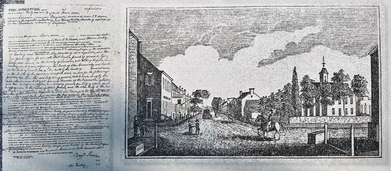
To the left of this photo is a "Property deed signed by Benjamin Shreve Sr. and Thomas Birkby". On the right is a "Central View of Leesburg, an engraving from Henry Howe's Historical Collections of Virginia (1845)".
Photographed by Craig Swain, June 2, 2025
4. Aerial Photo of Leesburg
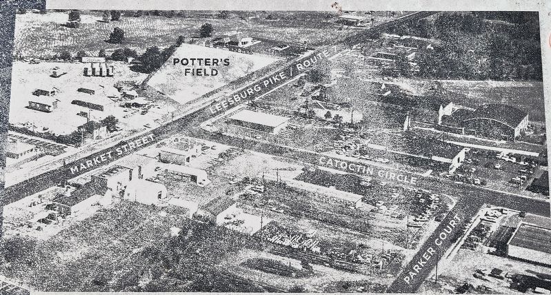
"Aerial photo of Market Street and Catoctin Circle, Leesburg, Virginia, 1972." The photo indicates the intersection of the Leesburg Turnpike (mentioned on the marker text, which becomes Market Street when entering town) and Catoctin Circle. Potter's Field is drawn in a trapezoid shape extending to the east (upper part of photo) beyond the pike. Note at the time of the photo in 1972 the area beside Potter's Field was used for storage and trailer staging. Several buildings from the 1972 photograph, including those of Frederick Douglass Elementary School, stand today. But the area of the field is now occupied by fast food restaurants and retail stores.
Photographed by Craig Swain, June 2, 2025
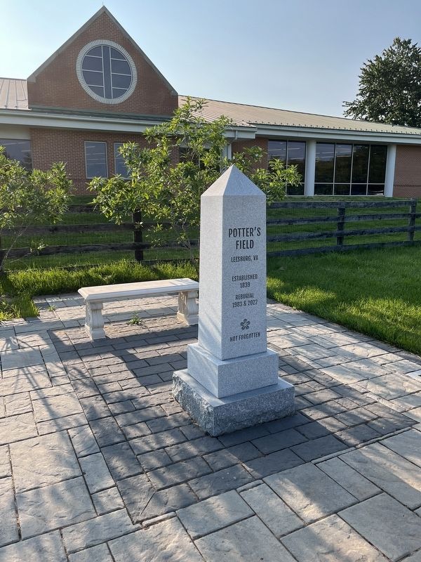
5. Memorial to Potter's Field
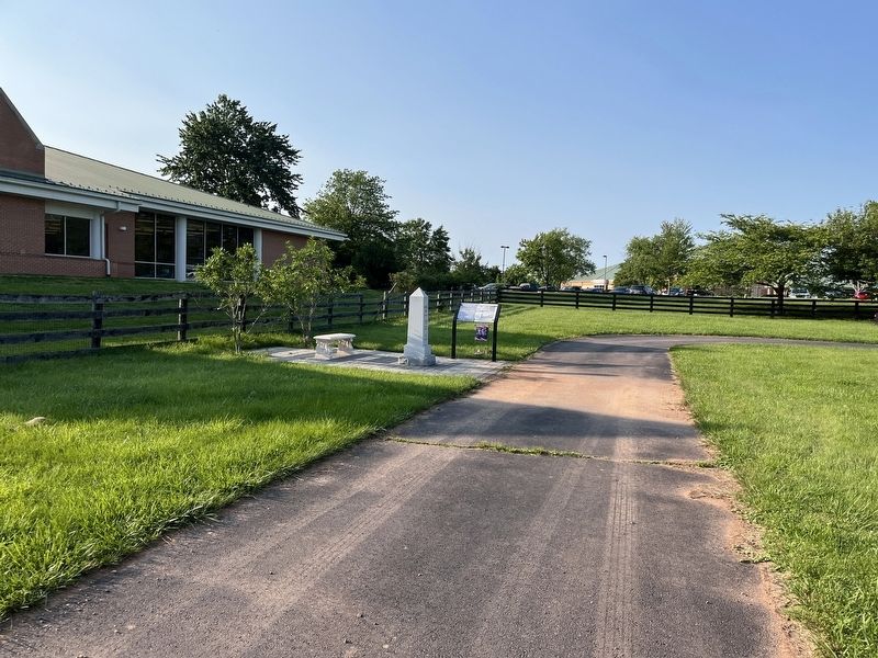
The memorial reads: Potter's Field
Leesburg, VA
Established 1839
Reburial 1983 & 2022
Not Forgotten
Leesburg, VA
Established 1839
Reburial 1983 & 2022
Not Forgotten
Photographed by Craig Swain, July 6, 2025
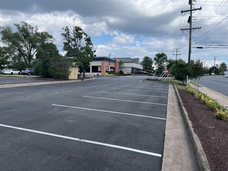
6. Potter’s Field Today
Looking from the northwest corner of the location of Potter’s Field today, with Market Street/Leesburg Pike (Virginia Highway 7) on the right of frame. The photo was taken near the intersection with Catoctin Circle, about a mile southeast from the marker.
Photographed by Craig Swain, June 2, 2025
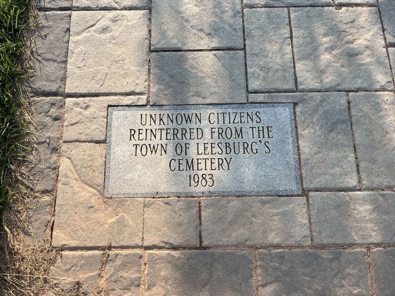
7. Vault
Unknown citizens reinterred from the Town of Leesburg's Cemetery 1983
Credits. This page was last revised on July 28, 2025. It was originally submitted on July 6, 2025, by Craig Swain of Leesburg, Virginia. This page has been viewed 225 times since then and 51 times this year. Last updated on July 7, 2025, by Gianluca De Fazio of Harrisonburg, Virginia. Photos: 1, 2, 3, 4, 5, 6, 7. submitted on July 6, 2025, by Craig Swain of Leesburg, Virginia. • Bernard Fisher was the editor who published this page.
