
Rapid City in Pennington County, South Dakota — The American Midwest (Upper Plains)
Measuring Gage Shut Down
Remembrance and Renewal
| — | Rapid City Flood of 1972 | — |
October 16, 2021
1. Measuring Gage Shut Down Marker
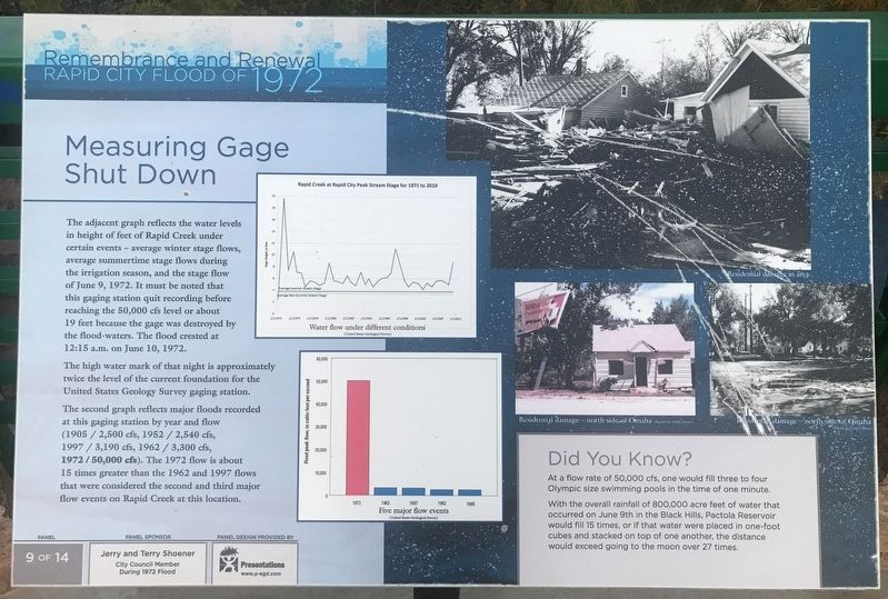
The adjacent graph reflects the water levels in height of feet of Rapid Creek under certain events — average winter stage flows, average summertime stage flows during the irrigation season, and the stage flow of June 9, 1972. It must be noted that this gaging station quit recording before reaching the 50,000 cfs level or about 19 feet because the gage was destroyed by the flood-waters. The flood crested at 12:15 a.m. on June 10, 1972.
The high water mark of that night is approximately twice the level of the current foundation for the United States Geology Survey gaging station.
The second graph reflects major floods recorded at this gaging station by year and flow (1905 / 2,500 cfs, 1952 / 2,540 cfs, 1997 / 3,190 cfs, 1962 / 3,300 cfs, 1972 / 50,000 cfs). The 1972 flow is about 15 times greater than the 1962 and 1997 flows that were considered the second and third major flow events on Rapid Creek at this location.
Did You Know?
At a flow rate of 50,000 cfs, one would fill three to four Olympic size swimming pools in the time of one minute.
With the overall rainfall of 800,000 acre feet of water that occurred
this page online
Erected by Jerry and Terry Shoener, city council member during 1972 flood. (Marker Number 9.)
Topics. This historical marker is listed in these topic lists: Disasters • Science & Medicine • Waterways & Vessels. A significant historical date for this entry is June 9, 1972.
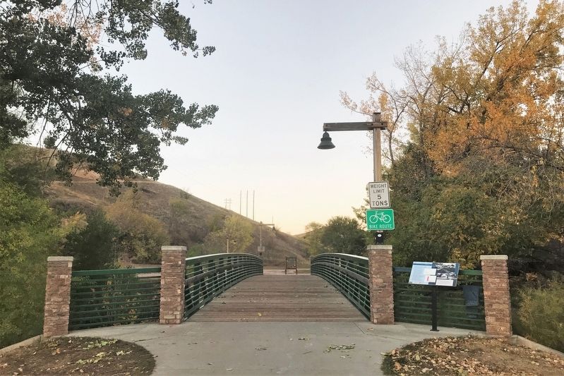
Location. 44° 5.109′ N, 103° 14.534′ W. Marker is in Rapid City, South Dakota, in Pennington County. It can be reached from West Omaha Street north of Oshkosh Street (State Highway 44), on the right when traveling west. The marker is located on the south side of a bridge over Rapid Creek in Founders Park. Touch for map. Marker is at or near this postal address: 1510 W Omaha Street, Rapid City SD 57701, United States of America. Touch for directions.

Regionally, this marker is in West River and in the Badlands. It is also in the American Black Hills, in the Lewis & Clark Corridor, on the prairies, and on the Northern Plains. Globally, it is in
October 16, 2021
2. Measuring Gage Shut Down Marker
Other nearby markers. At least 8 other markers are within walking distance of this marker: Landscapes (within shouting distance of this marker); Rapid City's Founders (within shouting distance of this marker); Welcome to Founders Park Plaza (within shouting distance of this marker); Pioneers and Native Americans (within shouting distance of this marker); Early Places (within shouting distance of this marker); Follow the Horseshoes through Founders Park Plaza (within shouting distance of this marker); Rapid Trout (within shouting distance of this marker); Rapid Creek Flood Mark (within shouting distance of this marker). Touch for a list and map of all markers in Rapid City.

October 16, 2021
3. Rapid Creek, from bridge near marker
Credits. This page was last revised on July 8, 2025. It was originally submitted on October 22, 2021. This page has been viewed 461 times since then and 21 times this year. Last updated on July 7, 2025. Photos: 1, 2, 3. submitted on October 22, 2021. • Devry Becker Jones was the editor who published this page.
