Gouda, South Holland, Netherlands — Northwestern Europe
Kazerne
⎯⎯⎯
Barracks

Photographed by Andrew Ruppenstein, June 21, 2025
1. Kazerne / Barracks Marker

Shortly after 1450, the Mary Magdalene Monastery was founded on this site. This monastery for converted prostitutes grew into the largest women's convent in Gouda. When the plague spread in the early 17th century and claimed many victims, the monastery was converted into a plague house. In 1841, it was converted into barracks, doubling in size. The left half is the old monastery, recognizable by its
this page online
Erected by the ANWB. (Marker Number 2162/10.)
Topics. This historical marker is listed in these topic lists: Industry & Commerce • Military • Religion & Religious Structures • Science & Medicine • Women. A significant historical year for this entry is 1450.
Location. 52° 0.864′ N, 4° 42.644′ E. Marker is in Gouda, Zuid-Holland (South Holland). It is on Agnietenstraat, on the right when traveling south. Touch for map. Marker is at or near this postal address: Agnietenstraat 15, Gouda, Zuid-Holland 2801 GK, Netherlands. Touch for directions.

Regionally, it is in Europe, the European Union, Atlantic Europe, the Benelux Low Countries, the Schengen Area, Western Europe, and the Western World. Historically, it finds itself in what was once the Roman Empire and specifically also the Holy Roman Empire.
Other nearby markers. At

Photographed by Andrew Ruppenstein, June 21, 2025
2. Kazerne / Barracks Marker - wide view
The marker is visible here to the right of the entrance.
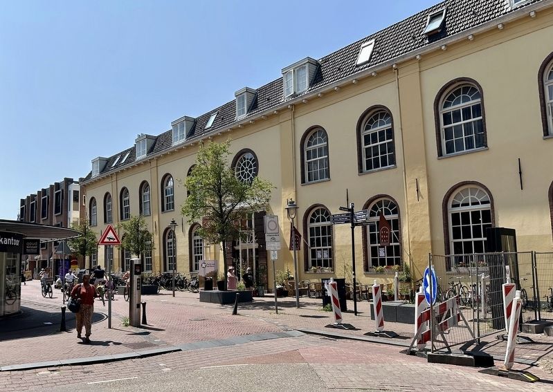
Photographed by Andrew Ruppenstein, June 21, 2025
3. Kazerne / Barracks
Credits. This page was last revised on July 9, 2025. It was originally submitted on July 8, 2025, by Andrew Ruppenstein of Lamorinda, California. This page has been viewed 86 times since then and 14 times this year. Photos: 1, 2, 3. submitted on July 8, 2025, by Andrew Ruppenstein of Lamorinda, California.
