
Morris Heights in the Bronx in Bronx County, New York — The American Northeast (Mid-Atlantic)
Featherbed Triangle

What was here before?
This landscaped triangle is bounded to the west by Martin Luther King Jr. Boulevard, also known as University Avenue. This street and neighborhood of University Heights to the north reference New York University, which was once based in this area. Founded in 1831 in Greenwich Village, NYU later moved to the Bronx in 1894.
Henry Mitchell MacCracken (1840-1918), a Presbyterian minister and professor of philosophy, became the chancellor of the university in 1891 and envisioned the new campus on a picturesque hill of the old Mali estate at one of the highest natural elevations in New York City. The resulting 50-acre campus, located at 180th Street between Sedgwick and University Avenues, was laid out by the notable architectural firm McKim, Mead and White, and still includes architectural relics of that age, namely Stanford White's domed Gould Library. In 1973, to offset financial difficulties, NYU sold the land to the City University of New York. Today, Bronx Community College, which was founded in 1957 and joined CUNY in 1961, is located within the historic campus.
How did this site become a park?
The
this page online
Who is this park named for?
There are four differing origin stories surrounding the name of Featherbed Lane, the namesake of this triangle. One says that during the Revolutionary War, locals could move quietly through the area. Another declares the road to have been so rough that those who traveled on it padded their carriage seats with featherbeds to keep it from being too uncomfortable. A third story, partly contradicting the first two, suggests that the road's muddy composition provided a similar effect to that of a featherbed and made for a very smooth ride. The last theory suggests that the name dates from the 1840s, when the area was home (and office) to many prostitutes.
Erected by NYC Parks. (Marker Number 300.)
Topics and series. This historical marker is listed in these topic lists: Architecture • Education • Parks & Recreational Areas • Roads & Vehicles. In addition,
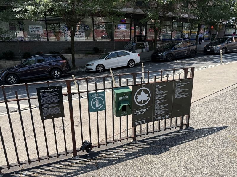
Location. 40° 50.78′ N, 73° 55.265′ W. Marker is in Bronx, New York, in Bronx County. It is in Morris Heights. It is at the intersection of University Avenue and Featherbed Lane, on the right when traveling north on University Avenue. Touch for map. Marker is at or near this postal address: 150 Featherbed Ln, Bronx NY 10452, United States of America. Touch for directions.

Regionally, this marker is in New York City. It is also in the American Mid-Atlantic. Globally, it is in the North Atlantic Region, the Western Hemisphere, and the Anglosphere. Historically, it finds itself in what was once one of the original Thirteen Colonies.
Other nearby markers. At least 8 other markers are within walking distance of this marker: Old Croton Aqueduct Trail (approx. 0.4 miles away); Step Stairs (approx. 0.4 miles away); McNally Plaza World War I Memorial (approx. half a mile away); The High Bridge (approx. 0.6 miles away); Juan Bosch Plaza (approx. 0.6 miles away); a different marker also named Old Croton Aqueduct Trail (approx. 0.6 miles away); Colonel William Baxter (approx. 0.7 miles away); United Palace (approx. 0.9 miles away). Touch for a list and map of all markers in Bronx.
Credits. This page was last revised on July 9, 2025. It was originally submitted on July 9, 2025, by Devry Becker Jones of Washington, District of Columbia. This page has been viewed 100 times since then and 27 times this year. Photos: 1, 2. submitted on July 9, 2025, by Devry Becker Jones of Washington, District of Columbia.
