Corapeake in Gates County, North Carolina — The American South (South Atlantic)
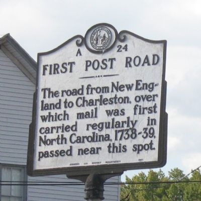
First Post Road
Erected 1942 by Archives and Highway Departments. (Marker Number A-24.)
Topics and series. This historical marker is listed in these topic lists: Colonial Era • Communications • Roads & Vehicles. In addition, it is included in the North Carolina Division of Archives and History, and the Postal Mail and Philately series lists.
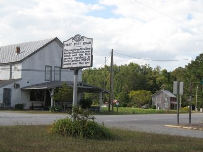
Location. 36° 32.034′ N, 76° 34.594′ W. Marker is in Corapeake, North Carolina, in Gates County. Marker is at the intersection of Highway 32 N (State Highway 32) and Corapeake Road, in the median on Highway 32 N. Touch for map. Marker is in this post office area: Corapeake NC 27926, United States of America. Touch for directions.
Other nearby markers. At least 8 other markers are within 12 miles of this marker, measured as the crow flies. North Carolina / Virginia (approx. 1.2 miles away); Nansemond County Virginia / North Carolina (approx. 1.2 miles away in Virginia); George Washington (approx. 3˝ miles away); Dismal Town (approx. 8 miles away in Virginia); Washington Ditch (approx. 8.1 miles away in Virginia); North West Canal (approx. 11.9 miles away in Virginia); Somerton Friends Meeting (approx. 11.9 miles away in Virginia); Glencoe (approx. 11.9 miles away in Virginia). Touch for a list and map of all markers in Corapeake.
Related markers. Click here for a list of markers that are related to this marker.
Credits. This page was last revised on June 29, 2021. It was originally submitted on October 2, 2007, by Laura Troy of Burke, Virginia. This page has been viewed 1,496 times since then and 34 times this year. Photos: 1, 2. submitted on October 2, 2007, by Laura Troy of Burke, Virginia. • J. J. Prats was the editor who published this page.

