Inwood in Manhattan in New York County, New York — The American Northeast (Mid-Atlantic)
Trace
Wennie Huang
| — | Completed 2011. Silicate stain on glazed brick | — |
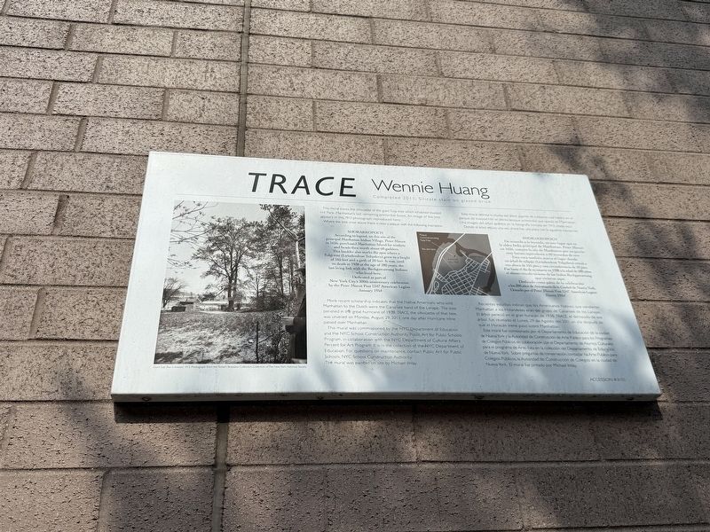

This mural traces the silhouette of the giant Tulip tree which inhabited Inwood Hill Park - Manhattan's last remaining primordial forest. An image of the tree appears in the 1913 photograph reproduced here.
Where the tree once stood, there is now a plaque with the following inscription.
Shorakkopoch According to legend, on this site of the principal Manhattan Indian Village, Peter Minuit in 1626, purchased Manhattan Island for trinkets and beads then worth about 60 guilders. This boulder also marks the spot where a Tulip tree (Liriodendron Tulipifera) grew to a height of 165 feet and a girth of 20 feet. It was, until its death in 1938 at the age of 280 years, the last living link with the Reckgawawang Indians who lived here.
Dedicated as part of New York City's 300th anniversary celebration by the Peter Minuit Post 1247 American Legion
January 1954
More recent scholarship indicates that the Native Americans who sold Manhattan to the Dutch were the Canarsee band of the Lenape. The tree perished in the great hurricane of 1938. Trace, the silhouette of that tree, was unveiled on Monday, August 29,
this page online
This mural was commissioned by the NYC Department of Education and the NYC School Construction Authority Public Art for Public Schools program, in collaboration with the NYC Department of Cultural Affairs Percent for Art Program. It is in the collection of the NYC Department of Education. For questions on maintenance, contact Public Art for Public Schools, NYC School Construction Authority.
The mural was painted on site by Michael Imlay.
Shorakkopoch De acuerdo a la leyenda, en este lugar que es la aldea India principal de Manhattan, Peter Minuit en 1626, compro la isla de Manhattan por un precio muy barato equivalente a 60 monedas de oro. Esta roca también marca el lugar donde un árbol de tulipán (Lirodendron Tulipifera) creció a una altura de 165 piesy una circunferencia de 20 pies. Fue hasta el día de su muerte en 1938 a la edad de 280 años, el último vinculo viviente de los Indios Reckgawawang que vivieron aquí.
Dedicado como parte de la celebración a los 300 años de Aniversario de la Ciudad de Nueva York. Donado por el Peter Minuit Post 1247 American Legion
Enero 1954

Recientes estudios indican que los Americanos Nativos que vendieron Manhattan a los Holandeses eran del grupo de Canarsee de los Lanape. El árbol preció en el gran huracán de 1938. Trace, el delineado de ese árbol, fue revelado el Lunes, 29 de Agosto del 2011, un día después de que el Huracán Irene paso sobre Manhattan.
Ese mural fue comisionado por el Departamento de Educación de la ciudad de Nueva York y la Autoridad de Construcción de Arte Publico para los Programas de Colegios Público para los Programas de Colegios Públicos, en colaboración con el Departamento de Asuntos Culturales para el programa de Arte. Esta en la colección del Departamento de Educación de Nueva York. Sobre preguntas de conservación, contactar ha Arte Publico para Colegios Públicos, la Autoridad de Construcción de Colegios en la ciudad de Nueva York. El mural fue pintado por Michael Imlay.
Erected 2011 by NYC Department of Education and the NYC School Construction Authority Public Art for Public Schools Program in collaboration with the NYC Department of Cultural Affairs Percent for Art Proram. (Marker Number 31151.)
Topics. This historical marker is listed in these topic lists: Arts, Letters, Music • Colonial Era • Indigenous Peoples and Communities • Industry & Commerce. A significant historical date for this entry is August 29, 2011.
Location. 40° 51.928′ N, 73° 55.317′ W. Marker is in Manhattan, New York, in New York County. It is in Inwood. It is on West 204th Street west of Sherman Avenue, on the right when traveling west. Touch for map. Marker is at or near this postal address: 610A W 204th St, New York NY 10034, United States of America. Touch for directions.

Regionally, this marker is in New York City. It is also in the American Northeast, in the Mid-Atlantic, and on the Eastern Seaboard. Globally, it is in the North Atlantic Region, North America, the Western Hemisphere, the Western World, and the Anglosphere. Historically, it finds itself in what was once New Netherland and also one of the original Thirteen Colonies.
Other nearby markers. At least 8 other markers are within walking distance of this marker: Dyckman Farmhouse (about 700 feet away, measured in a direct line); a different marker also named Dyckman Farmhouse Museum (about 800 feet away); The Military Hut (approx. 0.2 miles away); The Hessian Military Hut (approx. 0.2 miles away); Catholic War Veterans Memorial (approx. 0.2 miles away); Monsignor Kett Playground (approx. ¼ mile away); Anne Loftus Playground (approx. 0.3 miles away); Bruce Reynolds Garden (approx. 0.4 miles away). Touch for a list and map of all markers in Manhattan.
Another marker is no longer nearby. Dyckman Farmhouse Museum (was about 700 feet away but has been replaced with another marker now near it).
Credits. This page was last revised on July 11, 2025. It was originally submitted on July 11, 2025, by Devry Becker Jones of Washington, District of Columbia. This page has been viewed 115 times since then and 33 times this year. Photos: 1, 2. submitted on July 11, 2025, by Devry Becker Jones of Washington, District of Columbia.
