Near Chester in Chesterfield County, Virginia — The American South (Mid-Atlantic)
John N. Pastore, D.D.S.
Co-founder and First Chairman from 1985-1991 of The Henricus Foundation
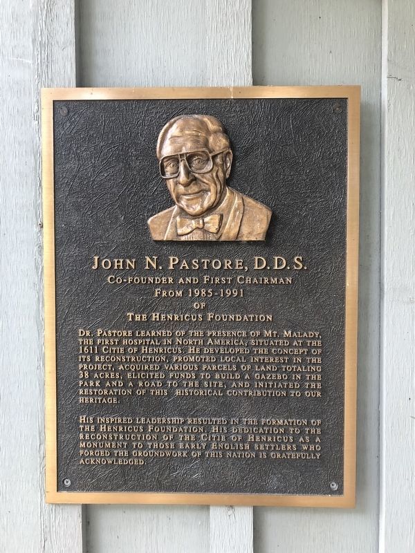
Dr. Pastore learned of the presence of Mt. Malady, the first hospital in North America, situated at the 1611 Citie of Henricus. He developed the concept of its reconstruction, promoted local interest in the project, acquired various parcels of land totaling 38 acres, elicited funds to build a gazebo in the park and a road to the site, and initiated the restoration of this historical contribution to our heritage.
His inspired leadership resulted in the formation of the Henricus Foundation. His dedication to the reconstruction of the Citie of Henricus as a monument to those early English settlers who forged the groundwork of this nation is gratefully acknowledge.
Topics. This historical marker is listed in these topic lists: Colonial Era • Education • Science & Medicine • Settlements & Settlers. A significant historical year for this entry is 1611.
Location. 37° 22.437′ N, 77° 21.754′ W. Marker is near Chester, Virginia, in Chesterfield County. It is on Henricus Park Road 1.3 miles east of Coxendale Road, on the right when traveling east. Touch for map. Marker is at or near this postal address: 251 Henricus
this page online

Regionally, this marker is in the Piedmont, in Central Virginia, and in the Richmond Metropolitan Area. It is also in the American South, specifically in the Upper South, and on the Eastern Seaboard. Globally, it is in the North Atlantic Region, North America, the Western Hemisphere, the Western World, and the Anglosphere. Historically, it finds itself in what was once the territory of the Mississippian Culture, one of the original Thirteen Colonies, one of the Confederate States of America, and the Antebellum South.
Other nearby markers. At least 8 other markers are within walking distance of this marker: Citie of Henricus (a few steps from this marker); 1622 Indian Attack (within shouting distance of this marker); The Bermuda Hundred Campaign (within shouting distance of this marker); a different marker also named The Bermuda Hundred Campaign (within shouting distance of this marker); a different marker also named The Bermuda Hundred Campaign (within shouting distance of this marker); Farrar's Island (about 400 feet away, measured in a direct
Credits. This page was last revised on July 16, 2025. It was originally submitted on May 9, 2020, by Devry Becker Jones of Washington, District of Columbia. This page has been viewed 268 times since then and 16 times this year. Last updated on July 14, 2025, by Evan Dwyer of Richmond, Virginia. Photos: 1, 2. submitted on May 9, 2020, by Devry Becker Jones of Washington, District of Columbia.
