Kure Beach in New Hanover County, North Carolina — The American South (South Atlantic)
Fighting the Sea - Saving the Fort
Photographed by Bernard Fisher, March 11, 2010
1. Fighting the Sea - Saving the Fort Marker
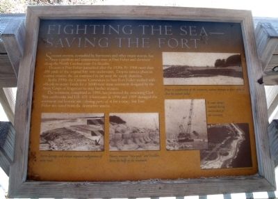
Erosion at Fort Fisher intensified after the 1930s. By 1968 more than 200 yards of the original fort were underwater. Despite various plans to control erosion, the sea continued to eat away the sandy shoreline.
In the 1990s the Citizens’ Committee to Save Fort Fisher worked with officials to secure funds for a 3,040-foot stone revetment designed by the Army Corps of Engineers to stop further erosion.
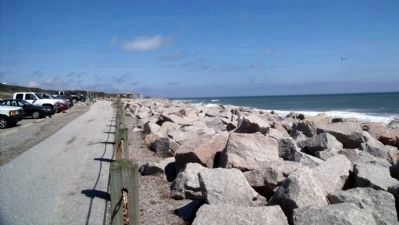
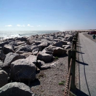
The revetment, completed in 1996, has protected the remaining Civil War earthworks and U.S. 421. Hurricanes in 1996 and 1999 damaged the revetment and historic site (closing parts of it for at time), but Fort Fisher was saved from the destructive waters.
(captions)
Prior to the construction of the revetment, various attempts to place rubble to slow the erosion failed.
Storm damage and erosion required realignment of some roads.
Heavy concrete “stay-pods” and boulders form the bulk of the revetment.
A crane dumps material during construction of the revetment.
Courtesy U.S. Army Corps of Engineers
Erected by Fort
this page online
Topics. This historical marker is listed in these topic lists: Forts and Castles • Man-Made Features • War, US Civil. A significant historical year for this entry is 1968.
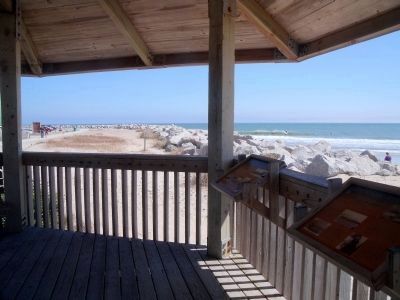
Location. Marker is missing. It was located near 33° 58.081′ N, 77° 55.162′ W. Marker was in Kure Beach, North Carolina, in New Hanover County. It could be reached from Battle Acre Road near Fort Fisher Boulevard South (U.S. 421). This marker is located in the oceanfront gazebo at the "Battle Acre" tour stop. Touch for map. Marker was in this post office area: Kure Beach NC 28449, United States of America. Touch for directions.

Regionally, this marker was in the Coastal Plain and on the Cape Fear Coast. It was also in the American South, specifically in the Upper South, in the Tidewater, and on the Eastern Seaboard. Globally, it was in the North Atlantic Region, North America, the Western Hemisphere, the Western World, and the Anglosphere. Historically, it found itself in what was once the territory of the Mississippian Culture, one of the original Thirteen Colonies, one of the Confederate States of
Photographed by Bernard Fisher, March 11, 2010
2. "Battle Acre" oceanfront gazebo
Other nearby markers. At least 8 other markers are within walking distance of this location: The Columbiad Battery (within shouting distance of this marker); "How Grand a Fame It Watches Over": The Fort Fisher Monument (about 600 feet away, measured in a direct line); Fort Fisher Monument (about 600 feet away); Headquarters of Fort Fisher (about 600 feet away); …A Light House And Dwelling House At Federal Point (about 600 feet away); W.H.C. Whiting (about 800 feet away); Fort Fisher (about 800 feet away); a different marker also named Fort Fisher (approx. 0.2 miles away). Touch for a list and map of all markers in Kure Beach.
Another marker is no longer nearby. Blockade-Running (was here, next to this marker but has been confirmed missing).
Also see . . .
1. Fort Fisher. North Carolina Historic Sites entry (Submitted on March 16, 2010, by Bernard Fisher of Richmond, Virginia.)
2. Fort Fisher State Recreation Area. North Carolina State Parks entry (Submitted on March 16, 2010, by Bernard Fisher of Richmond, Virginia.)
Additional commentary.
1. Facts
Photographed by Bernard Fisher, May 2, 2009
3. Protective revetment (facing north)
Jack BiddLe was the operator who placed every piece of granite at the seawall and also dug out underwater for the stay pods that were placed and cut the slope back for the placement of the granite. The article can be seen in the Star newspaper with a picture of Biddle.
They were going to use the crane to place the granite but found out quickly they could not do this so Biddle took over and started placing the granite with the trackhoe. This is why they were able to complete the job 3 months early. There is a picture of mM. Biddle sitting on the rocks with a hard hat on in that newspaper article. It was an amazing feat to place the granite—to dig out under water and only be a couple inches difference in height for the stay pods. Sheathing had to be placed out in the ocean to prevent waves from coming onto the machine. Note To Editor only visible by Contributor and editor
— Submitted July 3, 2016, by JACK W Biddle of Currie, North Carolina.
2. More about the seawall
The crane shown on this sign wasn’t used for anything more than moving the state pods that
Photographed by Bernard Fisher, March 11, 2010
4. Protective revetment (facing south)
The granite started coming in from Raleigh on flatbeds. They could only haul three at a time maybe four depending on the wait the crane was supposed to lift them off and placed them where they needed to go, but they could not do it the grappling, kept sliding over the granite and he couldn’t get a handle on them so he couldn’t pick them up.
The Army Corps of Engineers didn’t know what they were going to do and I told him just stand out of the way and I’ll show them what I was going to do—just watch. I dug a hole in the ground because they couldn’t be picked up from the top of the ground. The frontend loader rolled one into the hole. I picked it up, lock them in place with the bucket of the machine, and place them where they are. The way we got them off of the flatbed was—the front in loader pushed them off to the side and then pushed them over into a pile. When I needed one, he would get it and bring it over and put it in the hole that I dug.
The crane was
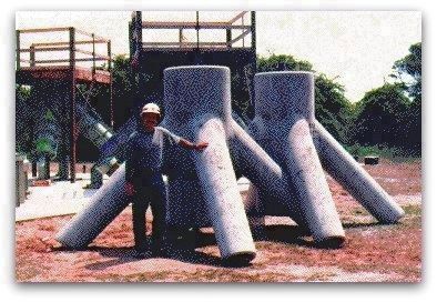
5. Stay-pods placed at the base of the granite stones.
I placed all of them for Mizner Marine, the company that I was working for at the time.
If anyone would like to contact Md. Biddle for more detailed information or to ask questions, please contact an editor here at the Historical Marker Database. —Ed. Note To Editor only visible by Contributor and editor
— Submitted July 18, 2025, by JACK W Biddle of Currie, North Carolina.
Credits. This page was last revised on July 18, 2025. It was originally submitted on March 16, 2010, by Bernard Fisher of Richmond, Virginia. This page has been viewed 1,882 times since then and 71 times this year. Last updated on July 15, 2025, by Evan Dwyer of Richmond, Virginia. Photos: 1, 2, 3, 4. submitted on March 16, 2010, by Bernard Fisher of Richmond, Virginia. 5. submitted on August 8, 2016, by JACK W Biddle of Currie, North Carolina.
