
Niagara-on-the-Lake in Niagara Region, Ontario — Central Canada (North America)
Fort Mississauga
Le Fort Mississauga
Photographed by Dale K. Benington, July 27, 2011
1. Fort Mississauga Marker

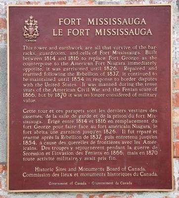
This tower and earthwork are all that survive of the barracks, guardroom, and cells of Fort Mississauga. Built between 1814 and 1816 to replace Fort George as the counterpoise to the American Fort Niagara immediately opposite, it was garrisoned until 1826. Repaired and rearmed following the Rebellion of 1837, it continued to be maintained until 1854 in response to border disputes with the United States. It was manned during the tense years of the American Civil War and the Fenian scare of 1866, but by 1870 it was no longer considered of military value.
Erected by Historic
this page online
Topics and series. This historical marker is listed in these topic lists: Colonial Era • Forts and Castles • War of 1812. In addition, it is included in the Canada, Historic Sites and Monuments Board series list. A significant historical year for this entry is 1814.
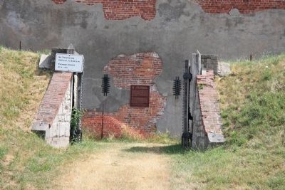
Location. Marker has been reported missing. It was located near 43° 15.698′ N, 79° 4.621′ W. Marker was in Niagara-on-the-Lake, Ontario, in Niagara Region. It could be reached from Simcoe Street north of Front Street, on the left when traveling east. This historical marker is located on the Canadian side of the mouth of the Niagara River, where the river empties into Lake Ontario. It is situated along the river on the northern edge of the Niagara-on-the-Lake Golf Course, at the end of the Fort Mississauga footpath that leads to the site of Fort Mississauga. This historical marker is affixed to the outside wall of the fort's tower, and visible by viewing it through the fort's opened main gate. Touch for map. Marker was in this post office area: Niagara-on-the-Lake ON L0S 1J0, Canada. Touch for directions.

Regionally, this
Photographed by Dale K. Benington, July 27, 2011
2. Fort Mississauga Marker
View of the historic marker affixed to the outside wall of the fort's tower, as seen through the main gateway into the fort.
Other nearby markers. At least 8 other markers are within walking distance of this location: Fort Mississauga is a National Historic Site (within shouting distance of this marker); A Fort Evolves (within shouting distance of this marker); A Strategic Location (within shouting distance of this marker); Fort Mississauga Trail (about 240 meters away, measured in a direct line); Richardson-Kiely House circa 1832 (approx. 0.4 kilometers away); William Kirby's Home (approx. 0.4 kilometers away); Cottage Hospital circa 1820, 1920-1951 (approx. 0.4 kilometers away); McDougal-Harrison House 1820 (approx. half a kilometer away). Touch for a list and map of all markers in Niagara-on-the-Lake.
Another marker is no longer nearby. Point Mississauga Lighthouse
Photographed by Dale K. Benington, July 27, 2011
3. Fort Mississauga Marker
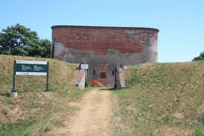
A more distant view of the historic marker as seen through the front gate of the fort.
More about this marker. As of July 2025: The plaque is not currently on display. It was temporarily placed into storage during 2022-2024 repairs. As of July 2025, Parks Canada intends to display it again in the same old location, but no timeframe for this.
Regarding Fort Mississauga. Lake Ontario had record high water levels in 2017 and 2019, which eroded shoreline adjacent to Fort Mississauga's earthworks.
During 2022-2024, Parks Canada performed repairs to prevent future erosion along the shoreline; and also to the fort itself.
Also see . . .
1. Fort Mississauga. This is a link to inbformation provided by Wikipedia, the free encyclopedia. (Submitted on November 4, 2011, by Dale K. Benington of Toledo, Ohio.)
2. Fort Mississauga. This is a link to information and ariel photographs provided by marinas.com. (Submitted on November 4, 2011, by Dale K. Benington of Toledo, Ohio.)
3. Fort Mississauga National Historic Site of Canada. This is a link to information from a website administered by Parks Canada. (Submitted on November 4, 2011, by Dale K. Benington of Toledo, Ohio.)
Photographed by Dale K. Benington, July 27, 2011
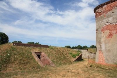
4. Fort Mississauga
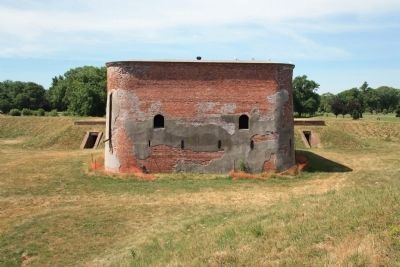
View of the fort's tower as seen from the interior of the fort.
Photographed by Dale K. Benington, July 27, 2011
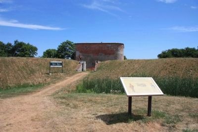
5. Fort Mississauga
View from the interior of the fort looking northwest, towards the main gate.
Photographed by Dale K. Benington, July 27, 2011
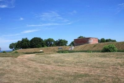
6. Fort Mississauga
A distant view of the front entrance to the fort, the fort's tower, and the earthworks surrounding the fort.
Photographed by Dale K. Benington, July 27, 2011
7. Fort Mississauga
A distant view of the fort and its earthworks, and a more distant view of Lake Ontario in the far left corner background.

Photographed by Kevin Westell
8. July 2025: plaque currently not on display.
I circled the four holes where the plaque was previously mounted.
Credits. This page was last revised on July 17, 2025. It was originally submitted on October 25, 2011, by Dale K. Benington of Toledo, Ohio. This page has been viewed 873 times since then and 26 times this year. Last updated on July 15, 2025, by Kevin Westell of St. Catharines, Ontario. Photos: 1. submitted on October 27, 2011, by Dale K. Benington of Toledo, Ohio. 2, 3, 4, 5, 6, 7. submitted on October 28, 2011, by Dale K. Benington of Toledo, Ohio. 8. submitted on July 15, 2025, by Kevin Westell of St. Catharines, Ontario. • Devry Becker Jones was the editor who published this page.
