Chester in Chesterfield County, Virginia — The American South (Mid-Atlantic)
Grave Holes (ca. 1864)
Photographed by Evan Dwyer, May 24, 2025
1. Grave Holes (ca. 1864) Marker
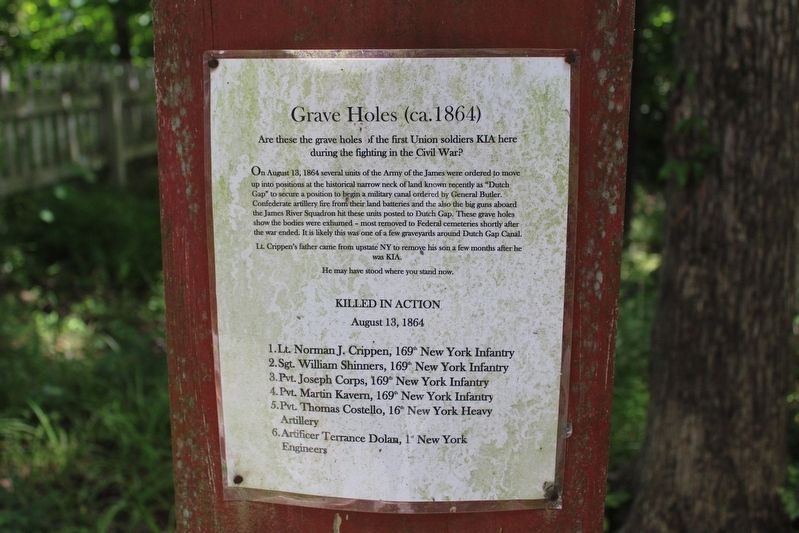
Are these the grave holes of the first Union soldiers KIA here during the fighting in the Civil War?
On August 13, 1864 several units of the Army of the James were ordered to move up into positions at the historical narrow neck of land known recently as "Dutch Gap" to secure a position to begin a military canal ordered by General Butler. Confederate artillery fire from their land batteries and the also the big guns aboard the James River Squadron hit these units posted to Dutch Gap. These grave holes show the bodies were exhumed - most removed to Federal cemeteries shortly after the war ended. It is likely this was one of a few graveyards around Dutch Gap Canal.
Lt. Crippen's father came from upstate NY to remove his son a few months after he was KIA.
He may have stood where you stand now.
Killed In Action
August 13, 1864
1. Lt. Norman J. Crippen, 169th New York Infantry
2. Sgt. William Shinners, 169th New York Infantry
3. Pvt. Joseph Corps, 169th New York Infantry
4. Pvt. Martin Kavern, 169th New York Infantry
5. Pvt. Thomas Costello, 16th New York Heavy Artillery
6. Artificer Terrance Dolan, 1st
this page online
Erected by Henricus Historical Park.
Topics. This historical marker is listed in these topic lists: Cemeteries & Burial Sites • War, US Civil. A significant historical date for this entry is August 13, 1864.
Location. 37° 22.518′ N, 77° 21.637′ W. Marker is in Chester, Virginia, in Chesterfield County. It can be reached from Henricus Park Road 1.3 miles east of Coxendale Road, on the right when traveling north. Marker is on the Henricus Historical Park interpretive trail. Touch for map. Marker is at or near this postal address: 301 Henricus Park Road, Chester VA 23836, United States of America. Touch for directions.

Regionally, this marker is in Virginia’s Piedmont, in Central Virginia, and in the Richmond Metropolitan Area. It is also in the American South, specifically in the Upper South, and on the Eastern Seaboard. Globally, it is in the North Atlantic Region, North America, the Western Hemisphere, the Western World, and the Anglosphere. Historically, it finds itself in what was once the territory of the Mississippian Culture, one of the original Thirteen Colonies, one of the Confederate States

Photographed by Evan Dwyer, May 24, 2025
2. Grave Holes (ca. 1864) Marker
Other nearby markers. At least 8 other markers are within walking distance of this marker: Trench Warfare (within shouting distance of this marker); Field Hospital (within shouting distance of this marker); Henricopolis (about 400 feet away, measured in a direct line); The Lightkeeper’s House (about 400 feet away); Changes Over Time (about 400 feet away); Mortar Pit (about 400 feet away); The Church of Henricopolis (about 400 feet away); John Smith Explores the Chesapeake (about 400 feet away). Touch for a list and map of all markers in Chester.
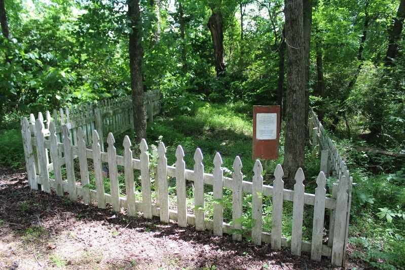
More about this marker. The marker is mounted on a wooden plank but the text itself is a laminated sheet. Nevertheless, this marker is part of the interpretation of that side of the park, along with two other similarly constructed signs. This sign is within a picket fence that protects at least four grave indentions in a slight rise on the ground. They do not show well in photographs posted here, but in person the depressions are quite distinct.
Regarding Grave Holes (ca. 1864). Of the men listed by name on the marker, Lt. Crippen's remains
Photographed by Evan Dwyer, May 24, 2025
3. Grave Holes (ca. 1864) Marker & Cemetery Fence
Also see . . . Henricus Historical Park. (Submitted on July 16, 2025.)

Photographed by Evan Dwyer, May 24, 2025
4. Grave Holes (ca. 1864)
Though not particularly distinct on camera, there are at least four former graves in this view. The flag at lower left is at the head of one of them. They present as dents in the ground with sloping rises between, creating an undulating pattern that this picture attempts to capture. The foliage is thickest and greenest between the grave holes and may be the most prominent way to identify the spacing in this photo.
Credits. This page was last revised on July 16, 2025. It was originally submitted on July 15, 2025, by Evan Dwyer of Richmond, Virginia. This page has been viewed 109 times since then and 27 times this year. Photos: 1, 2, 3, 4. submitted on July 15, 2025, by Evan Dwyer of Richmond, Virginia. • Bernard Fisher was the editor who published this page.
