Koehler Township near Afton in Cheboygan County, Michigan — The American Midwest (Great Lakes)
What is this thing?
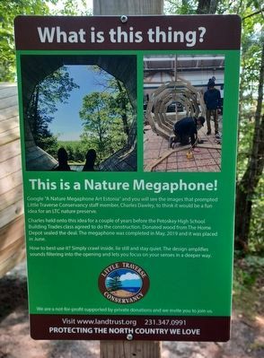
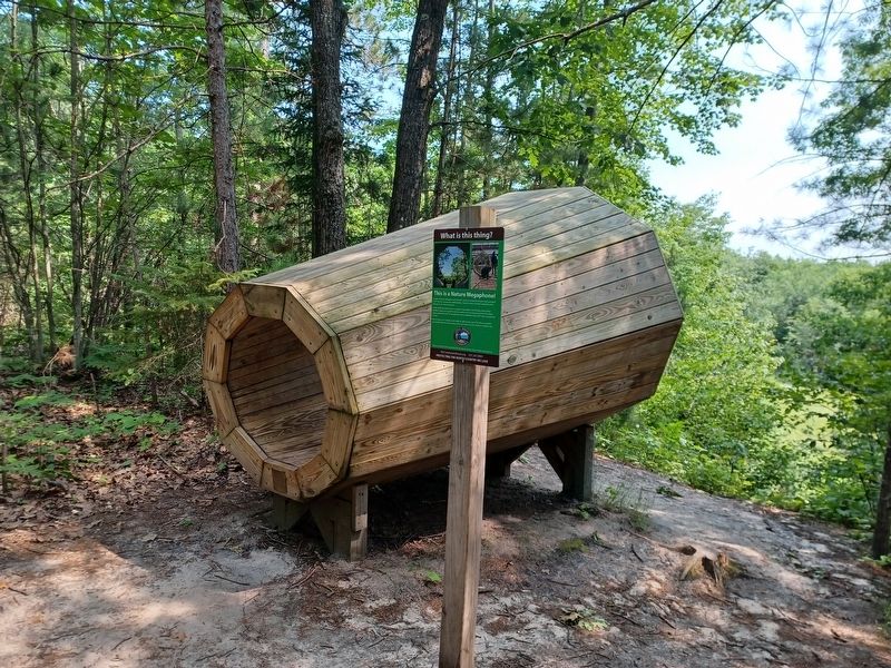
This is a Nature Megaphone!
Photographed by Joel Seewald, July 3, 2025
1. What is this thing? Marker
Google "A Nature Megaphone Art Estonia" and you will see the images that prompted Little Traverse Conservancy staff member, Charles Dawley, to think it would be a fun idea for an LTC nature preserve.
Charles held onto this idea for a couple of years before the Petoskey High School Building Trades class agreed to do the construction. Donated wood from The Home Depot sealed the deal. The megaphone was completed in May, 2019 and it was placed in June.
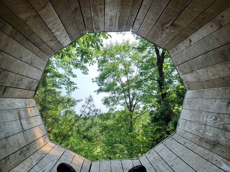
How to best use it? Simply crawl inside, lie still and stay quiet. The design amplifies sounds filtering into the opening and lets you focus on your senses in a deeper way.
Erected by Little Traverse Conservancy.
Topics. This historical marker is listed in these topic lists: Environment • Parks & Recreational Areas. A significant historical month for this entry is May 2019.
Location. 45° 23.505′ N, 84° 31.441′ W. Marker is near Afton, Michigan, in Cheboygan County. It is in Koehler Township. It can be reached from State Highway 68 0.2 miles west of Afton Road, on the right when traveling west. Marker is in Boyd B. Banwell Family Nature Preserve, about a 1.3 mile hike
this page online

Regionally, this marker is in Northern Michigan Lower Peninsula, on the Straits of Mackinac, and in one of the Lake Huron Shore counties. It is also in the American Midwest. Globally, it is in North America, in the Great North Woods, on the Great Lakes, in the Western Hemisphere, in the Western World, and in the Anglosphere. Historically, it finds itself in what was once the Northwest Territory.
Other nearby markers. At least 6 other markers are within 11 miles of this marker, measured as the crow flies: Inland Waterway (approx. 5.1 miles away); The Cross in the Woods (approx. 5.2 miles away); Michigan Central Depot (approx. 9.1 miles away); Michigan Central Railroad (approx. 9.1 miles away); North Central State Trail (approx. 9.1 miles away); Burn-Out: A People Displaced, But Not Destroyed (approx. 10.9 miles away).
Photographed by Joel Seewald, July 3, 2025
2. What is this thing? Marker

Photographed by Joel Seewald, July 3, 2025
3. Plaque on megaphone
Photographed by Joel Seewald, July 3, 2025
4. What is this thing? Marker
View from inside the megaphone overlooking the Pigeon River.

Photographed by Joel Seewald, July 3, 2025
5. What is this thing? Marker
Nature preserve sign along M-68.
Credits. This page was last revised on July 16, 2025. It was originally submitted on July 16, 2025, by Joel Seewald of Madison Heights, Michigan. This page has been viewed 113 times since then and 28 times this year. Photos: 1, 2, 3, 4, 5. submitted on July 16, 2025, by Joel Seewald of Madison Heights, Michigan.
