New Lenox in Will County, Illinois — The American Midwest (Great Lakes)
Village of New Lenox
Lincoln Highway
| — | Agriculture on the Highway | — |

Photographed by Sean P. Flynn, July 19, 2025
1. Village of New Lenox Marker
Area business and farms located directly on the highway or nearby thrived due to the increased automobile traffic. Village stores adapted to the needs of the automobile traveler by installing gas pumps and carrying supplies to service the customer and the car. Recognizing the benefits of the Lincoln Highway and the potential for growth, New Lenox prospered while retaining its identity as an agricultural settlement.
From the beginning concept of the Lincoln Highway, New Lenox was proud to become involved in its development. The village straightened the main thoroughfare that would become the Lincoln Highway to ensure a direct route for the road to travel under the Wabash railroad viaduct. This was the first paved road in New Lenox which opened up the opportunity for local farmers to market their harvest to Chicago.
While Traveling the Lincoln Highway...
this page online
• Lincoln Highway Interpretive Exhibit is located in the Dixon Welcome Center.
• Lincoln Highway's First Concrete Mile, the Seeding Mile, is located in Malta.
• Interactive Kiosk is located at the Phillips Park Visitors Center in Aurora.
• Check the web site for locations of the Lincoln Highway traveling exhibit.
www.drivelincolnhighway.com
The Interpretive Gazebo Project was partially funded through a National Scenic Byway Grant from the Federal Highway Administration (FHWA), with support from the Village of New Lenox. The project was coordinated by the Lincoln Highway Coalition, the management agency for the Illinois Lincoln Highway National Scenic Byway. Grant funds were provided to tell the history and heritage of the Lincoln Highway in Illinois and stories of our corridor communities.
Erected by Illinois Lincoln Highway Coalition.
Topics and series. This historical marker is listed in these topic lists: Agriculture • Industry & Commerce • Roads & Vehicles. In addition, it is included
Photographed by Sean P. Flynn, July 19, 2025
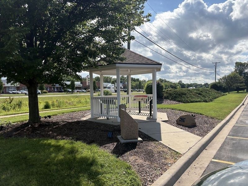
2. The Lincoln Highway gazebo in front of Lincoln-Way Central HS
The gazebo overlooks Lincoln Highway (U.S. 30) in New Lenox, about 40 miles (by car) southwest of Chicago.
Location. 41° 30.694′ N, 87° 55.788′ W. Marker is in New Lenox, Illinois, in Will County. It is on Lincoln Highway. The marker is one of four under a gazebo in front of Lincoln-Way Central High School. Touch for map. Marker is at or near this postal address: 1801 East Lincoln Highway, New Lenox IL 60451, United States of America. Touch for directions.

Regionally, this marker is in Greater Chicago. It is also in the American Midwest. Globally, it is in North America, on the Great Lakes, in the Western Hemisphere, in the Western World, and in the Anglosphere. Historically, it finds itself in what was once the territory of the Mississippian Culture and also the Northwest Territory.
Other nearby markers. At least 8 other markers are within 2 miles of this marker, measured as the crow flies: American Patriotism on the Highway (here, next to this marker); Original Lincoln Highway Marker (here, next to this marker); Advertising Across America's Roadways (here, next to this marker); The Lincoln Highway (here, next to this marker); Veterans Memorial
Photographed by Sean P. Flynn, July 19, 2025
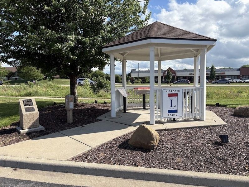
3. Lincoln Highway gazebo
An original Lincoln Highway marker is to the left of the gazebo, which houses four historical markers about the Lincoln Highway.
More about this marker. The gazebo, which houses four historical markers, is one of 16 that were erected by the Illinois Lincoln Highway Coalition along the roadway's 179 miles in the state. An original highway marker, erected by Boy Scouts in 1928, sits next to the gazebo.
"Lincoln-Way" in the high school's name is derived from "Lincoln Highway." In addition to Lincoln-Way Central, there are also a Lincoln-Way East, Lincoln-Way South and Lincoln-Way North.
Also see . . .
1. The Lincoln Highway, the Road, the School. From the New Lenox Area Historical Society (Submitted on July 20, 2025, by Sean P. Flynn of Oak Park, Illinois.)
2. History of the Village of New Lenox. From the New Lenox Area Historical Society
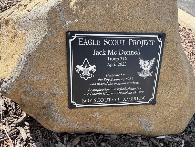
Excerpt: "The coming of the Rock Island Railroad in 1852 changed the settlement of the Township considerably. Previously farmers could do "cash crop" farming(Submitted on July 20, 2025, by Sean P. Flynn of Oak Park, Illinois.)by hauling the products to the I & M Canal or by wagon all the way to larger cities like Chicago. The presence of the railroad brought distant markets to the farmer. Eventually New Lenox Township was served by three additional railroads: the Wabash, the Michigan Central, and the Elgin, Joliet and Eastern."Photographed by Sean P. Flynn, July 19, 20254. Eagle Scout refurbishment plaqueA 2023 project by Eagle Scout Jack McDonnell refurbished the area around the Lincoln Highway markers in front of Lincoln-Way Central High School.
Photographed by Sean P. Flynn, July 19, 2025
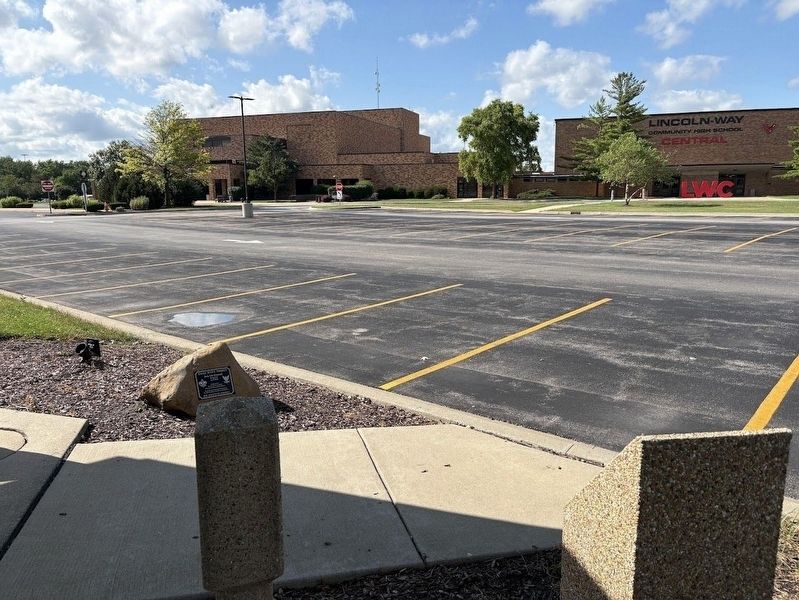
5. Lincoln-Way Central High School
The gazebo and markers are in front of the high school.
Credits. This page was last revised on May 26, 2026. It was originally submitted on July 20, 2025, by Sean P. Flynn of Oak Park, Illinois. This page has been viewed 118 times since then and 43 times this year. Photos: 1, 2, 3, 4, 5. submitted on July 20, 2025, by Sean P. Flynn of Oak Park, Illinois.
