Winchester, Virginia — The American South (Mid-Atlantic)
The Second Battle of Kernstown
Confederate Sharpshooters Lead the Way
| — | Kernstown Battlefield | — |
Photographed by Mark P Brock-Cancellieri, July 4, 2025
1. The Second Battle of Kernstown Marker
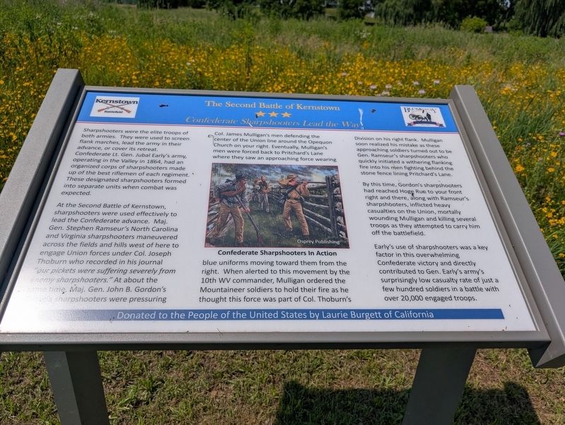
At the Second Battle of Kernstown, sharpshooters were used effectively to lead the Confederate advance. Maj. Gen. Stephen Ramsuer's North Carolina and Virginia sharpshooters maneuvered across the field and hills west of here to engage Union forces under Col. Joseph Thoburn who recorded in his journal "our pickets were suffering severely from enemy sharpshooters." At about the same time, Maj. Gen. John B. Gordon's Georgia sharpshooters were pressuring Col. James Mulligan's men defending the center of the Union line around the Opequon Church on your right. Eventually, Mulligan's men were forced back to Pritchard's Lane where they saw an approaching force wearing blue uniforms moving towards them from the right. When alerted to this movement
this page online
By this time, Gordon's sharpshooters had reached Hoge Run to your front right and there, along with Ramseur's sharpshooters, inflicted heavy casualties on the Union, mortally wounding Mulligan and killing several troops as they attempted to carry him off the battlefield.
Early's use of sharpshooters was a key factor in this overwhelming Confederate victory and directly contributed to Gen. Early's army's surprisingly low causality rate of just a few hundred soldiers in a battle with over 20,000 engaged troops.
Donated to the People of the United States by Laurie Burgett of California
(caption) Confederate Sharpshooters in action. Osprey Publishing
Erected by Blue and Grey Education Society.
Topics. This historical marker is listed in this topic list: War, US Civil. A significant historical year for this entry is 1864.
Location. 39° 8.508′ N, 78° 11.843′ W. Marker is in Winchester, Virginia. It can be reached from Quail Run Road half a mile west of Valley Pike (U.S. 11), on the left when traveling west. Touch for map. Marker is at or near this postal address: 3075 Quail Run Rd, Winchester VA 22602, United States of America. Touch for directions.

Regionally, this marker is in the Shenandoah Valley. It is also in the American South, specifically in the Upper South, and in the Mid-Atlantic. Globally, it is in North America, the Western Hemisphere, the Western World, and the Anglosphere. Historically, it finds itself in what was once the territory of the Mississippian Culture, one of the original Thirteen Colonies, one of the Confederate States of America, and the Antebellum South.
Other nearby markers. At least 8 other markers are within walking distance of this marker: A different marker also named Second Battle of Kernstown (about 400 feet away, measured in a direct line); The First Battle of Kernstown (about 500 feet away); Enslaved Labor in the Shenandoah Valley (about 600 feet away); Agriculture in the Shenandoah Valley (about 600 feet away); The Pritchard House (about 600 feet away); Site of the Original Pritchard Barn (about 600 feet away); a different marker also named The First Battle of Kernstown (about 600 feet away); Battle of First Kernstown (about 800 feet away). Touch for a list and map of all markers in Winchester.
Another marker is no longer nearby. The Second Battle of Kernstown (was about 500 feet away but has been permanently removed).
Credits. This page was last revised on July 27, 2025. It was originally submitted on July 21, 2025, by Mark P. Brock-Cancellieri of Baltimore, Maryland. This page has been viewed 126 times since then and 38 times this year. Photo 1. submitted on July 21, 2025, by Mark P. Brock-Cancellieri of Baltimore, Maryland. • Bernard Fisher was the editor who published this page.
