
Welland in Niagara Region, Ontario — Central Canada (North America)
Main Street Bridge 1930
Photographed by Kevin Westell, July 21, 2025
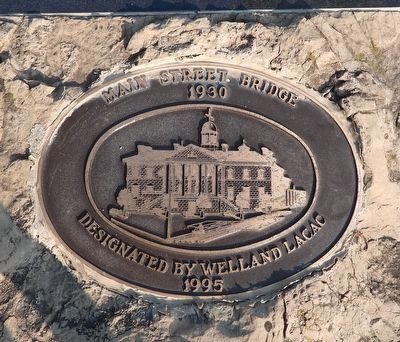
1. Main Street Bridge 1930 - Marker
Main Street Bridge
1930
Designated by Welland LACAC
1995
Erected 1995 by Welland LACAC (Local Architectural Conservation Advisory Committee).
Topics and series. This historical marker is listed in these topic lists: Bridges & Viaducts • Roads & Vehicles • Waterways & Vessels. In addition, it is included in the The Welland Canals series list. A significant historical year for this entry is 1927.
Location. 42° 59.491′ N, 79° 15.05′ W. Marker is in Welland, Ontario, in Niagara Region. It is at the intersection of King Street and East Main Street, on the right when traveling south on King Street. Touch for map. Marker is at or near this postal address: 8 King St, Welland ON L3B 3H9, Canada. Touch for directions.

Regionally, this marker is on Ontario’s Golden Horseshoe and in Niagara Canada. It is also in Central Canada. Globally, it is in North America, on the Great Lakes, in the Western Hemisphere, in the Western World, and in the Anglosphere. Historically, it finds itself in what was once a British colony, the Viceroyalty of New France, the Haudenosaunee (Iroquois) Confederacy,
this page online
Other nearby markers. At least 8 other markers are within walking distance of this marker: Main Street Bridge (Bridge 13) / Pont de la Rue Main (Pont 13) (here, next to this marker); Heritage Site Guide - W West | Ouest (a few steps from this marker); The Bridges of the Fourth Canal (within shouting distance of this marker); The Main and Division St. Bridges (within shouting distance of this marker); M. Beatty & Sons, Foundry and Machine Shops (within shouting distance of this marker); The Aqueduct Lock (within shouting distance of this marker); Beatty & Sons Shipyard (within shouting distance of this marker); The County Buildings (within shouting distance of this marker). Touch for a list and map of all markers in Welland.
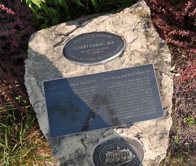
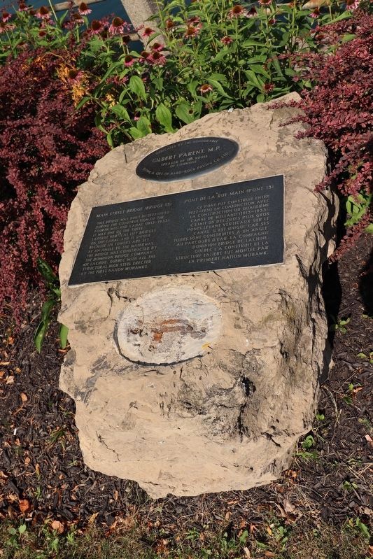
More about this marker. This marker is mounted on a rock with an unrelated marker about the same bridge.
Regarding Main Street Bridge 1930. This vertical lift bridge was built in the late 1920s to carry road traffic over the future 4th Welland Canal. (Previous bridges were constructed in this same location, over previous versions of the canal.) The 22 degree skew in the bridge structure
Photographed by Kevin Westell, July 21, 2025
2. Main Street Bridge 1930 - Marker in context
This marker is mounted on a rock with two other plaques.
During 1931-1972, this bridge carried traffic over the Welland Canal.
When the Welland Canal by-pass was completed in 1973, and ships no longer utilized this section of canal, the bridge no longer needed to raise. It has continued to carry road traffic, but over time, various parts (related to raising and lowering) have been removed.
Photographed by Kevin Westell, July 21, 2025
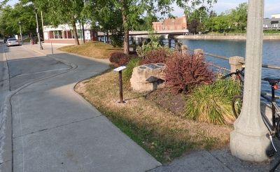
3. Main Street Bridge 1930 - Marker in context
Photo faces south and south-west from East Main Street. King Street is on the left, the Welland recreational canal is on the right.

Photographed by Kevin Westell, July 21, 2025
4. Main Street Bridge, viewed from south
Photographed by Kevin Westell, July 21, 2025
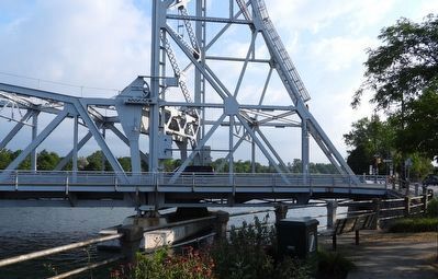
5. Main Street Bridge - skewed east pier and counterweight support
Photo faces north from the marker. The bridge structure has an odd skew - it isn't just perspective! The concrete support pier in the water, and the beams across the bridge are NOT at right angles to the beams along the length of the bridge.
Photographed by Kevin Westell, July 21, 2025
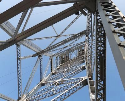
6. Main Street Bridge (Bridge 13) - View vertically up through the east counterweight shaft
In the photo, the "up-and-down" beams (up and down on the photo) are parallel to the road; and the left-right beams are parallel to the canal. There is a skew at an angle of 22 degrees from square.
Photographed by Trevor L Whited, August 14, 2026
7. Main Street Bridge 1930 Marker
Marker has been vandalized
Credits. This page was last revised on August 28, 2026. It was originally submitted on July 22, 2025, by Kevin Westell of St. Catharines, Ontario. This page has been viewed 84 times since then and 21 times this year. Photos: 1, 2, 3, 4, 5, 6. submitted on July 22, 2025, by Kevin Westell of St. Catharines, Ontario. 7. submitted on August 27, 2026, by Trevor L Whited of Kokomo, Indiana. • Andrew Ruppenstein was the editor who published this page.
