Near Fulton in Oswego County, New York — The American Northeast (Mid-Atlantic)
Battle Island Park
Photographed by Steve Stoessel, July 23, 2025
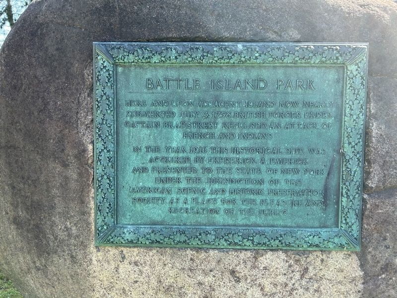
1. Battle Island Park Marker
Here and upon adjacent island now nearly submerged July 3, 1758 British forces under Captain Bradstreet repulsed an attack of French and Indians.
In the year 1916, this historical site was acquired by Frederick A. Emerick and presented to the State of New York under the jurisdiction of the American Scenic and Historic Preservation Society as a place for the pleasure and recreation of the public.
Topics. This historical marker is listed in these topic lists: Parks & Recreational Areas • War, French and Indian. A significant historical date for this entry is July 3, 1758.
Location. 43° 21.767′ N, 76° 26.528′ W. Marker is near Fulton, New York, in Oswego County. It is on New York State Route 48 0.6 miles north of Stoney Robby Road, on the right when traveling north. Touch for map. Marker is in this post office area: Fulton NY 13069, United States of America. Touch for directions.

Regionally, this marker is in Upstate New York, specifically in Central New York, and in the Syracuse Metropolitan Area. It is also in the American Northeast and in the Mid-Atlantic. Globally, it is in North America, on the Great Lakes,
this page online
Other nearby markers. At least 8 other markers are within 4 miles of this marker, measured as the crow flies: Historic Houses (approx. ¾ mile away); Canal Storehouse (approx. 2.8 miles away); The Erie Canalway National Heritage Corridor (approx. 3.1 miles away); Oswego Canal (approx. 3.2 miles away); In Memory (approx. 3.2 miles away); Fulton Public Library (approx. 3.3 miles away); Fulton’s Industries Along the River (approx. 3.3 miles away); John Wells Pratt House (approx. 3.3 miles away). Touch for a list and map of all markers in Fulton.
Also see . . .
1. Battle Island State Park (Wikipedia). (Submitted on July 23, 2025, by Steve Stoessel of Niskayuna, New York.)
2. Battle Island. (Submitted on July 23, 2025, by Steve Stoessel of Niskayuna, New York.)
Photographed by Steve Stoessel, July 23, 2025
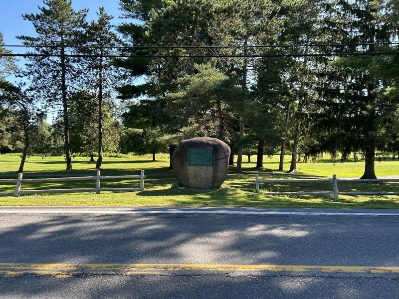
2. Battle Island Park Marker
Credits. This page was last revised on July 23, 2025. It was originally submitted on July 23, 2025, by Steve Stoessel of Niskayuna, New York. This page has been viewed 145 times since then and 50 times this year. Photos: 1, 2. submitted on July 23, 2025, by Steve Stoessel of Niskayuna, New York.
