
Thorold in Niagara Region, Ontario — Central Canada (North America)
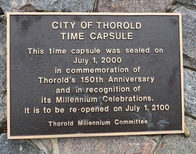
City of Thorold Time Capsule
Photographed by Kevin Westell, April 26, 2025
1. City of Thorold Time Capsule - Marker
It is to be re-opened on July 1, 2100
Erected 2000 by Thorold Millennium Committee.
Topics and series. This historical marker is listed in these topic lists: Colonial Era • Parks & Recreational Areas • Settlements & Settlers. In addition, it is included in the Time Capsules series list. A significant historical year for this entry is 1850.
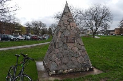
Location. 43° 7.366′ N, 79° 12.054′ W. Marker is in Thorold, Ontario, in Niagara Region. It can be reached from Sullivan Avenue, on the right when traveling east. The marker is on the north-west face of a tall, stone cairn with a metal point on it. Now, within the Battle of Beaverdams Park, there are three cairns. THIS pointy stone cairn is 40 metres east of the Battle of Beaverdams cairns and the circle at the north end of the park. Touch for map. Marker is at or near this postal address: 4 Sullivan Avenue, Thorold ON L2V 2X9, Canada. Touch for directions.

Regionally, this marker is on Ontario’s Golden Horseshoe
this page online
Other nearby markers. At least 8 other markers are within walking distance of this marker: Laura Ingersoll Secord (within shouting distance of this marker); In Memory of Unknown American Soldiers (within shouting distance of this marker); Beaver Dams (within shouting distance of this marker); a different marker also named Beaver Dams (within shouting distance of this marker); Battle of Beaverdams Park (within shouting distance of this marker); In Memory of John Bean, Ph.D., M.D. (within shouting distance of this marker); The JB Stone (within shouting distance of this marker); The 1827 Stone (within shouting distance of this marker). Touch for a list and map of all markers in Thorold.
Photographed by Kevin Westell, April 26, 2025
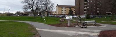
2. City of Thorold Time Capsule - Marker in context
Photo faces north from the centre of Battle of Beaverdams Park. The Battle of Beaverdams cairn and circle are out-of-frame left, along the path. THIS marker is on the pointy cairn distant centre-left, just left of the tree.
Photographed by Kevin Westell, July 28, 2025
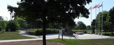
3. City of Thorold Time Capsule - Marker in context
Photo faces south-east. Photo shows all 3 tall cairns within the north end of Battle of Beaverdams Park:
- the cairn with THIS marker is distant left, right of the wiggly paved path, partially hidden behind a ridge
- centre, in the concrete circle, is the cairn with the national maroon-coloured plaque about the battle
- distant right (between the Canadian and American flag-poles) is the concrete cairn that was moved to this location (from the battle location 1 km east of here) in 1976
- the cairn with THIS marker is distant left, right of the wiggly paved path, partially hidden behind a ridge
- centre, in the concrete circle, is the cairn with the national maroon-coloured plaque about the battle
- distant right (between the Canadian and American flag-poles) is the concrete cairn that was moved to this location (from the battle location 1 km east of here) in 1976
Photographed by Kevin Westell, April 26, 2025
4. City of Thorold Time Capsule
Credits. This page was last revised on August 1, 2025. It was originally submitted on July 27, 2025, by Kevin Westell of St. Catharines, Ontario. This page has been viewed 117 times since then and 30 times this year. Photos: 1, 2. submitted on July 27, 2025, by Kevin Westell of St. Catharines, Ontario. 3. submitted on July 28, 2025, by Kevin Westell of St. Catharines, Ontario. 4. submitted on July 27, 2025, by Kevin Westell of St. Catharines, Ontario. • Andrew Ruppenstein was the editor who published this page.
