Burkittsville in Frederick County, Maryland — The American Northeast (Mid-Atlantic)
Burkittsville
Houses of Worship Become Houses of Misery
| — | Antietam Campaign 1862 | — |
Photographed by Mark P Brock-Cancellieri, July 4, 2025
1. Burkittsville Marker
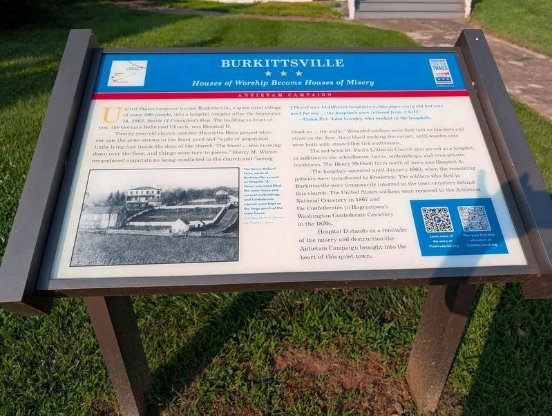
"[There] was 14 different hospitals in this place every old hut was used for one ... the hospitals were lettered from A to O." —Union Pvt. John Lovejoy, who worked in the hospitals.
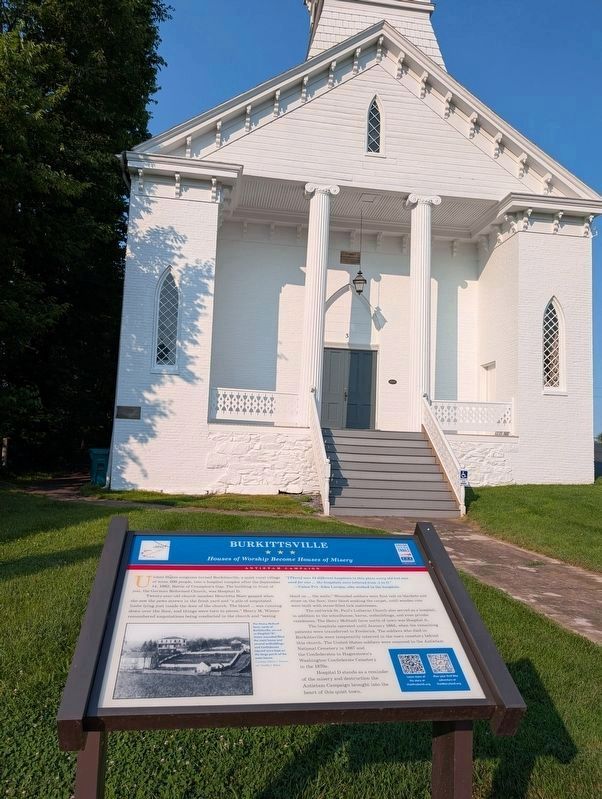
United States surgeons turned Burkittsville, a quiet rural village of some 200 people, into a hospital complex after the September 14, 1862, Battle of Crampton's Gap. The building in front of you, the German Reformed Church, was Hospital D.
Twenty-year-old church member Henrietta Biser gasped when she saw the pews strewn in the front yard and "a pile of amputated limbs lying just inside the door of the church. The blood ... was running down over the floor, and things were torn to pieces." Henry M. Wiener remembered amputations being conducted in the church and "seeing blood on ... the walls." Wounded soldiers were first laid on blankets and straw on the floor, their blood soaking the carpet, until wooden cots were built with straw-filled tick mattresses.
The red-brick St. Paul's Lutheran Church also served as a hospital, in addition to the schoolhouse, barns, outbuildings, and even private residences. The Henry McDuell farm north
this page online
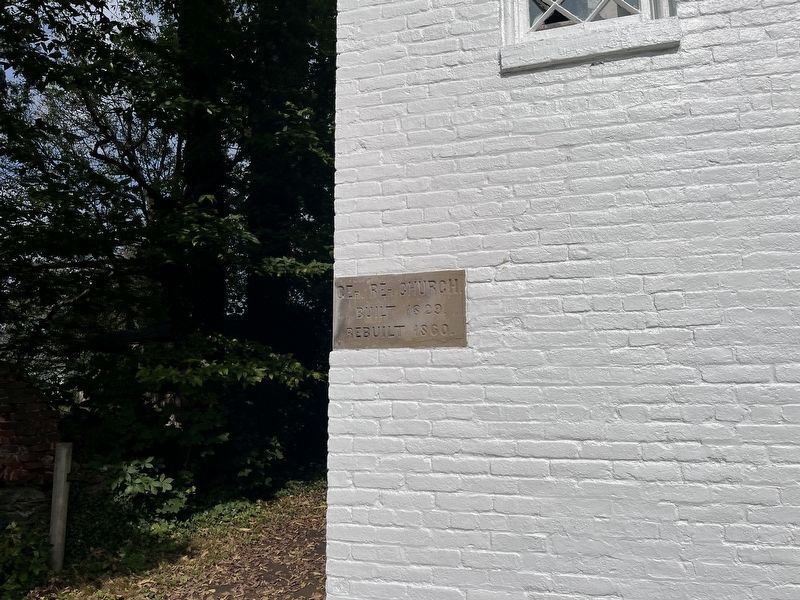
The hospitals operated until January 1863, when the remaining patients were transferred to Frederick. The soldiers who died in Burkittsville were temporarily interred in the town cemetery behind this church. The United States soldiers were removed to the Antietam National Cemetery in 1867 and the Confederates to Hagerstown's Washington Confederate Cemetery in the 1870s.
Hospital D stands as a reminder of the misery and destruction the Antietam Campaign brought into the heart of this quiet town.
Learn more of the story at VisitFrederick.org
Plan your Civil War adventure at VisitMaryland.org
(caption) The Henry McDuell farm, north of Burkittsville, served as Hospital "A". Union wounded filled the main house and several outbuildings, and Confederate injured were kept on the large porch of the main house. Courtesy Melvin J. Berman via Timothy J. Reese
Erected by Maryland Civil War Trails.
Topics and series. This historical marker is listed in these topic lists: Religion & Religious Structures • War, US Civil. In addition, it is included in the Maryland Civil War Trails series list. A significant historical date for this entry is September 14, 1862.
Location. 39° 23.625′ N,
Photographed by Mark P Brock-Cancellieri, July 4, 2025
2. Burkittsville Marker and church

Regionally, this marker is in the Washington Metropolitan Area and in Central Maryland. It is also in the American Mid-Atlantic. Globally, it is in North America, the Western Hemisphere, the Western World, and the Anglosphere. Historically, it finds itself in what was once one of the original Thirteen Colonies and also the Antebellum South.
Other nearby markers. At least 8 other markers are within walking distance of this marker: Cobbled Stagecoach Stop (within shouting distance of this marker); The Arnold Farm (approx. 0.2 miles away); “Sealed With Their Lives” (approx. 0.7 miles away); Chew’s Ashby Artillery (approx. 0.7 miles away); Burkittsville: Henry Burkitt’s Town (approx. 0.7 miles away); The Confusion of Battle

Photographed by Adam Margolis, September 20, 2025
3. Burkittsville Marker
Other markers no longer nearby. Burkittsville (was a few steps from this marker but has been replaced with another marker now near it); Confederate Forces (was approx. 0.4 miles away but has been confirmed missing).
Related marker. Click here for another marker that is related to this marker. Old CWT Marker At This Location also titled "Bukittsville"
Also see . . .
1. South Mountain Heritage Society. Sharing the History of one of Maryland's Best Preserved Rural Landscapes (Submitted on July 27, 2025.)
2. Visit Frederick. (Submitted on July 27, 2025.)
Photographed by Adam Margolis, September 20, 2025
4. Burkittsville Marker
Credits. This page was last revised on May 14, 2026. It was originally submitted on July 27, 2025, by Mark P. Brock-Cancellieri of Baltimore, Maryland. This page has been viewed 181 times since then and 47 times this year. Photos: 1, 2. submitted on July 25, 2025, by Mark P. Brock-Cancellieri of Baltimore, Maryland. 3, 4. submitted on May 13, 2026, by Adam Margolis of Mission Viejo, California. • Bernard Fisher was the editor who published this page.
