Shiprock in San Juan County, New Mexico — The American Mountains (Southwest)
Shiprock
Photographed by Mike Stroud, May 31, 1994
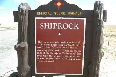
1. Shiprock Marker
This huge volcanic neck was formed in Pliocene times, over 3,000,000 years ago. It rises 1700 feet above the surrounding plain and is famed in legends of the Navajo as "Sa-bit-tai-e" (the rock with the wings). They hold that it was the great bird that brought them from the north.
Erected by New Mexico Historic Preservation Division.
Topics. This historical marker is listed in these topic lists: Environment • Indigenous Peoples and Communities.
Location. Marker has been reported missing. It was located near 36° 46.324′ N, 108° 44.006′ W. Marker was in Shiprock, New Mexico, in San Juan County. It was on U.S. 64, on the left when traveling west. West of the town of Shiprock, there are several un-named Reservation roads in the area. Touch for map. Marker was in this post office area: Shiprock NM 87420, United States of America. Touch for directions.

Regionally, this marker was in New Mexico’s Navajo Nation and in the San Juan Basin. It was also in the American Southwest, in the Mountain West, on the Colorado Plateau, and at the Four Corners. Globally,
this page online
Regarding Shiprock. Shiprock, located in northwestern New Mexico, is a most impressive example of a volcanic neck, or a central feeder pipe. The remnant of an eruption around 30 million years ago during the Oligocene, it is the basalt core of an extinct volcano. Near the main peak, one can see small pinnacles, the remains of smaller auxiliary volcanic vents. When the magma solidifies before ever reaching the surface, it is referred to as a "diatreme". The local Navajos consider it sacred, being a main character in their folklore. They call it Tse Bitai, meaning "the winged rock". The central part of Shiprock, visible from many kilometers away, is roughly 500 meters in diameter. Stretching 600 meters into the sky above the surrounding terrain, Shiprock is part of both the Navajo and Chuska volcanic fields in northeastern Arizona and northwestern New Mexico, extending north into Utah and Colorado. It is also within the boundaries of the vast Colorado Plateau.
Photographed by Mike Stroud, May 31, 1994
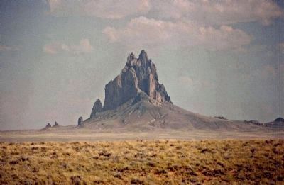
2. Shiprock
The world's finest example of an exposed volcanic throat and can be seen for 100 miles. On hot summer days Shiprock looks as if it is floating, hovering like, above the desert floor, giving the appearence of flying...having wings.
The name "Shiprock" apparently came into use in the 1870s as indicated by U.S.Geological Survey Maps.
Also see . . .
1. Shiprock. Wikipedia entry:
The peak and surrounding land are of great religious and historical significance to the Navajo people. (Submitted on April 23, 2010, by Mike Stroud of Bluffton, South Carolina.)
2. Shiprock Peak. Navaho Tourism Department website entry (Submitted on March 27, 2021, by Larry Gertner of New York, New York.)
Photographed by Mike Stroud, May 31, 1994
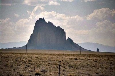
3. Shiprock
The soft volcanic rock makes up the awesome monolith, making it a dangerous challenge to climb; however, the California Sierra Club scaled it successfully in 1939. Shiprock has been closed to public access for climbing since 1970.
From www.lapahie.com, circa 1914
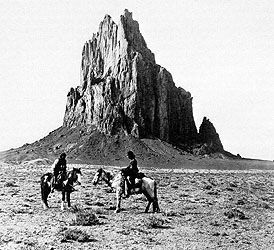
4. Shiprock
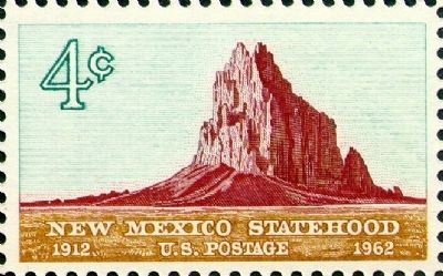
by USPS, 1962
5. Shiprock
A stamp of Shiprock Peak (Tsé Bit'Ai), New Mexico on the Navajo Nation. Issued in 1962 for commemoration of the 50 years of New Mexico Statehood (1912-1962).
Photographed by Mike Stroud, June 1, 1994
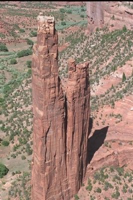
6. Spider Rock, found in nearby Canyon de Chelly
see "The Legend of Spider Rock" as mentioned from link
Credits. This page was last revised on August 19, 2025. It was originally submitted on April 23, 2010, by Mike Stroud of Bluffton, South Carolina. This page has been viewed 2,865 times since then and 96 times this year. Last updated on July 30, 2025, by Bill Wingate of Albuquerque, New Mexico. Photos: 1, 2, 3, 4, 5, 6. submitted on April 23, 2010, by Mike Stroud of Bluffton, South Carolina. • J. Makali Bruton was the editor who published this page.
