Near Lamy in Santa Fe County, New Mexico — The American Mountains (Southwest)
Galisteo Basin
⎯⎯⎯
Southern Rockies
Photographed by J. J. Prats, April 13, 2012
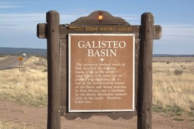
1. Galisteo Basin Face of Marker
Galisteo Basin. The extensive lowland south of here is called Galisteo basin, a sag in the earth’s crust where rock layers are depressed and thickened. It is one of the northernmost basins in the Basin and Range province in New Mexico and is bordered by the Rocky Mountains immediately to the north. Elevation 6,400 feet.
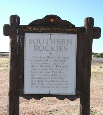
Southern Rockies. These foothills and the higher glaciated peaks to the north are the southern tip of the Rocky Mountains. This particular segment is known as the Sangre de Cristo (“blood of Christ”), a formidable barrier that rises above 13,000 feet in a chain of peaks that trend from Santa Fe on the south to Salida, Colorado, on the north.
Erected by New Mexico Historic Preservation Division.
Topics. This historical marker is listed in these topic lists: Environment • Natural Features.
Location. 35° 28.23′ N, 105° 54.255′ W. Marker is near Lamy, New Mexico, in Santa Fe County. It is at the intersection of U.S. 285 at milepost 290 and Old Lamy Trail (County Road 33), on the right when traveling south on U.S. 285. On right-of-way adjacent
this page online

Regionally, this marker is in Northern New Mexico. It is also in the American Southwest, in the Mountain West, and on the Santa Fe Trail Corridor. Globally, it is in North America, the Rocky Mountains, the Western Hemisphere, the Western World, and the Anglosphere. Historically, it finds itself in what was once New Spain, the territory of the Ancestral Puebloans, and the Republic of Texas.
Other nearby markers. At least 8 other markers are within 11 miles of this marker, measured as the crow flies: Southern Rockies / Galisteo Basin (here, next to this marker); Galisteo Pueblo (approx. 5.7 miles away); Route 66 (approx. 6½ miles away); Hispano New Mexicans in the US Civil War (approx. 6.9 miles away); Cañoncito at Apache Canyon (approx. 6.9 miles away); Seton Village (approx. 9.4 miles away); Glorieta Pass Battlefield (approx. 10.9 miles away); a different marker also named Glorieta Pass Battlefield (approx. 10.9 miles away).
Another
Photographed by J. J. Prats, April 13, 2012
2. Southern Rockies Face of Marker
Also see . . . Galisteo Basin Preserve. “For approximately 100 years, beginning around 1400, the Southern Tewa were challenged by Diné-speaking peoples—warriors from Apache and Navajo tribes that raided and deeply stressed the Tewas’ resources and sense of security. In the mid to late 1500s, Spanish explorers (or conquistadors) from Mexico journeyed north to New Mexico in search of gold and other treasure. In their wake, the Spanish brought deadly disease and new hardship on the struggling southern Tewa peoples. By 1600, the Spanish were in the Galisteo Basin to stay—introducing longhorn cattle and unknown crops like watermelon, wheat, chiles, and melons to the region. The Spanish also began mining silver in the Cerrillos Hills around 1581.” (Submitted on May 12, 2012.)
Additional keywords. geography, geology
Photographed by J. J. Prats, April 13, 2012
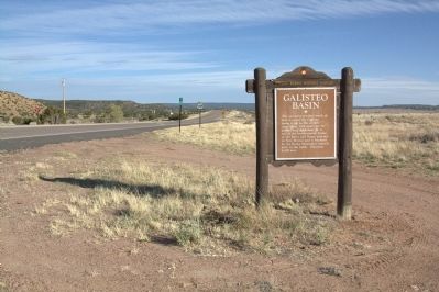
3. Galisteo Basin and Marker
Photographed by J. J. Prats, April 13, 2012
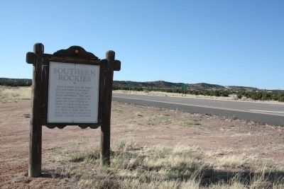
4. Foothills of the Southern Rockies and Marker
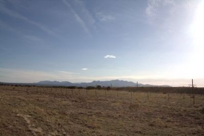
Photographed by J. J. Prats, April 13, 2012
5. View of the Southern Rockies from Route 41 in the Galisteo Basin
The telegraph wires on the horizon mark the tracks of the southernmost transcontinental railroad laid by the Atchison, Topeka and Santa Fe Railway, now the BNSF Railway.
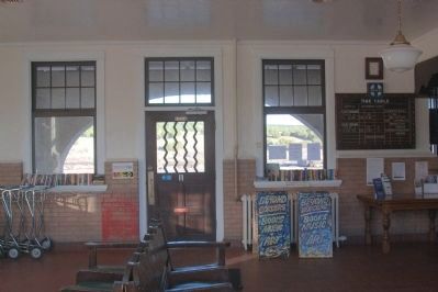
Photographed by J. J. Prats, April 13, 2012
6. Lamy Station Waiting Room
Trackside is beyond the door. Signboard shows the Amtrak Southwest Chief. Train No. 3 to Los Angeles stops at 1:17 in the afternoon followed by No. 4 to Kansas City and Chicago at 2:24.
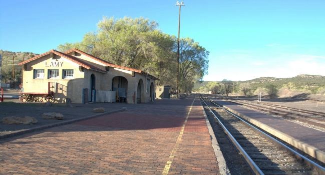
Photographed by J. J. Prats, April 13, 2012
7. AT&SF Railway's Lamy Station, Now an Amtrak Stop
Passengers to Santa Fe changed trains here. Today they change to a bus, the Lamy Shuttle, for the 30 minute ride to Santa Fe.
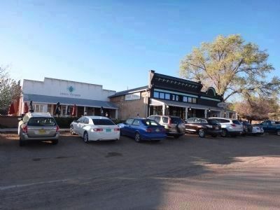
Photographed by Phyllis A. Prats, April 12, 2012
8. The Legal Tender Saloon & Restaurant in Lamy, New Mexico
Directly across the road from the railroad station, it is now the Lamy Railroad & History Museum. It reverts to its former glory for dinner Fridays and Saturdays only. Other than this restaurant, there are no other businesses in Lamy. You can visit the museum when it is open as a restaurant at no additional charge, and it is the turnaround destination of the tourist train from Santa Fe operated by the Santa Fe Southern Railroad.
Credits. This page was last revised on November 10, 2025. It was originally submitted on May 12, 2012. This page has been viewed 1,506 times since then and 65 times this year. Last updated on July 30, 2025. Photos: 1, 2, 3, 4, 5, 6, 7, 8. submitted on May 12, 2012, by J. J. Prats of Powell, Ohio. • Devry Becker Jones was the editor who published this page.
