Perkinsville in Weathersfield in Windsor County, Vermont — The American Northeast (New England)
The Crown Point Road

Photographed by William Fischer, Jr., July 27, 2025
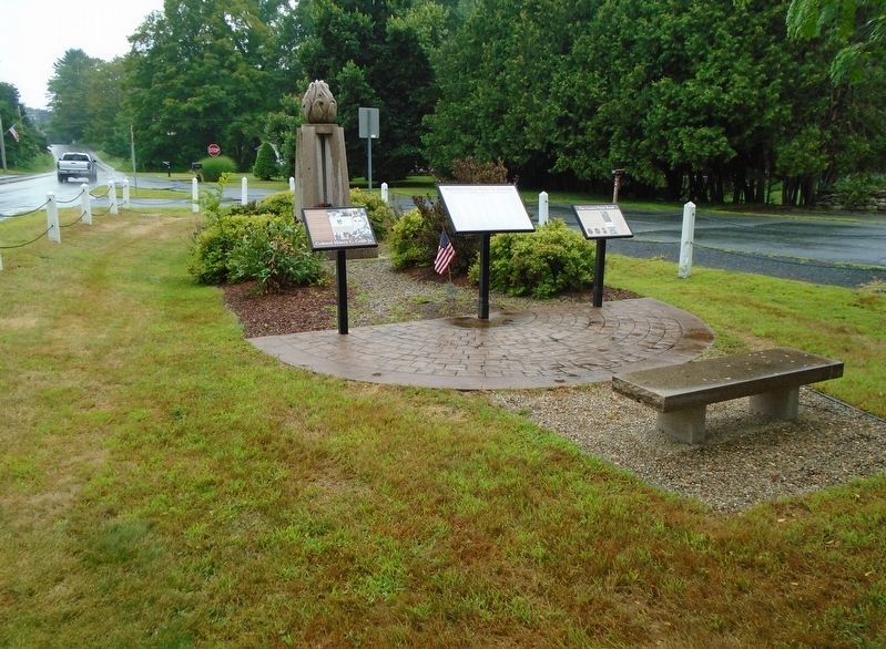
1. The Crown Point Road Marker
The British, upon command of General Jeffrey Amherst, began construction of the Crown Point Road in 1759 during the French and Indian War to provide a more direct route for the provision of fresh troops and supplies between their fort at Crown Point, New York and their Fort # 4 on the Connecticut River in New Hampshire. The road provided a shorter route than the previously established supply route from the Atlantic ports by way of Albany and Lake George. Captain John Stark and Lieutenant John Small are credited with carrying out the order to construct the road. In 1760 they improved what they had built the year before, especially in the east, where the road was only a trail and needed to be 20 feet wide for wagons.
In the summer heat of 1760, there were many desertions from the 360 troops building the road, and one soldier received 100 lashes for encouraging mutiny, but by the end of summer five droves of cattle of about 80 head each had made the trip, plus men, arms, and provisions.
During the American Revolution, colonial militias, schooled by the British during the previous war, turned the tables on them
this page online
In addition to its military purpose, the road also served to open the wilderness to settlers. Almost seven of the approximately 85 miles of the CPR are in Weathersfield, where the first settler arrived in 1768. By 1800 the town had 1,944 residents, who had been using the road as their main artery from which other roads branched out.
The route in Weathersfield includes the only two remaining original milestones on the Crown Point Road. There are also many sites in Weathersfield attesting to the use of the CPR in this town in the late 1700s. There are two cemeteries, three cellar holes, the remains of a pre-Revolutionary sawmill, and a fine home built in 1780 along the route of the Crown Point Road in Weathersfield.
The Town of Weathersfield accepted the CPR as a Town road in 1782 and again the next year with an alteration. In 2010 the Weathersfield Select Board retained the road as a Class 4 Town road following the route "along what is historically known and marked as the Crown Point Road."
CPR Association
[Illustration captions, left to right, read]
Photographed by William Fischer, Jr., July 27, 2025
2. The Crown Point Road Marker
• Captain John Stark — Road Builder (1728-1820)
• Lieutenant John Small — Road Builder (1726-1796)
• The Crown Point Road in Weathersfield
• The Crown Point Road through Springfield & Weathersfield
• Original 10-mile marker stone, 1759, near Branch Creek
• [Map of Vermont showing fort locations]
Topics. This historical marker is listed in these topic lists: Patriots & Patriotism • Roads & Vehicles • War, French and Indian • War, US Revolutionary. A significant historical year for this entry is 1759.
Location. 43° 22.31′ N, 72° 30.977′ W. Marker is in Weathersfield, Vermont, in Windsor County. It is in Perkinsville. It is at the intersection of Vermont Route 106 and High Street, on the right when traveling south on Vermont Route 106. Markers and Veterans Eternal Burning Flame Memorial are on the Town Green. Touch for map. Marker is in this post office area: Perkinsville VT 05151, United States of America. Touch for directions.

Regionally, this marker is in the Connecticut River Valley and in the Green Mountains. It is also in the American Northeast and in New England. Globally, it is in North America, the Western Hemisphere, the Western World, and the Anglosphere. Historically, it finds itself in what was once the Vermont Republic.
Other nearby markers. At least 8 other markers are within 5 miles of this marker, measured as the crow flies: Weathersfield Roll of Honor (here, next to this marker); Colonel Henry C. Cobb Jr. (here, next to this marker); Veterans Eternal Burning Flame Memorial (here, next to this marker); Bomber Crash on Hawks Mountain / Crew of B-29A #44-62228 Crashed Perkinsville, Vermont 15 June 1947 (within shouting distance of this marker); Salmond Bridge (approx. 4.1 miles away); Knights of Columbus Memorial (approx. 4.3 miles away); "Our Fathers" Memorial Tree (approx. 4.3 miles away); Springfield Veterans Memorial (approx. 4.3 miles away). Touch for a list and map of all markers in Weathersfield.
Related markers. Click here for a list of markers that are related to this marker.
Also see . . . History of The Crown Point Road. (Submitted on August 1, 2025, by William Fischer, Jr. of Reynoldsburg, Ohio.)
Credits. This page was last revised on August 1, 2025. It was originally submitted on August 1, 2025, by William Fischer, Jr. of Reynoldsburg, Ohio. This page has been viewed 239 times since then and 93 times this year. Photos: 1, 2. submitted on August 1, 2025, by William Fischer, Jr. of Reynoldsburg, Ohio.
