Frederick in Frederick County, Maryland — The American Northeast (Mid-Atlantic)
Frederick
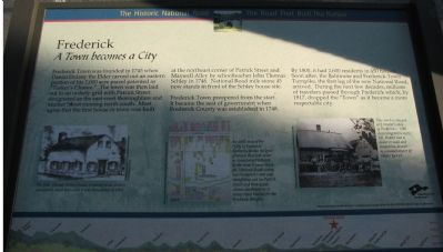
A Town becomes a City
— The Historic National Road - The Road That Built The Nation —
Frederick Town prospered from the start. It became the seat of government when Frederick County was established in 1748. By 1800 it had 2,600 residents in 450 houses. Soon after, the Baltimore and Frederick-Town Turnpike, the first leg of the new National Road, arrived. During the next few decades, millions of travelers passed through Frederick which, by 1817, dropped the "Town" as it became a more respectable city.
Erected by America's ByWays.
Topics and series. This historical marker is listed in these topic lists: Roads & Vehicles • Settlements & Settlers. In addition, it is included in the The Historic National Road series list. A significant historical year for this entry is 1745.
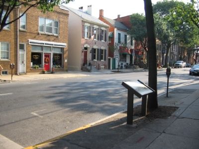
Location. 39° 24.843′ N, 77° 24.547′ W. Marker is in Frederick, Maryland, in Frederick County. Marker is at the intersection of East Patrick Street (State Highway 144) and Maxwell Alley, on the left when traveling east on East Patrick Street. Touch for map. Marker is in this post office area: Frederick MD 21701, United States of America. Touch for directions.
Other nearby markers. At least 8 other markers are within walking distance of this marker. One Vast Hospital (a few steps from this marker); 1862 Antietam Campaign (within shouting distance of this marker); Hospitals in Frederick (within shouting distance of this marker); Loats Female Orphan Asylum of Frederick City (about 400 feet away, measured in a direct line); Market & Patrick Streets (about 400 feet away); Diehl Memorial Fountain (about 400 feet away); Hood College (about 400 feet away); Civil War Hospital Center (about 400 feet away). Touch for a list and map of all markers in Frederick.
More about this marker. "The John Thomas Schley House, rendered in an artist's conception, stood here until it was demolished in 1853," is on the lower left of the marker.
"An 1841 map of the 'City of Frederick' distinctly shows the grid of streets that still exists in downtown Frederick. In the town's lower third, the National Road curves into Frederick's east end, straightens out on Patrick Street then again curves southwest as it leaves town headed for the Braddock Heights," is in the lower center.
On the lower right
a photograph displays, "This coach is stopped at J. Walter's shop in Frederick c. 1880. According to his sign, Mr. Walter was a dealer in wool and sheepskins, as well as a manufacturer of Neat's foot oil."
The marker's background is "National Road at Fairview Inn," the standard for this marker series. This marker is listed as Wayside 21 in the series.
Credits. This page was last revised on March 24, 2024. It was originally submitted on October 6, 2007, by Craig Swain of Leesburg, Virginia. This page has been viewed 2,379 times since then and 94 times this year. Photos: 1, 2, 3. submitted on October 6, 2007, by Craig Swain of Leesburg, Virginia. 4. submitted on September 15, 2016, by Allen C. Browne of Silver Spring, Maryland.


