Port Robinson in Thorold in Niagara Region, Ontario — Central Canada (North America)
Carl-Misener-Bald Cemetery
Photographed by Kevin Westell, August 1, 2025
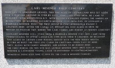
1. Carl-Misener-Bald Cemetery - Marker
Leonard Misener U.E.L 1744-1806 & Barbara Bender 1741-1821 came from Pennsylvania to Upper Canada in 1785 with their 9 children. He received 700 acres of Crown land having served with the New Jersey militia. In 1789 he built the first log cabin on Chippawa Creek east of here. They, along with family members, are known to be buried here. The first burial on this site was George Misener 1801-1802 son of John Misener & Catharine Young, later transferred to Fonthill cemetery.
Memorial dedicated June 12 1999 by the Carl & Misener families
Erected 1999 by The Carl and Misener Families.
Topics. This historical marker is
this page online
Location. 43° 2.071′ N, 79° 12.944′ W. Marker is in Thorold, Ontario, in Niagara Region. It is in Port Robinson. It can be reached from the intersection of Carl Street and Towpath Rd. The marker and pioneer cemetery are adjacent to the Welland Canals Parkway Trail (a paved walking/biking trail), 300 metres north-west of the dead-end of Egerter Rd, and 200 metres south-west of the dead-end of Carl St. Touch for map. Marker is at or near this postal address: 63 Carl Street, Thorold ON L0S 1K0, Canada. Touch for directions.

Regionally, this marker is on the Golden Horseshoe and in Niagara Canada. It is also in Central Canada. Globally, it is in North America, on the Great Lakes, in the Western Hemisphere, in the Western World, and in the Anglosphere. Historically, it finds itself in what was once a British colony, the Viceroyalty of New France, the Haudenosaunee (Iroquois) Confederacy, and Rupert’s Land.
Other nearby markers. At least 8 other
Photographed by Kevin Westell, August 1, 2025
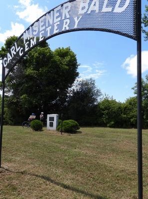
2. Carl-Misener-Bald Cemetery
Photo faces west from the biking/walking path. The cemetery entrance sign is easily visible from the path. The marker is the top plaque on the taller white stone.
More about this marker. On the marker, "U.E.L." means United Empire Loyalist.
Photographed by Kevin Westell, August 1, 2025
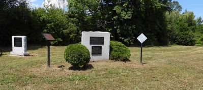
3. Carl-Misener-Bald Cemetery
In some recent decade, the no-longer-legible limestone gravestones were removed. These modern signs remain. THIS marker is the top plaque on the taller white stone.
Photographed by Kevin Westell, August 1, 2025
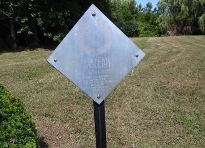
4. United Empire Loyalists Burial Site
Similar signs are at many pioneer cemeteries around Niagara. (Not all of them have a pigment problem, like this one...)
Credits. This page was last revised on August 4, 2025. It was originally submitted on August 3, 2025, by Kevin Westell of St. Catharines, Ontario. This page has been viewed 111 times since then and 33 times this year. Photos: 1, 2, 3, 4. submitted on August 3, 2025, by Kevin Westell of St. Catharines, Ontario. • Andrew Ruppenstein was the editor who published this page.
