Port Robinson in Thorold in Niagara Region, Ontario — Central Canada (North America)
Private John Carl U.E.L., Butler's Rangers
Photographed by Kevin Westell, August 1, 2025
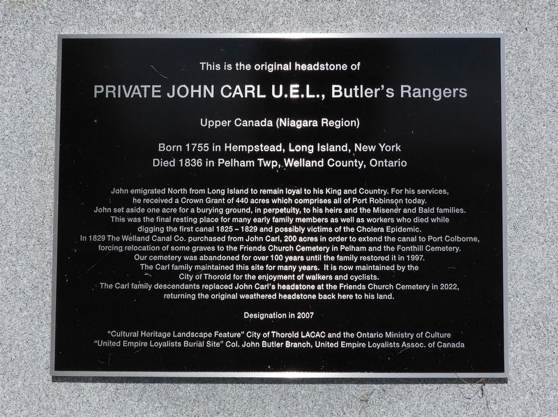
1. Private John Carl U.E.L., Butler's Rangers - Marker
This is the original headstone of
Private John Carl U.E.L., Butler's Rangers
Upper Canada (Niagara Region)
Born 1755 in Hempstead, Long Island, New York
Died 1836 in Pelham Twp, Welland County, Ontario
John emigrated North from Long Island to remain loyal to his King and Country. For his services, he received a Crown grant of 440 acres which comprises all of Port Robinson today. John set aside one acre for a burying ground, in perpetuity, to his heirs and the Misener and Bald families. This was the final resting place for many early family members as well as workers who died while digging the first canal 1825-1829 and possibly victims of the cholera epidemic. In 1829 The Welland Canal Co. purchased from John Carl, 200 acres in order to extend the canal to Port Colborne, forcing relocation of some graves to the Friends Church cemetery in Pelham and the Fonthill cemetery. Our cemetery was abandoned for over 100 years until the family restored it in 1997. The Carl family maintained this site for many years. It is now maintained by the City of Thorold for the enjoyment of walkers and cyclists. The
this page online
Designation in 2007
"Cultural Heritage Landscape Feature" City of Thorold LACAC and the Ontario Ministry of Culture
"United Empire Loyalists Burial Site" Col. John Butler Branch, United Empire Loyalists Assoc. of Canada
Topics and series. This historical marker is listed in these topic lists: Cemeteries & Burial Sites • Colonial Era • Settlements & Settlers • War, US Revolutionary. In addition, it is included in the The Welland Canals series list. A significant historical year for this entry is 1755.
Location. 43° 2.07′ N, 79° 12.947′ W. Marker is in Thorold, Ontario, in Niagara Region. It is in Port Robinson. It can be reached from Carl Street. The marker and pioneer cemetery are adjacent to the Welland Canals Parkway Trail (a paved walking/biking trail), 300 metres north-west of the dead-end of Egerter Rd, and 200 metres south-west of the dead-end of Carl St. Touch for map. Marker is at or near this postal address: 63 Carl Street, Thorold ON L0S 1K0,
Photographed by Kevin Westell, August 1, 2025
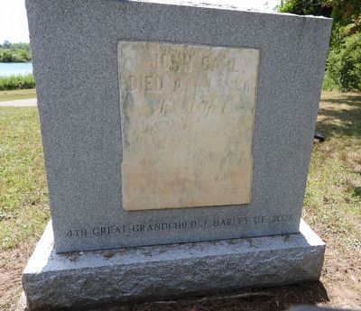
2. Reverse - the original headstone (referred to by the marker)
These are visible left of the stone: the paved walking/biking path; then further back, the Welland canal.

Regionally, this marker is on the Golden Horseshoe and in Niagara Canada. It is also in Central Canada. Globally, it is in North America, on the Great Lakes, in the Western Hemisphere, in the Western World, and in the Anglosphere. Historically, it finds itself in what was once a British colony, the Viceroyalty of New France, the Haudenosaunee (Iroquois) Confederacy, and Rupert’s Land.
Other nearby markers. At least 8 other markers are within walking distance of this marker: Carl-Misener-Bald Cemetery (here, next to this marker); Allanburg Firehouse First World War Memorial (approx. 0.7 kilometers away); The Pew House (approx. 0.7 kilometers away); The Pew House c. 1871 (approx. 0.7 kilometers away); 2nd Welland Canal River Lock At Port Robinson (approx. 0.8 kilometers away); a different marker also named 2nd Welland Canal River Lock At Port Robinson (approx. 0.8 kilometers away); Founding Of Port Robinson (approx. 0.8 kilometers away); Beckett's Reserve-McFarland House c. 1840 / Stephen Beatty House 1879 (approx. 0.9 kilometers away). Touch for a list and map of all markers in Thorold.
More about this marker.
Photographed by Kevin Westell, August 1, 2025
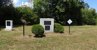
3. Marker in context
Photo faces north-west from near the hiking/biking trail. This cluster of signs is at the south end of the burying ground. This marker is the left-most white stone.
Credits. This page was last revised on August 4, 2025. It was originally submitted on August 3, 2025, by Kevin Westell of St. Catharines, Ontario. This page has been viewed 105 times since then and 28 times this year. Photos: 1, 2, 3. submitted on August 3, 2025, by Kevin Westell of St. Catharines, Ontario. • Andrew Ruppenstein was the editor who published this page.
