Fairgrounds in Columbus in Franklin County, Ohio — The American Midwest (Great Lakes)
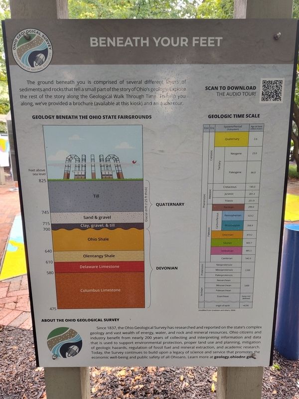
Beneath Your Feet
Photographed by Craig Doda, July 27, 2025
1. Beneath Your Feet Marker
About The Ohio Geological Survey
Since 1837, the Ohio Geological Survey has researched and reported on the state's complex geology and vast wealth of energy, water, and rock and mineral resources. Ohio citizens and industry benefit from nearly 200 years of collecting and interpreting information and data that is used to support environmental protection, proper land use and planning, mitigation of geologic hazards; regulation of fossil fuel and mineral extraction, and academic research. Today, the Survey continues to build upon a legacy of science and service that promotes the economic well-being and public safety of all Ohioans.
Erected by Ohio Department Of Natural Resources Division Of Geological Survey.
Topics. This historical marker is listed in these topic lists: Environment • Parks & Recreational Areas. A significant historical year for this entry is 1837.
Location. 39° 59.712′ N,
this page online

Regionally, this marker is in the Scioto Valley. It is also in the American Midwest and in the Corn Belt. Globally, it is in North America, the Western Hemisphere, the Western World, and the Anglosphere. Historically, it finds itself in what was once the Haudenosaunee (Iroquois) Confederacy, the territory of the Mississippian Culture, and the Northwest Territory.
Other nearby markers. At least 8 other markers are within walking distance of this marker: Mothman (here, next to this marker); Geological Cross Section of Ohio (a few steps from this marker); Grindstones (a few steps from this marker); Serpent Mound Impact Structure (a few steps from this marker); Flint: Ohio's State Gemstone (a few steps from this marker); Ohio Buckeye (within shouting distance of this
Photographed by Craig Doda, July 27, 2025
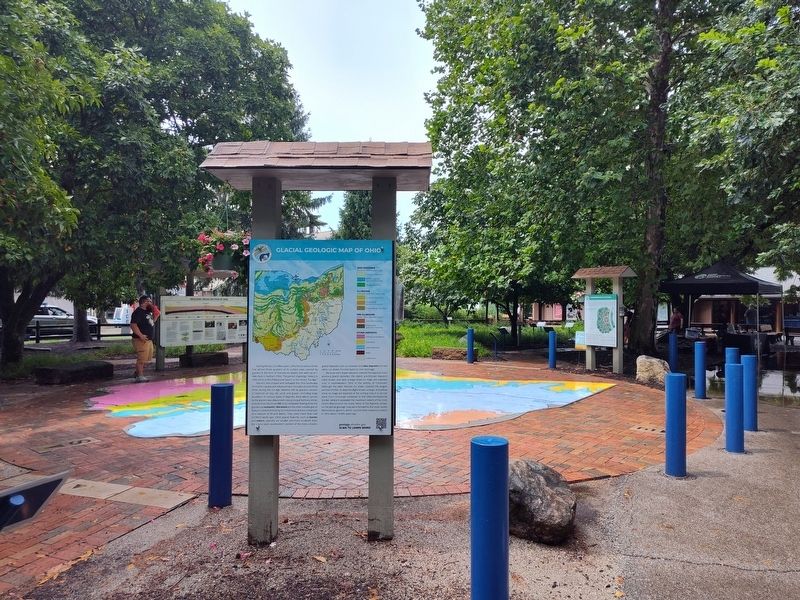
2. Beneath Your Feet Marker
Credits. This page was last revised on August 22, 2025. It was originally submitted on August 6, 2025, by Craig Doda of Napoleon, Ohio. This page has been viewed 60 times since then and 21 times this year. Photos: 1, 2. submitted on August 6, 2025, by Craig Doda of Napoleon, Ohio. • Devry Becker Jones was the editor who published this page.
