Near Mountainair in Socorro County, New Mexico — The American Mountains (Southwest)
Las Misiones de los Pueblos de Salinas
Photographed by James Hulse, April 10, 2025
1. Las Misiones de los Pueblos de Salinas Marker
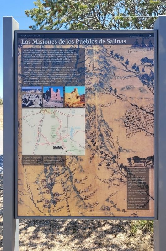
 Salinas Pueblo Missions National Monument preserves the remnants of three indigeous villages where Spanish friars started missions nearly 400 years ago. These pueblos were major trade centers for centuries prior to the arrival of Spanish explorers. Salt taken from nearby dry salt lakes was an important commodity traded between Pueblo and Plains peoples - so important that Spanish government officials called this entire region the "Salinas Jurisdiction."
Captions
(Photo #1) You can learn about life in early New Mexico at Abo, Gran Quivira, and Quarai as well as at the park headquarters visitor center in Mountainair.
(Photo #2) In 1583, explorer Antonio Espejo reported that this area had "eleven pueblos with a great many people, over 40,000.” This 1760 map by Bernardo Mäera y Pacheco shows that the Salinas Jurisdiction stretched from the Southern half of the Estancia Basin, along the eastern slopes of the Manzano Mountains, south to Chupadera Mesa and the Tularosa Basin.
Salinas Pueblo Missions National Monument preserva los restos de tres pueblos indígenas donde los frailes españoles iniciaron las misiones hace casi 400 años. Estos pueblos fueron importantes centros de comercio durante siglos antes del arribo de los exploradores españoles. La sal extraída de lagos salados secos cercanos fue un bien de consumo importante comercializado entre los indígenas de los pueblos y las grandes llanuras - tan importante que los oficiales del gobierno español llamaron a esta región entera la "Jurisdicción de Salinas.
Subtítulos
Foto #1) Usted puede aprender acerca de la vida en el antiguo Nuevo México en Abó, Gran Quivira y Quarai, asi como en el centro de visitantes en Mountainair.
(Foto #2) En 1583, el explorador Antonio Espejo reportó que esta área tenia "once pueblos con mucha gente, más de 40,000."
Este mapa de 1760, por Bernardo Miera y Pacheco, muestra que la Jurisdicción de Salinas se extendía desde la mitad sureña de la cuenca de Estancia, junto a la serranía al este, hacia la Musa Chupadera y la cuenca de Tularosa al sur.
Erected by Salinas
this page online
Topics. This historical marker is listed in these topic lists: Indigenous Peoples and Communities • Parks & Recreational Areas. A significant historical year for this entry is 1583.
Location. 34° 15.534′ N, 106° 5.621′ W. Marker is near Mountainair, New Mexico, in Socorro County. It is on Wsmr S Rte 41 south of New Mexico Route 55. The marker is located on the grounds of the Salinas Pueblo Missions National Monument - Gran Quivíra Ruins. Touch for map. Marker is in this post office area: Claunch NM 87011, United States of America. Touch for directions.

Regionally, this marker is in Southwest New Mexico and in the Rio Grande Valley. It is also in the American Southwest. Globally, it is in North America, the Western Hemisphere, the Western World, and the Anglosphere. Historically, it finds itself in what was once New Spain and also the Republic of Texas.
Other nearby markers. At least 8 other markers are within walking distance of this marker: Four-wing saltbush (within shouting distance of this marker); Walkingstick cholla (within
Photographed by James Hulse, April 10, 2025
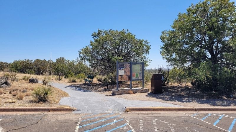
2. The view of the marker at the entrance trail
Photographed by James Hulse, April 10, 2025
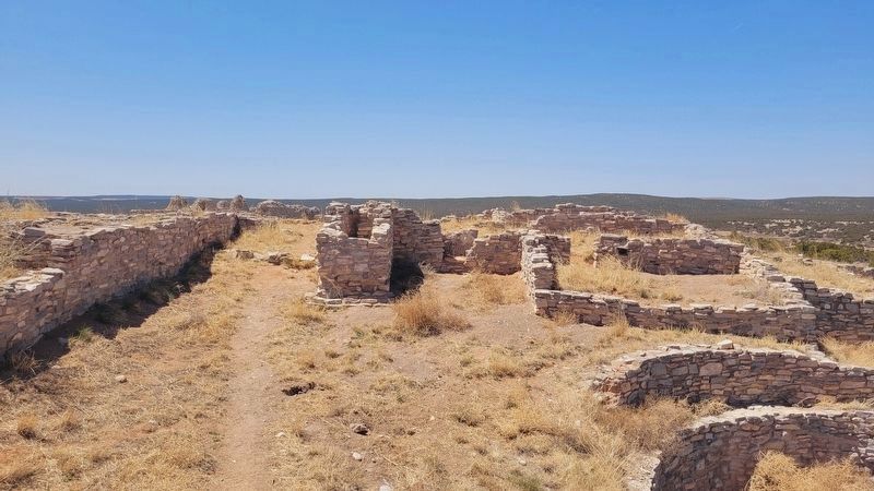
3. Gran Quivíra Ruins
Photographed by James Hulse, April 10, 2025
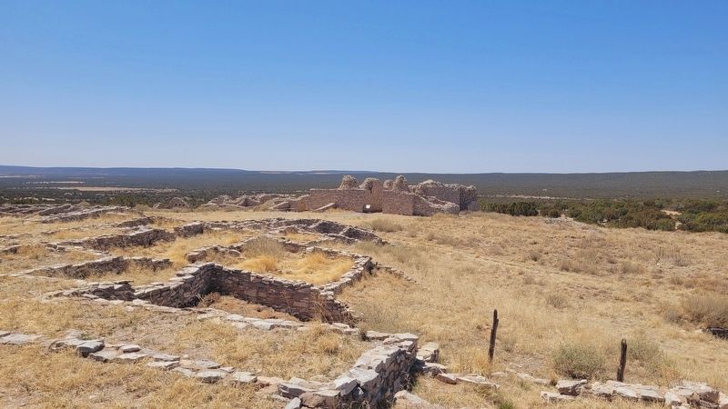
4. Gran Quivíra Ruins
Credits. This page was last revised on August 9, 2025. It was originally submitted on August 7, 2025, by James Hulse of Medina, Texas. This page has been viewed 96 times since then and 19 times this year. Photos: 1, 2, 3, 4. submitted on August 8, 2025, by James Hulse of Medina, Texas.
