La Veta in Huerfano County, Colorado — The American Mountains (Southwest)
The Legends of Spanish Peaks
| — | Scenic Highway of Legends | — |
Photographed by Cosmos Mariner, July 11, 2025
1. The Legends of Spanish Peaks Marker
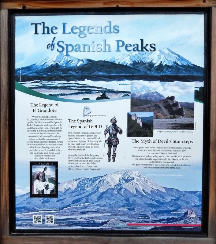
The Legend of El Grandote
When the young Mexican, El Grandote, left his home to look for gold in the Wayatoyas (The Spanish Peaks), leaving behind Nana, his wife, and their unborn child. One night he saw Nana in a dream, and realized she was dead. Deeply disturbed, he returned to Mexico and found that indeed she had been murdered. A second dream instructed him to return to Wayatoya where Nana came to him in his dreams, holding their infant child in her arms. It is said that they still stroll night after night, along the quiet streams and lakes of the Wahatoyas.
The Spanish Legend of GOLD
One Spanish expedition reportedly found a rich vein of gold in the Spanish Peaks, and enslaved local natives to dig it out. Before they left to head back south over Cuchara Pass, the Spanish killed all those they had enslaved.
Along the banks of the Purgatory River the Spaniards themselves were ambushed and killed. This earned this river its name: Rio de las Animas Perdido en Purgatorio (River of Souls Lost in Purgatory).
The Myth of Devil's Stairsteps
Once upon a time, before the Rockies were mountains, when the earth was new, the devil was
this page online
[photo captions]
• Nugget from Blanca Peak Mining
• West Spanish Peak
• Spanish Peaks National Monument
• The Great Wall Radial Dike
• Radial Dike
• Goemmer Butte
Erected by Colorado Department of Transportation.
Topics. This historical marker is listed in these topic lists: Exploration • Hispanic Americans • Waterways & Vessels.
Location. 37° 32.449′ N, 105° 3.558′ W. Marker is in La Veta, Colorado, in Huerfano County. It is at the intersection of U.S. 160 and County Road 450, on the right when traveling east on U.S. 160. The marker is located in a wayside picnic area on US Highway 160. Touch for map. Marker is in this post office area: La Veta CO 81055, United States of America. Touch for directions.

Regionally, this marker is in the American Mountain
Courtesy PhotoColorado.com
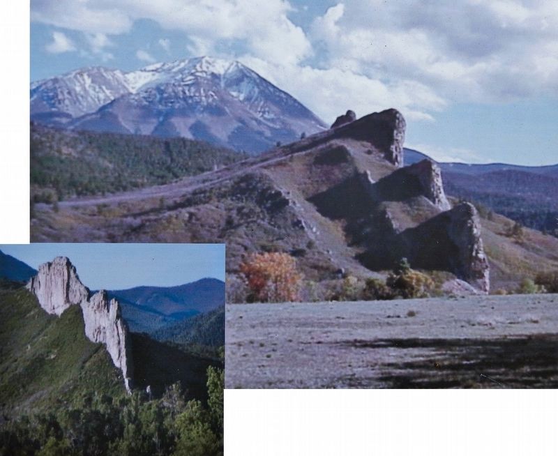
2. Marker detail: The Devil’s Stairsteps
“This is paradise enough for me.” Colonel John Francisco
Other nearby markers. At least one other marker is within walking distance of this marker: Close to Heaven, Down to Earth (here, next to this marker).
Also see . . .
1. Spanish Peaks (Wikipedia).
Excerpt: The Spanish Peaks are a pair of prominent mountains located in southwestern Huerfano County, Colorado. The Comanche people call them Huajatolla (or Wa-ha-toy-yah) meaning "double mountain". The two peaks, East Spanish Peak at elevation 12,688 feet and West Spanish Peak at elevation 13,631 feet, are higher than any point in the United States farther east. They were an important landmark on the Santa Fe Trail, the first sighting of the Rocky Mountains for travelers on the trail. The Spanish Peaks were designated a National Natural Landmark in 1976 as two of the best-known examples of igneous dikes.(Submitted on August 11, 2025, by Cosmos Mariner of Cape Canaveral, Florida.)
2. Purgatoire River (Wikipedia).
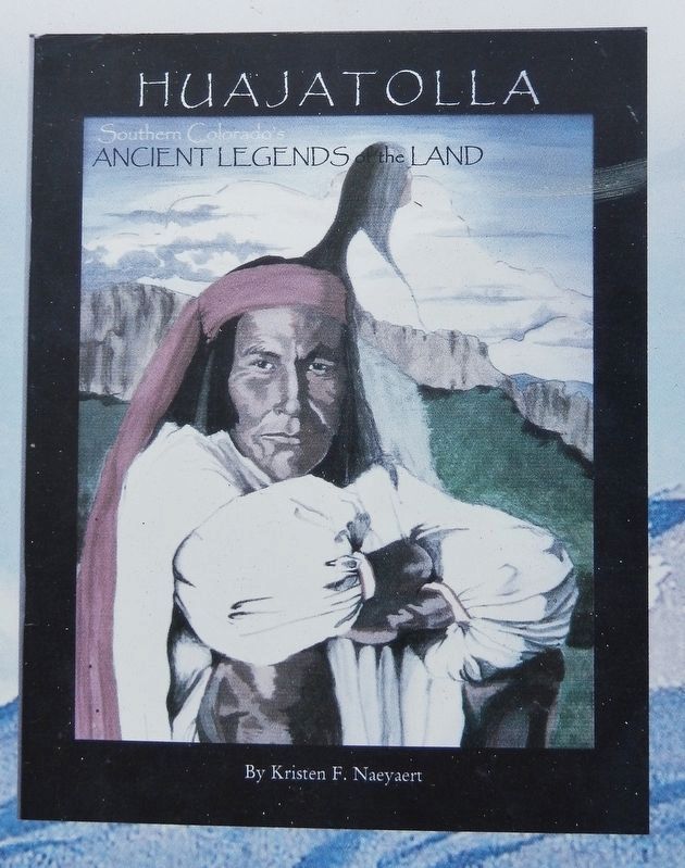
3. Marker detail: Huajatolla
Southern Colorado’s Ancient Legends of the Land, by Kristen F. Naeyaert
Excerpt: It was named by New Mexican Governor Antonio Valverde y Cosío in 1719 during his exploration of the region. Valverde named it "Rio de las Ánimas," meaning "River of the Spirits," as a warning to subsequent explorers of the dangers of crossing the nearby Ratón Pass. Over time, the true meaning of the river's name became lost, and various interpretations emerged. By the end of the 18th-century Spanish traders believed it to be "Rio de las Ánimas en Purgatorio," or "River of the Souls in Purgatory," after a supposed massacre that occurred on its banks. French trappers learned the name and later translated it as "Rivière des âmes au Purgatoire." They related their translation to members of the Stephen H. Long expedition in 1820 who renamed it "Purgatory Creek" by removing all references to souls. Mexican traders on the old Santa Fe Trail expanded on the legend and named the river "Rio de las Ánimas Perdidas en Purgatorio," or "River of the Souls Lost in Purgatory," believing the souls to have become lost. Mountain Men had difficulty pronouncing the French translation and called it "Picatoire," while Anglophone settlers during(Submitted on August 11, 2025, by Cosmos Mariner of Cape Canaveral, Florida.)the Colorado Gold Rush anglicized it to "Picketwire," despite the river having no relation to any fence.Photographed by Cosmos Mariner, July 11, 20254. The Legends of Spanish Peaks MarkerLooking south from Colorado Highway 160; the Spanish Peaks are in background. This marker is the leftmost panel in this 3-panel interpretive kiosk.Depending on the language spoken, the river had five different names - Ánimas, Purgatorio, Purgatoire, Purgatory, and Picketwire — by the end of the 19th century. On December 6, 1911, the US Board on Geographic Names resolved the naming issue by selecting the French translation "Purgatoire" as the official name of the river. It is one of the state's oldest continuously named rivers, spanning over 300 years. Most locals today refer to it simply as "Purgatory."
Credits. This page was last revised on August 11, 2025. It was originally submitted on August 10, 2025, by Cosmos Mariner of Cape Canaveral, Florida. This page has been viewed 274 times since then and 93 times this year. Photos: 1, 2, 3, 4. submitted on August 11, 2025, by Cosmos Mariner of Cape Canaveral, Florida.
