Port Dalhousie in St. Catharines in Niagara Region, Ontario — Central Canada (North America)
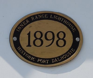
Inner Range Lighthouse 1898
Photographed by Kevin Westell, August 10, 2025
1. Inner Range Lighthouse 1898 - Marker
Inner Range Lighthouse
1898
Historic Port Dalhousie
Erected by The Port Dalhousie Conservancy.
Topics and series. This historical marker is listed in these topic lists: Man-Made Features • Waterways & Vessels. In addition, it is included in the Lighthouses series list. A significant historical year for this entry is 1898.
Location. 43° 12.413′ N, 79° 15.79′ W. Marker is in St. Catharines, Ontario, in Niagara Region. It is in Port Dalhousie. It is on Lighthouse Road, on the left when traveling north. Touch for map. Marker is at or near this postal address: 61 Lighthouse Road, St Catharines ON L2N 7P4, Canada. Touch for directions.

Regionally, this marker is on the Golden Horseshoe and in Niagara Canada. It is also in Central Canada. Globally, it is in North America, on the Great Lakes, in the Western Hemisphere, in the Western World, and in the Anglosphere. Historically, it finds itself in what was once a British colony, the Viceroyalty of New France, the Haudenosaunee (Iroquois) Confederacy, and Rupert’s Land.
Other nearby markers. At least 8 other markers are within walking distance
this page online
Regarding Inner Range Lighthouse 1898. 1. These lighthouse are still functional, to aid the few pleasure craft that might enter Port Dalhousie at night.
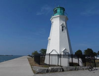
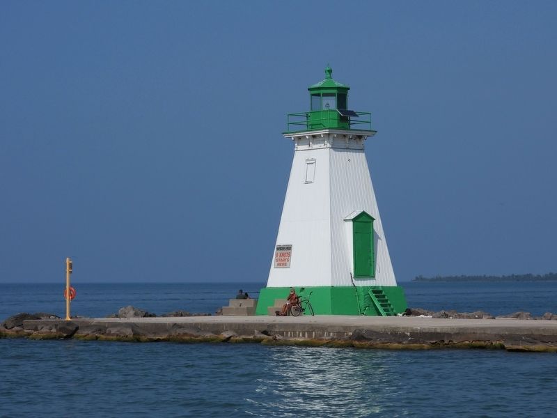
2. The inner range lighthouse, the third one constructed on this spot, was built in 1898. It is one of few (8?) remaining examples in Canada of an octagonal lighthouse. The outer range lighthouse (shorter and square) was built in 1879, and is also a heritage building.
3. A navigator can use a pair of range-lights AKA leading-lights to follow a line.
Photographed by Kevin Westell, August 10, 2025
2. Inner Range Lighthouse
Photo faces north, along Port Dalhousie's east pier. In the foreground is the back-range lighthouse; the marker is mounted high on the entrance door. In the distance is the green-and-white back-range lighthouse; a red-and-white tower, at the tip of the west pier; and Lake Ontario.
Photographed by Kevin Westell, August 10, 2025
3. Outer Range Lighthouse
The outer lighthouse is also special (even though it has no historic plaque). In the distance is the west pier protecting the entrance to the current (fourth) Welland canal.
Credits. This page was last revised on May 6, 2026. It was originally submitted on August 11, 2025, by Kevin Westell of St. Catharines, Ontario. This page has been viewed 85 times since then and 25 times this year. Photos: 1, 2, 3. submitted on August 11, 2025, by Kevin Westell of St. Catharines, Ontario. • Andrew Ruppenstein was the editor who published this page.
