
the Town of Ticonderoga in Essex County, New York — The American Northeast (Mid-Atlantic)
Edmund "Undy" Morette
1913 - 2000
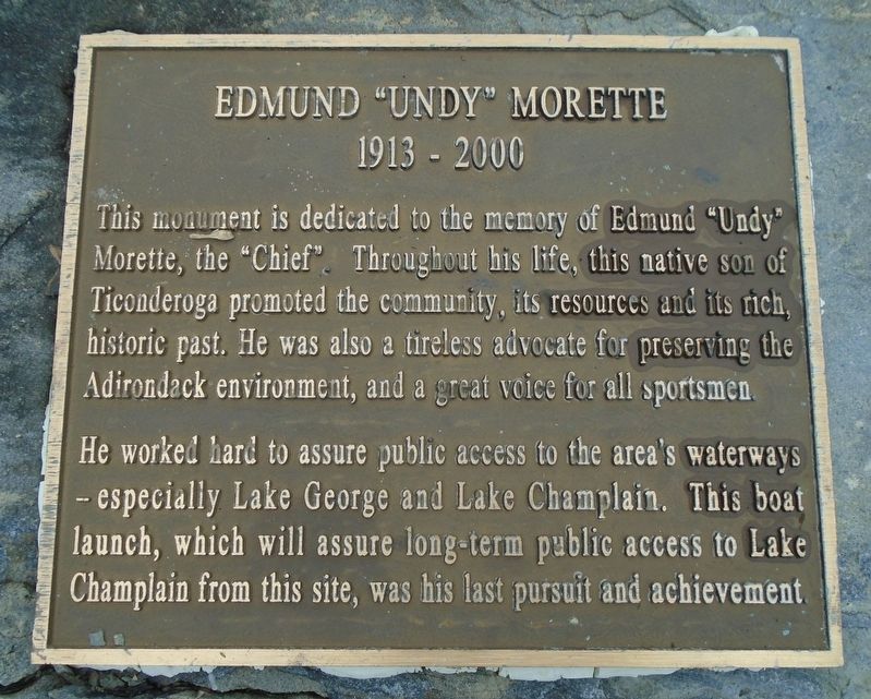
Photographed by William Fischer, Jr., July 31, 2025
1. Edmund "Undy" Morette Marker
This monument is dedicated to the memory of Edmund "Undy" Morette, the "Chief". Throughout his life, this native son of Ticonderoga promoted the community, its resources and its rich, historic past. He was also a tireless advocate for preserving the Adirondack environment, and a great voice for all sportsmen.
He worked hard to assure public access to the area's waterways - especially Lake George and Lake Champlain. This boat launch, which will assure long-term public access to Lake Champlain from this site, was his last pursuit and achievement
Topics. This historical marker is listed in these topic lists: Charity & Public Work • Parks & Recreational Areas • Waterways & Vessels.
Location. 43° 51.227′ N, 73° 23.128′ W. Marker is near Ticonderoga, New York, in Essex County. It is in the Town of Ticonderoga. It can be reached from Fort Ti Road. Marker is on the Ticonderoga Boat Launch grounds, adjacent to the Fort Ticonderoga Ferry on Fort Ticonderoga Road (New York Route 74) at Lake Champlain. Touch for map. Marker is in this post office area: Ticonderoga
this page online

Regionally, this marker is in Upstate New York, in the Adirondacks & North Country, and in the Champlain Valley. It is also in the American Northeast and in the Mid-Atlantic. Globally, it is in North America, the Great North Woods, the Western Hemisphere, the Western World, and the Anglosphere. Historically, it finds itself in what was once the Viceroyalty of New France, New Netherland, and one of the original Thirteen Colonies.
Other nearby markers. At least 8 other markers are within walking distance of this marker: Lake Champlain (a few steps from this marker); Larrabee’s Point (approx. half a mile away in Vermont); The Fort Ticonderoga Ferry (approx. half a mile away in Vermont); Near this spot stood Montcalm (approx. half a mile away); The French Lines (approx. half a mile away); Hut Sites (approx. half a mile away); The Carillon Battlefield (approx. half a mile away); “The Black Watch” (approx. half a mile away). Touch for a list and map of all markers in Ticonderoga.

Photographed by William Fischer, Jr., July 31, 2025
2. Edmund "Undy" Morette Marker
Credits. This page was last revised on August 11, 2025. It was originally submitted on August 11, 2025, by William Fischer, Jr. of Reynoldsburg, Ohio. This page has been viewed 121 times since then and 20 times this year. Photos: 1, 2. submitted on August 11, 2025, by William Fischer, Jr. of Reynoldsburg, Ohio.
