San Luis in Costilla County, Colorado — The American Mountains (Southwest)
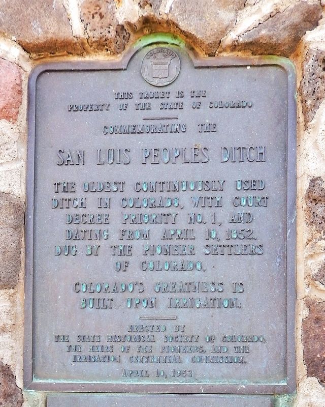
Commemorating the San Luis Peoples Ditch
Photographed by Cosmos Mariner, July 12, 2025
1. San Luis Peoples Ditch Marker
The oldest continuously used ditch in Colorado, with court decree priority No. 1, and dating from April 10, 1852. Dug by the pioneer settlers of Colorado.
———
This tablet is the property of the State of Colorado
———
Erected by the State Historical Society of Colorado,
the heirs of the pioneers,
and the Irrigation Centennial Commission.
April 10, 1952.
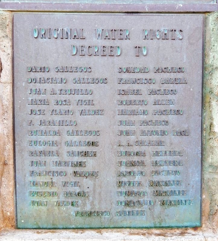
Original water rights decreed to:
Dario Gallegos • Donaciano Gallegos • Juan A. Trujillo • Maria Rosa Vigil • Jose Ylario Valdez • F. Jaramillo • Rumalda Gallegos • Eulogia Gallegos • Rafaela Sanchez • Juan Martinez • Francisco Valdez • Manuel Vigil • Eusebio Bargas • Juan Valdez • Soledad Pacheco • Francisco Barela • Isabel Pacheco • Roberto Allen • Mariano Pacheco • Juan Pacheco • Juan Antonio Baca • A. A. Salazar • Eulogia Herrera • Juanita Herrera • Antonio Pacheco • Miguel Martinez • Rumaldo Martinez • Donaciano Martinez • Francisco Sanchez
Erected 1952 by State Historical Society of Colorado,
this page online
Topics and series. This historical marker is listed in these topic lists: Agriculture • Architecture • Settlements & Settlers • Waterways & Vessels. In addition, it is included in the History Colorado series list. A significant historical date for this entry is April 10, 1852.
Location. 37° 11.696′ N, 105° 25.715′ W. Marker is in San Luis, Colorado, in Costilla County. It is at the intersection of Main Street (State Highway 159) and 1st Street, on the right when traveling north on Main Street. The marker is in a pull-out overlooking the subject ditch. Touch for map. Marker is in this post office area: San Luis CO 81152, United States of America. Touch for directions.

Regionally, this marker is in the San Juan Mountains and in the San Luis Valley. It is also in the American Mountain West. Globally, it is in North America, the Rocky Mountains, the Western Hemisphere, the Western World, and the Anglosphere. Historically, it finds itself in what was once New Spain and also the Republic of Texas.
Other nearby markers. At least 8 other markers are within
Photographed by Cosmos Mariner, July 12, 2025
2. Original Water Rights Marker
Also see . . .
1. A look at the San Luis People’s Ditch (Coyote Gulch).
(From The Pueblo Chieftain) Excerpt: Originally a long, shallow, earthwork excavation, this “acequia” or gravity-fed irrigation channel was hand-dug by San Luis’ first settlers to channel water for crops and livestock from the Culebra River and its tributaries. Extending 4 miles west from La Vega, the town’s communal grazing land, it is the oldest continuously used, community irrigation ditch in Colorado.(Submitted on August 14, 2025, by Cosmos Mariner of Cape Canaveral, Florida.)The People’s Ditch was granted the first adjudicated water rights in what is now Colorado, referred to as “court decree priority No. 1” and dating from April 10, 1852.
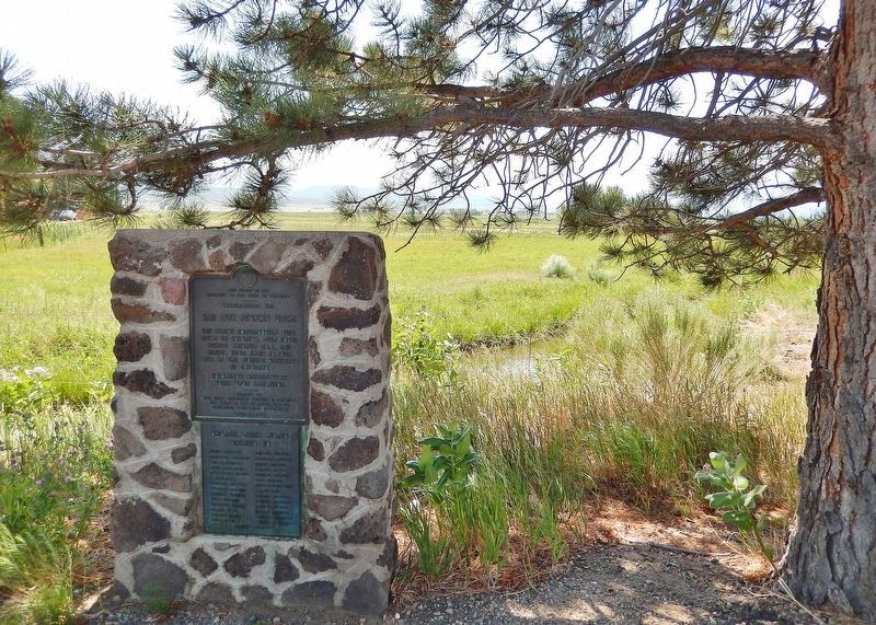
These rights were conveyed just 370 days after San Luis was established — and 24 years before Colorado became a state. Today, the ditch serves some 16 “parciantes” or affiliated water-users, and irrigates more than 2,000 acres of hay and other crops.Photographed by Cosmos Mariner, July 12, 20253. Commemorating the San Luis Peoples Ditch MarkerLooking east from Main Street. The marker comprises two panels: the historical marker on top with a supplemental “original water rights” tablet mounted below. The San Luis Peoples Ditch (water flowing) is visible in the background.
2. Rio Culebra (Wikipedia).
Excerpt: The Rio Culebra basin is part of the Sangre de Cristo Land Grant awarded to the family of Carlos Beaubien in 1843. In 1850 settlers began arriving at the Rio Culebra and in 1851, ten settlers from Taos, New Mexico established the town of San Luis on the banks of the Rio Culebra, the first permanent settlement in Colorado. In 1852, the settlers began digging what became known as the San Luis People's Ditch to irrigate farmland with the water of the Rio Culebra. The People's Ditch is 3.7 miles long. Each settler received a long, narrow strip of land 70 to 275 feet wide fronting on the ditch and extending at a right angle from the ditch as much as 19 miles across the valley.(Submitted on August 14, 2025, by Cosmos Mariner of Cape Canaveral, Florida.)The San Luis People's Ditch was the first of a dozen acequias (irrigation ditches)
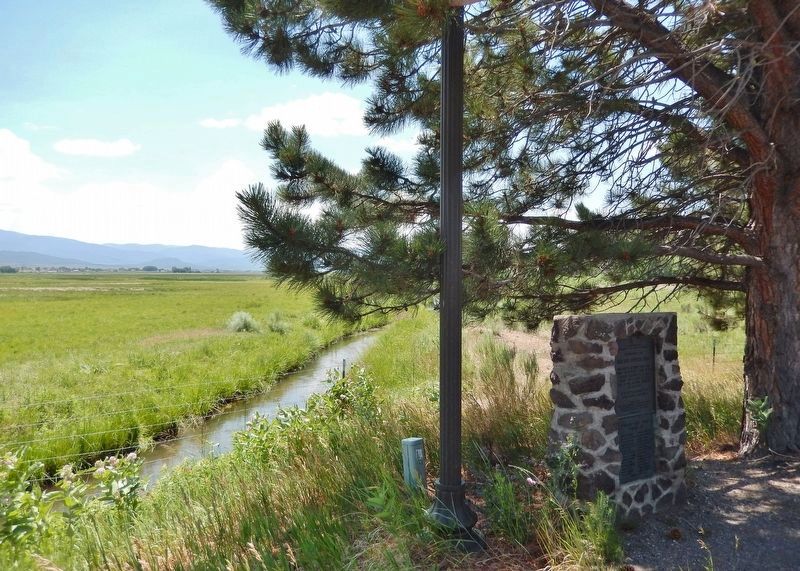
constructed by 1874. In 1986, 83 acequias were utilizing the water of the Rio Culebra and its tributaries. The population of Costilla County peaked in 1940 when 600 to 700 farm families occupied the Rio Culebra watershed; in 2003 that number had declined to 270 families who irrigated 24,000 acres of crop and pastureland.Photographed by Cosmos Mariner, July 12, 20254. Commemorating the San Luis Peoples Ditch MarkerLooking southeast from Main Street. The San Luis Peoples Ditch (water flowing) is visible in the left background.
Photographed by Cosmos Mariner, July 12, 2025
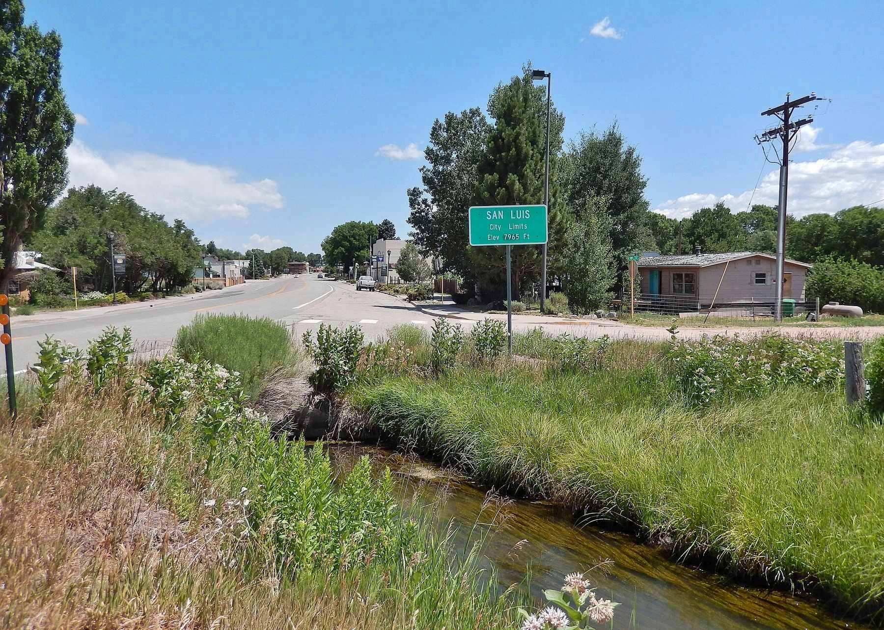
5. The San Luis Peoples Ditch
Looking north along Main Street through San Luis from near the marker. The ditch flows along the southwest side of the town.
Credits. This page was last revised on August 14, 2025. It was originally submitted on August 13, 2025, by Cosmos Mariner of Cape Canaveral, Florida. This page has been viewed 142 times since then and 40 times this year. Photos: 1, 2, 3, 4, 5. submitted on August 14, 2025, by Cosmos Mariner of Cape Canaveral, Florida.
