El Cerrito in Contra Costa County, California — The American West (Pacific Coastal)
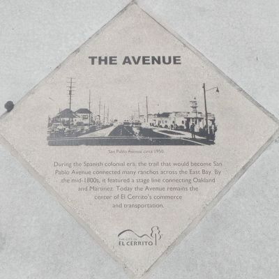
The Avenue
Photographed by Barry Swackhamer, April 21, 2016
1. The Avenue Marker
Caption: San Pablo Avenue circa 1950.
Erected by City of El Cerrito.
Topics and series. This historical marker is listed in these topic lists: Colonial Era • Roads & Vehicles. In addition, it is included in the California - El Cerrito - San Pablo Avenue Historical-Cultural Pavers series list.
Location. 37° 55.513′ N, 122° 19.117′ W. Marker is in El Cerrito, California, in Contra Costa County. It is on San Pablo Avenue near Cutting Boulevard, on the left when traveling north. Touch for map. Marker is at or near this postal address: 11575 San Pablo Boulevard, El Cerrito CA 94530, United States of America. Touch for directions.

Regionally, this marker is in the San Francisco Bay Area and on the Coast Ranges. It is also on the American Pacific Coast. Globally, it is in North America, on the Ring of Fire, on the Pacific
this page online
Other nearby markers. At least 8 other markers are within walking distance of this marker: Summertime Fun in El Cerrito (about 700 feet away, measured in a direct line); Japanese Nurseries (approx. 0.2 miles away); Stege Sanitary (approx. 0.3 miles away); Contra Costa Civic Theatre (approx. 0.4 miles away); Streetcars in El Cerrito (approx. 0.4 miles away); Little Italy (approx. 0.4 miles away); Santa Fe Railway (approx. 0.4 miles away); Holy Ghost Festa (approx. half a mile away). Touch for a list and map of all markers in El Cerrito.
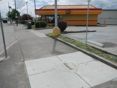
More about this marker. This marker is at the southwest corner of San Pablo Avenue and Cutting Boulevard.
This marker is one of The City of El Cerrito's Historical-Cultural Pavers.
Also see . . . State Route 123 - Wikipedia. San Pablo Avenue is one of the oldest existing roads in the East Bay. It originated in the Spanish colonial era as the Camino de la Contra Costa ("road of the opposite shore", i.e. opposite from the Presidio of San Francisco and the settlement around the Mission in San Francisco) and was legally a "camino real" ("royal road", i.e., property of the Spanish crown) until Mexico won its independence in 1821. It ran from the Encinal ("Oakland") landings of the Rancho San Antonio northward (actually northwestward) along the bayshore, then eastward just inland of the Carquinez Strait. It was the principal thoroughfare for the scattered ranches throughout this part of the East Bay.
Photographed by Barry Swackhamer, April 21, 2016
2. The Avenue Marker
Credits. This page was last revised on August 15, 2025. It was originally submitted on April 27, 2016, by Barry Swackhamer of Brentwood, California. This page has been viewed 502 times since then and 33 times this year. Last updated on August 14, 2025, by Hank Yukon of El Cerrito, California. Photos: 1, 2. submitted on April 27, 2016, by Barry Swackhamer of Brentwood, California. • Devry Becker Jones was the editor who published this page.
