
Port Colborne in Niagara Region, Ontario — Central Canada (North America)
Old Meets New - A Walk Across History
L'Ancien En Presence Du Nouveau
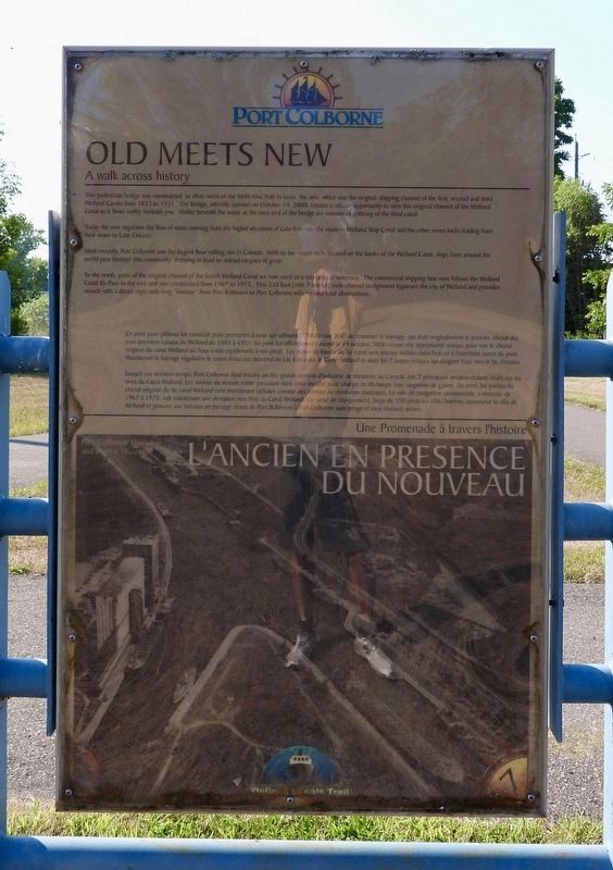
Photographed by Kevin Westell, August 14, 2025
1. Old Meets New - A Walk Across History - Marker

Old Meets New - A walk across History
This pedestrian bridge was constructed to allow users of the multi-use trail to cross the weir, which was the original shipping channel of the first, second and third Welland canals from 1833 to 1931. The bridge, officially opened on October 14, 2000, creates a unique opportunity to view this original channel of the Welland canal as it flows swiftly beneath you. Visible beneath the water at the west end of the bridge are remains of cribbing of the third canal.
Today the weir regulates the flow of water running from the higher elevation of Lake Erie into the modern Welland ship canal and the other seven locks leading from here down to Lake Ontario.
Until recently, Port Colborne was the largest flour milling site in Canada. With its two major mills located on the banks of the Welland canal, ships from around the world pass through this community, stopping to load or unload cargoes of grain.
To the north, parts of the original channel of the fourth Welland canal are now used as a recreational waterway. The commercial shipping lane now follows the Welland canal by-pass to the east and was constructed from 1967 to 1973. This 350 foot [106.7 metres] wide channel realignment bypasses the city of Welland and provides vessels with a direct eight-mile long "freeway" from Port Robinson to Port Colborne with no overhead obstructions.
L'Ancien En Presence Du Nouveau - Une Promenade à traverse l’histoire
Ce pont pour piéton fut construit pour permettre à ceux qui utilisent le "multi-use trail" de traverser le barrage, qui était originalement le premier chenal des trois premiers canaux de Welland de 1883 à 1931. Le pont fut officiellement ouvert le 14 octobre 2000 créant une opportunité unique pour voir le chenal original du canal Welland où l'eau coule rapidement à vos pieds. Les restes du bassin du 3e canal sont encore visibles dans l'eau et à l'extrémité ouest du pont. Maintenant le barrage régularise le cours d'eau qui descend du Lac Erie dans le Canal Welland et dans les 7 autres écluses qui dirigent l'eau vers le lac Ontario.
Jusqu'à ces derniers temps, Port Colborne était encore un des grands centres d'industrie de meunerie au Canada. Les 2 principaux moulins étaient situés sur les rives du Canal Welland. Les navires du monde entier passaient dans cette localité pour charger et décharger leur cargaison de grains. Au nord, les parties du chenal original du 4e canal Welland sont maintenant utilisées comme des centres de récréation nautiques. La voie de navigation commerciale, construite de 1967 à 1973, suit maintenant une déviation vers l'est du canal Welland. Ce canal de réalignement, large de 350 pieds ou 106.7 mètres, contourne la ville de Welland et procure aux bateaux un passage direct de Port Robinson à Port Colborne sans péage et sans obstacle aérien.
Topics and series.
this page online
Location. 42° 54.237′ N, 79° 14.764′ W. Marker is in Port Colborne, Ontario, in Niagara Region. It can be reached from Ramey Avenue. The marker is easily seen within Derek Point Park, along the Welland Canals trail, where another path forks off to the north (toward the geographical point). It is 200 metres north of Ramey Road along the trail; and also 200 metres east of Weir Road along the trail. Touch for map. Marker is at or near this postal address: 61 Ramey Avenue, Port Colborne ON L3K 2L2, Canada. Touch for directions.

Regionally, this marker is on Ontario’s Golden Horseshoe and in Niagara Canada. It is also in Central Canada. Globally, it is in North America, the Western Hemisphere, the Western World, and the Anglosphere. Historically, it finds itself in what was once a British colony, the Viceroyalty of New France, the Haudenosaunee (Iroquois) Confederacy,
Photographed by Kevin Westell, August 14, 2025
2. Old Meets New - reverse side
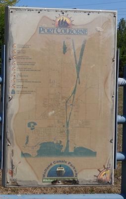
The reverse side is a map of Port Colborne, showing the locations of this series of historical markers. Most of them still exist.
Other nearby markers. At least 8 other markers are within walking distance of this marker: Derek Point (here, next to this marker); Port Colborne Tourist Information "Lighthouse" (approx. 0.3 kilometers away); Humberstone Hall (approx. 0.4 kilometers away); The Welland Ship Canal (approx. 0.4 kilometers away); Memorial to John Hansen (approx. 0.4 kilometers away); Knights of Columbus Gazebo (approx. half a kilometer away); Augustine House (approx. half a kilometer away); Citizens of Port Colborne Who Gave Their Lives ... Welland Canals (approx. half a kilometer away). Touch for a list and map of all markers in Port Colborne.
Regarding Old Meets New - A Walk Across History. 1. To clarify: the first, second and third Welland canals followed the path of the weir channel from 1833 to 1931 (the English inscription is correct, and the French inscription is not.)
2. To clarify the usage of "weir": Port Colborne has an island. The east side of the island is formed by the current (4th) Welland canal, with Lock 8. The west side of the island is formed by the weir channel, with a weir (a fancy, remotely adjustable weir)

Photographed by Kevin Westell, August 14, 2025
3. Old Meets New - A Walk Across History - Marker in context
Photo faces north and north-west, from the south end of Derek Point park. The walking/hiking path on the left is the Welland Canals trail; the path on the right just goes 200 metres to the north end of the island. The old Robin Hood flour mill (currently owned by LAC - London Agricultural Commodities) looms across the weir channel. Port Colborne has three other active grain mills, each with their own wharf.
Credits. This page was last revised on August 20, 2025. It was originally submitted on August 15, 2025, by Kevin Westell of St. Catharines, Ontario. This page has been viewed 103 times since then and 23 times this year. Photos: 1, 2, 3. submitted on August 15, 2025, by Kevin Westell of St. Catharines, Ontario. • Andrew Ruppenstein was the editor who published this page.
