Port Abino in Fort Erie in Niagara Region, Ontario — Central Canada (North America)
Point Abino Lighthouse
Le Phare De La Pointe Abino
Photographed by Kevin Westell, August 14, 2025
1. Point Abino Lighthouse - Marker

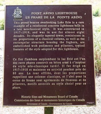
Point Abino Lighthouse
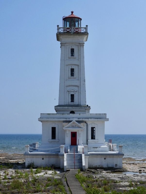
This proud beacon overlooking Lake Erie is a rare example of a reinforced concrete lighthouse built in a late neoclassical style. It was constructed in 1917-1918, and was in use for almost eight decades. Its elegantly tapered tower, reminiscent in its proportions of a classical column, as well as the rectangular structure housing the foghorn, are embellished with pediments and pilasters, typical features of the style adopted for this lighthouse.
Le Phare De La Pointe Abino
Ce fier flambeau surplombant le lac Erié est l'un des rares phares construit en béton armé à s'inspirer du style néo-classique tardif. II fut érigé en 1917-1918 et maintenu en activité pendant près de 80 ans La tour effilée, dont les proportions rappellent une colonne classique, et l'abri pour la corne de brume sont agrémentés de frontons et de pilastres, motifs associés au style choisi pour ce phare.
Erected 2003 by Historic Sites and Monuments Board of Canada.
Topics and series. This historical marker is listed in these topic lists: Man-Made Features • Waterways & Vessels.
this page online
Location. 42° 50.17′ N, 79° 5.729′ W. Marker is in Fort Erie, Ontario, in Niagara Region. It is in Port Abino. It can be reached from Point Abino Road South. Touch for map. Marker is at or near this postal address: 1075 Point Abino Road S, Fort Erie ON L0S 1N0, Canada. Touch for directions.

Regionally, this marker is on the Golden Horseshoe and in Niagara Canada. It is also in Central Canada. Globally, it is in North America, on the Great Lakes, in the Western Hemisphere, in the Western World, and in the Anglosphere. Historically, it finds itself in what was once a British colony, the Viceroyalty of New France, the Haudenosaunee (Iroquois) Confederacy, and Rupert’s Land.
Other nearby markers. At least 8 other markers are within 5 kilometers of this marker, measured as the crow flies: Holloway Memorial Chapel Centennial, 1894 - 1994 (approx. 1.2 kilometers away); Anchor from the wreck of the Briton (approx. 1.2 kilometers away); In Memory of Light Vessel 82 and its Crew
Photographed by Kevin Westell, August 14, 2025
2. Port Abino Lighthouse - Marker in context
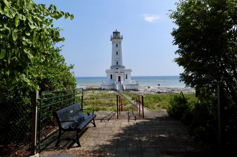
Photo faces south from near the private road. In this photo, the marker is right of the path, where the red railing starts, visible as a black rectangle lurking in the bushes.
More about this marker. The marker and lighthouse are at the very south end of Point Abino. They sit upon private property owned by the Port Abino Association. Reservations to visit can be made between June 21 and Labour Day, at forterie.ca/lighthouse. The "free option" involves a one-mile walk each way; the "tour option" includes a drive each way and access inside the lighthouse.
Regarding Point Abino Lighthouse. The lighthouse was constructed in 1917 by the Department of Marine and Fisheries in response to increased marine traffic at the east end of Lake Erie. The front door is elevated 16 steps (maybe 12 feet) over the stone on which the lighthouse sits. Lake Erie's water level varies: at Port Colborne, it has an 18 foot range, the highest water in a storm with
Photographed by Kevin Westell, August 14, 2025
3. Port Abino Association - Entrance
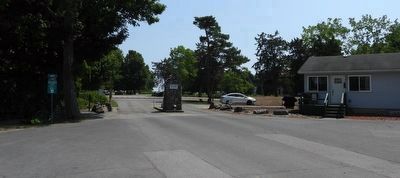
Photo faces south. This is the end of the public road; and the entrance to the private land. The private office is the building on the right.
Photographed by Kevin Westell, August 14, 2025
4. Port Abino Lighthouse
When it was in use, the light was 87 feet over the water. On the left side, New York state on Lake Erie's south shore is visible 10 or 12 miles away.
Photographed by Kevin Westell, August 14, 2025
5. Port Abino and its Lighthouse, across Abino Bay
Photo is from Crystal Beach's Waterfront Park, 3 km (2 miles) away.
Credits. This page was last revised on August 20, 2025. It was originally submitted on August 16, 2025, by Kevin Westell of St. Catharines, Ontario. This page has been viewed 124 times since then and 37 times this year. Photos: 1, 2, 3, 4, 5. submitted on August 16, 2025, by Kevin Westell of St. Catharines, Ontario. • Andrew Ruppenstein was the editor who published this page.
