Inner Harbor in Baltimore, Maryland — The American Northeast (Mid-Atlantic)
The Port of Baltimore
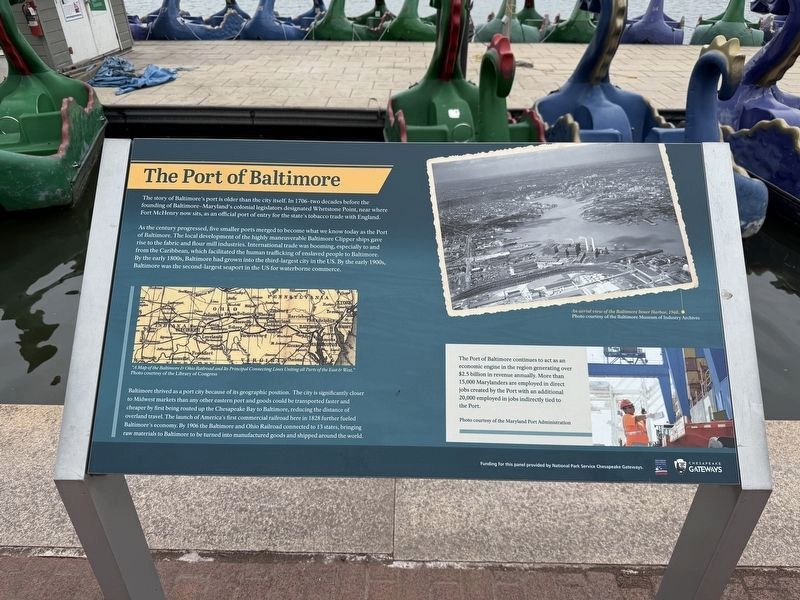
The story of Baltimore's port is older than the city itself. In 1706—two decades before the founding of Baltimore—Maryland's colonial legislators designated Whetstone Point, near where Fort McHenry now sits, as an official port of entry for the state's tobacco trade with England.
As the century progressed, five smaller ports merged to become what we know today as the Port of Baltimore. the local development of the highly maneuverable Baltimore Clipper ships gave rise to the fabric and flour mill industries. International trade was booming, especially to and from the Caribbean, which facilitated the human trafficking of enslaved people to Baltimore. By the early 1800s, Baltimore had grown into the third-largest city in the US. By the early 1900s, Batlimore was the second-largest seaport in the US for waterborne commerce.
Baltimore thrived as a port city because of its geographic position. The city is significantly closer to Midwest markets than any other eastern port and goods could be transported faster and cheaper by first being routed up the Chesapeake Bay to Baltimore, reducing the distance of overland travel.
this page online
[Sidebar:]
The Port of Baltimore continues to act as an economic engine in the region generating over $2.5 billion in revenue annually. More than 15,000 Marylanders are employed in direct jobs created by the Port with an additional 20,000 employed in jobs indirectly tied to the Port.
Erected by Baltimore National Heritage Area; National Park Service Chesapeake Gateways.
Topics and series. This historical marker is listed in these topic lists: Colonial Era • Industry & Commerce • Railroads & Streetcars • Waterways & Vessels. In addition, it is included in the Baltimore and Ohio Railroad (B&O) series list. A significant historical year for this entry is 1828.
Location. 39° 17.157′ N, 76° 36.613′ W. Marker is in Baltimore, Maryland. It is in the Inner Harbor. It can be reached from East Pratt Street west of Commerce Street, on the right when traveling east.


Regionally, this marker is in Central Maryland. It is also in the American Mid-Atlantic, in the Chesapeake Bay Region, and on the Eastern Seaboard. Globally, it is in the North Atlantic Region, North America, the Western Hemisphere, the Western World, and the Anglosphere. Historically, it finds itself in what was once one of the original Thirteen Colonies and also the Antebellum South.
Other nearby markers. At least 8 other markers are within walking distance of this marker: Living Classrooms (here, next to this marker); Exodus 1947: "The ship That Launched a Nation" (a few steps from this marker); An Active Port for 300 Years (within shouting distance of this marker); 9/11 Memorial of Maryland (within shouting distance of this marker); USS Constellation (within shouting distance of this marker); "Yuai" (within shouting distance of this marker); The Ship's Head (about 300 feet away, measured in a direct line); Hammock Rails (about 300 feet away). Touch for a list and map of all markers in Baltimore.
Other markers no longer nearby. Top of the World Observation Level World Trade Center (was a few steps from this marker but has been permanently removed); a different marker also named The Port of Baltimore (was within shouting distance of this marker but has been permanently removed).
Related marker. Click here for another marker that is related to this marker. This marker replaced the linked marker.
Credits. This page was last revised on August 18, 2025. It was originally submitted on March 15, 2025, by Devry Becker Jones of Washington, District of Columbia. This page has been viewed 350 times since then and 91 times this year. Last updated on August 18, 2025, by Evan Dwyer of Richmond, Virginia. Photos: 1, 2. submitted on March 15, 2025, by Devry Becker Jones of Washington, District of Columbia.
