Hempfield Township in Hannastown in Westmoreland County, Pennsylvania — The American Northeast (Mid-Atlantic)
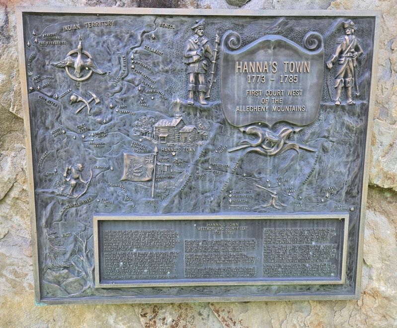
Hanna's Town
1785 - 1773
| — | First Court West of the Allegheny Mountains. | — |
Photographed by Bradley Owen, August 15, 2025
1. Hanna's Town Marker
Westmoreland County Seat
1773 - 1785
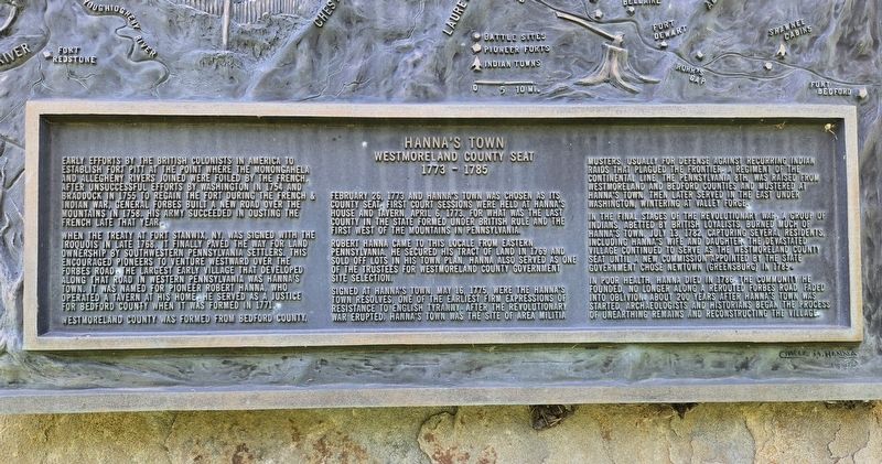
Early efforts by the British Colonists in America to establish Fort Pitt at the point where the Monongahela and Allegheny Rivers joined were foiled by the French. After unsuccessful efforts by Washington in 1754 and Braddock in 1755 to regain the fort during the French & Indian War, General Forbes built a new road over the mountains in 1758. His army succeeded in ousting the French late that year.
When the treaty at Fort Stanwix, NY, was signed with the Iroquois in late 1768, it finally paved the way for land ownership by southwestern Pennsylvania settlers. This encouraged pioneers to venture westward over the Forbes Road. The largest early village that developed along that road in western Pennsylvania was Hanna's Town. It was named for pioneer Robert Hanna, who operated a tavern at his home. He served as a justice for Bedford County when it was formed in 1771.
Westmoreland County was formed from Bedford County, February 26, 1773 and Hanna's Town was chosen as its county seat. First court sessions were held at Hanna's house and tavern, April 6, 1773, for what
this page online
Robert Hanna came to this locale from eastern Pennsylvania. He secured his tract of land in 1769 and sold off lots in his town plan. Hanna also served as one of the trustees for Westmoreland County government site selection.
Signed at Hanna's Town, May 16, 1775, were the Hanna's Town Resolves, one of the earliest firm expressions of resistance to English tyranny. After the Revolutionary War erupted, Hanna's Town was the site of area militia musters, usually for defense against recurring Indian raids that plagued the frontier. A regiment of the Continental Line, the Pennsylvania 8th, was raised from Westmoreland and Bedford Counties and mustered at Hanna's Town, then later served in the east under Washington, wintering at Valley Forge.
In the final stages of the Revolutionary War a group of Indians, abetted by British loyalists, burned much of Hanna's Town, July 13, 1782, capturing several residents, including Hanna's wife and daughter. The devastated village continued to serve as the Westmoreland County seat until
Photographed by Bradley Owen, August 15, 2025
2. Hanna's Town Marker
In poor health, Hanna died in 1786. The community he founded, no longer along a rerouted Forbes Road, faded into oblivion. About 200 years after Hanna's Town was started, archaeologists and historians began the process of unearthing remains and reconstructing the village.
Erected 1990 by Westmoreland Historical Society.
Topics. This historical marker is listed in these topic lists: Government & Politics • Indigenous Peoples and Communities • Settlements & Settlers • War, French and Indian. A significant historical year for this entry is 1773.
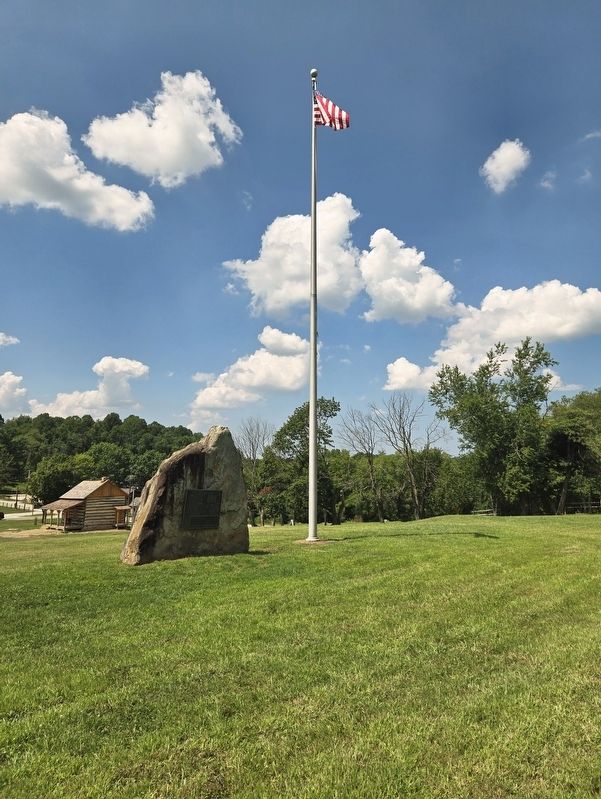
Location. 40° 20.628′ N, 79° 30.335′ W. Marker is in Hannastown, Pennsylvania, in Westmoreland County. It is in Hempfield Township. It is on Forbes Trail Road (Pennsylvania Route 1032) 0.1 miles west of Hannastown Road ( Route 1055), on the left when traveling west. Marker is located on the grounds of Historic Hanna's Town. Touch for map. Marker is at or near this postal address: 809 Forbes Trail Road, Hannastown PA 15635, United States of America. Touch for directions.

Regionally, this
Photographed by Bradley Owen, August 15, 2025
3. Hanna's Town Marker
Other nearby markers. At least 8 other markers are within walking distance of this marker: Peggy Shaw (about 300 feet away, measured in a direct line); For Safety and Survival (about 300 feet away); Historic Hanna's Town (about 400 feet away); Law and Order (about 400 feet away); Hannastown Fort (about 600 feet away); Hannastown (approx. 0.3 miles away); Hannastown Farm (approx. 0.6 miles away); Hannastown Honor Roll (approx. 0.8 miles away). Touch for a list and map of all markers in Hannastown.
Regarding Hanna's Town. The artwork for the marker was done by Charles M. Hanna.
Credits. This page was last revised on August 19, 2025. It was originally submitted on August 18, 2025, by Bradley Owen of Morgantown, West Virginia. This page has been viewed 196 times since then and 64 times this year. Photos: 1, 2, 3. submitted on August 19, 2025, by Bradley Owen of Morgantown, West Virginia.
