Fonthill in Niagara-on-the-Lake in Niagara Region, Ontario — Central Canada (North America)
Attack
Battle of Queenston Heights Walking Tour
⎯⎯⎯
L'attaque
Sentier auto-guidé de la bataille de Queenston
Photographed by Dale K. Benington, July 27, 2011
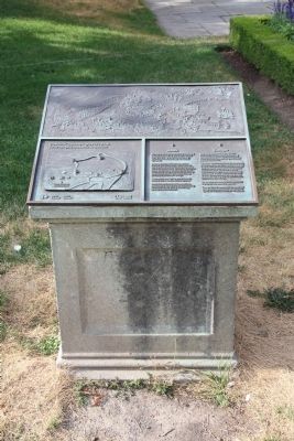
1. Attack Marker

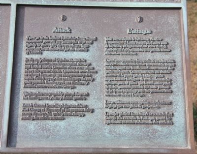
If you go to the lookout behind the Laura Secord monument you will see (across the river and slightly to your right) the area where a huge American force assembled for the invasion of Canada.
In the early hours of October 13, 1812 six hundred American soldiers crossed the river and landed on the Canadian shore somewhere above the present docks. Queenston was chosen as a target because it was an important point on the British supply line and because the only other possible landing spot was the heavily fortified area around Fort George.
The invaders were quickly pinned down at the landing area by heavy British gunfire.
British General Isaac Brock hastened from Fort George at the sound of the cannons firing across the river. He quickly took charge, sending for reinforcements.
On est aux premières heures du 13 octobre 1812, six cents soldats américains traversent la rivière et débarquent sur le sol canadien en amont des quais modernes. Queenston avait été choisie comme cible parce qu'elle était un poste important sur les lignes de ravitaillement des Britanniques, et parce que le seul autre point de débarquement possible sur cette portion de la rivière était trop près des positions bien défendues du fort George.
Les envahisseurs sont rapidement cloués sur la plage par une pluie de projectiles.
Le major général Isaac Brock accourt du fort George à la nouvelle de l'attaque, prend les opérations en main et demande des renforts.
Erected by Parks Canada. (Marker Number 1.)
Topics. This historical marker is listed in these topic
this page online
Location. 43° 9.614′ N, 79° 3.069′ W. Marker is in Niagara-on-the-Lake, Ontario, in Niagara Region. It is in Fonthill. It can be reached from Niagara Parkway. The marker is within Queenston Heights Park, 120 metres east of Brock's Monument, 30 metres east of the restaurant, and 8 metres south of the Laura Secord monument. Touch for map. Marker is at or near this postal address: 14184 Niagara Parkway, Niagara-on-the-Lake ON L0S 1J0, Canada. Touch for directions.

Regionally, this marker is on the Golden Horseshoe and in Niagara Canada. It is also in Central Canada. Globally, it is in North America, on the Great Lakes, in the Western Hemisphere, in the Western World, and in the Anglosphere. Historically, it finds itself in what was once a British colony, the Viceroyalty of New France, the Haudenosaunee (Iroquois) Confederacy, and Rupert’s Land.
Other nearby markers. At least 8 other markers are within walking distance of this marker: Laura Ingersoll Secord (a few steps from this marker); The Decisive Battle / La bataille décisive (about
Photographed by Dale K. Benington, July 27, 2011
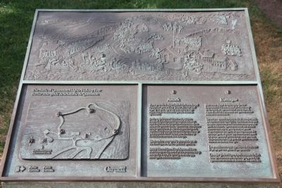
2. Attack Marker
View of the plaque on the top of the historical monument.
Related markers. Click here for a list of markers that are related to this marker. To better understand the relationship, study each marker in the order shown.
Photographed by Dale K. Benington, July 27, 2011
3. Attack Marker
A close-up view of the text on the top of the historical monument.
Photographed by Dale K. Benington, July 27, 2011
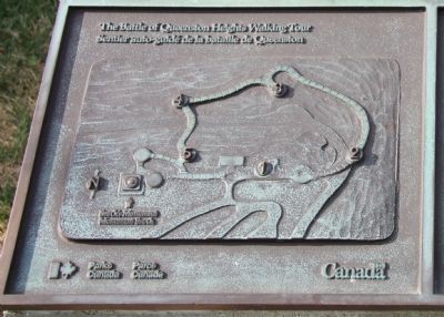
4. Attack Marker
A close-up view of the map, showing the route of the battlefield walking tour, on the top of the historical monument.
Photographed by Dale K. Benington, July 27, 2011
5. Attack Marker
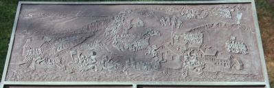
A close-up view of the battlefield scene sculpting on the top of the historical monument.
Photographed by Dale K. Benington, July 27, 2011
6. Attack Marker
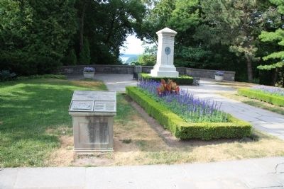
View of the historical monument situated just to the left of the Laura Secord monument, with the crest of the Niagara Escarpment in the background.
Photographed by Dale K. Benington, July 27, 2011
7. Attack Marker
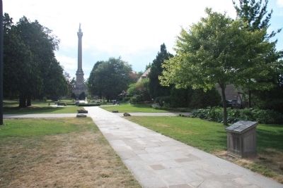
View looking west of the historical monument, situated along the walking path that leads to the Brock Memorial Monument, seen in the distant background.
Photographed by Dale K. Benington, July 27, 2011
8. Attack Marker
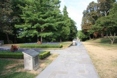
View of the historical monument, looking east along the main park walkway.
Credits. This page was last revised on November 10, 2025. It was originally submitted on January 16, 2012, by Dale K. Benington of Toledo, Ohio. This page has been viewed 949 times since then and 39 times this year. Last updated on August 18, 2025, by Kevin Westell of St. Catharines, Ontario. Photos: 1, 2, 3, 4, 5, 6, 7, 8. submitted on January 16, 2012, by Dale K. Benington of Toledo, Ohio. • Devry Becker Jones was the editor who published this page.
