Queenston in Niagara-on-the-Lake in Niagara Region, Ontario — Central Canada (North America)
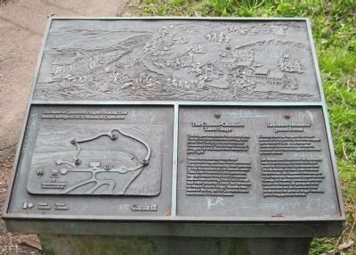
The Counter-Offensive Takes Shape
Battle of Queenston Heights Walking Tour
⎯⎯⎯
La contre-offensive prend forme
Sentier auto-guidé de la bataille de Queenston
Photographed by David Graff, April 28, 2012
1. The Counter-Offensive Takes Shape Marker

The Niagara escarpment rises above you. The British reinforcements arriving here from Fort George, in battle dress and exhausted from a "double quick march", struggled up this slope some distance to your right.
While the Americans controlled Queenston Heights they were prevented from properly establishing their position by the harassment of 120 Indians under Chief John Norton. In the meantime, Regular British troops and Canadian militia were arriving from Fort George and other outposts. Under the direction of Major General Roger Sheaffe, they climbed the heights of Queenston and assembled for the last battle.
Les Américains contrôlent les hauteurs, mais n'arrivent pas à renforcer leurs positions à cause du harcèlement des 120 Mohawks du chef John Norton. Entre-temps, les réguliers britanniques et les miliciens canadiens, partis du fort George et d'autres positions, arrivent au pas
this page online
Erected by Parks Canada. (Marker Number 4.)
Topics. This historical marker is listed in these topic lists: Colonial Era • War of 1812. A significant historical date for this entry is October 13, 1812.
Location. Marker is missing. It was located near 43° 9.705′ N, 79° 3.148′ W. Marker was in Niagara-on-the-Lake, Ontario, in Niagara Region. It was in Queenston. It could be reached from Niagara River Parkway 0.3 kilometers east of York Road (Local Road 81), on the right when traveling west. This marker's pedestal is in the forest 140 metres north-north-east of Brock's Monument, 120 metres west of Stop #3 on the walking tour, at the intersection of two unmarked trails. Touch for map. Marker was at or near this postal address: Niagara River Parkway, Niagara-on-the-Lake ON L0S 1J0, Canada. Touch for directions.

Regionally, this marker was on the Golden Horseshoe and in Niagara Canada. It was also in Central Canada. Globally, it was in North America, on the Great Lakes, in the Western Hemisphere,
Photographed by David Graff, April 28, 2012
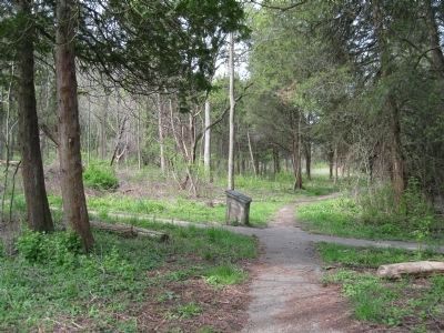
2. The Counter-Offensive Takes Shape Marker
The walking trail turns to the left at this marker, not straight ahead.
Other nearby markers. At least 8 other markers are within walking distance of this location: Seeds Of Reform (about 120 meters away, measured in a direct line); Home of William Lyon Mackenzie (about 120 meters away); Gordon's Quarter Medium Press (about 120 meters away); The Colonial Advocate (about 120 meters away); The Battle of Queenston Heights / la Bataille de Queenston (about 150 meters away); Sir Roger Hale Sheaffe (about 150 meters away); The Decisive Battle / La bataille décisive (about 150 meters away); Site of Redan Battery (about 150 meters away). Touch for a list and map of all markers in Niagara-on-the-Lake.
Related markers. Click here for a list of markers that are related to this marker. To better understand the relationship, study each marker in the order shown.
Additional keywords. Brock
Photographed by Dale K. Benington, June 10, 2012
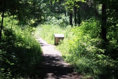
3. The Counter-Offensive Takes Shape Marker
View of the historic marker along the side of the walking trail.

Photographed by Kevin Westell, July 3, 2025
4. The plaque has been defaced.
Photographed by David Graff, April 28, 2012
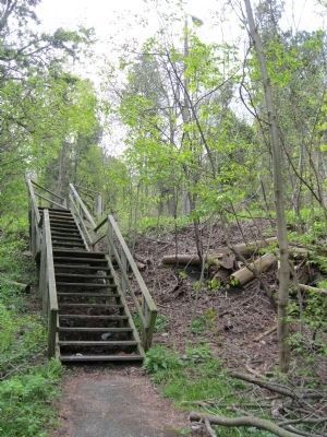
5. The Niagara Escarpment Slope
The British troops and Canadian militia advanced up the slope near here, without benefit of the stairs.
Credits. This page was last revised on November 10, 2025. It was originally submitted on May 20, 2012, by David Graff of Halifax, Nova Scotia. This page has been viewed 914 times since then and 33 times this year. Last updated on August 19, 2025, by Kevin Westell of St. Catharines, Ontario. Photos: 1, 2. submitted on May 20, 2012, by David Graff of Halifax, Nova Scotia. 3. submitted on June 28, 2012, by Dale K. Benington of Toledo, Ohio. 4. submitted on July 15, 2025, by Kevin Westell of St. Catharines, Ontario. 5. submitted on May 20, 2012, by David Graff of Halifax, Nova Scotia. • Devry Becker Jones was the editor who published this page.
