Queenston in Niagara-on-the-Lake in Niagara Region, Ontario — Central Canada (North America)
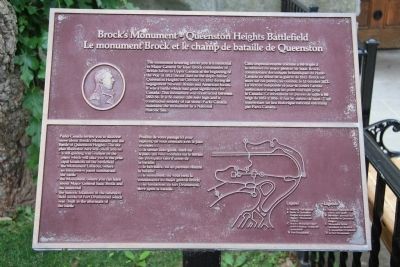
Brock's Monument - Queenston Heights Battlefield
Le monument Brock et le champ de bataille de Queenston
| — | [Start of Battle of Queenston Heights Walking Tour] | — |
Photographed by Dale K. Benington, July 27, 2011
1. Brock's Monument - Queenston Heights Battlefield Marker

The monument towering above you is a memorial to Major-General Sir Isaac Brock commander of British forces in Upper Canada at the beginning of the War of 1812. Brock died on the slopes below Queenston Heights on October 13, 1812, during an engagement between British and American forces. It was a battle which had great significance for Canada. This monument was constructed between 1853-56. It is 56 metres (184 feet) high and is constructed entirely of cut stone. Parks Canada maintains the monument as a National Historic Site.
Parks Canada invites you to discover more about Brock's Monument and the Battle of Queenston Heights. The site plan illustrated here will orient you to:
• a self-guiding trail (outline on the plan) which will take you to the principal locations on the battlefield
• the Monument Lookout, where an interpretive panel summarizes the battle
• the Monument, where you can learn about Major General Isaac Brock and his memorial
• the historic locations of the defensive field works of Fort Drummond which was built in the aftermath of the battle
Legend
A. Walking Trail stations
B. Battle
this page online
C. Brock's Monument interpretive displays (inside the monument).
D. Fort Drummond
Profitez de votre passage ici pour explorer, en vous orientant avec le plan ci-contre:
• le sentier auto-guidé, tracé sur le plan, qui vous conduira sur le terrain
des principaux faits d'armes de la bataille
• le belvédère, où un panneau résume la bataille
• le monument, où vous ferez la connaissance du major général Brock
• les fondations du fort Drummond, élevé après la bataille.
Légende
A. Panneaux explicatifs du sentier auto-guidé
B. Belvédère: panneau
Photographed by Dale K. Benington, July 27, 2011
2. Brock's Monument - Queenston Heights Battlefield Marker
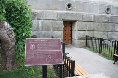
View of the historical marker situated near the entrance at the base of the Brock Memorial Monument, along the side of the footpath that leads to the monument's doored east side, entrance.
C. Monument Brock: panneaux sur Brock et le monument à l'intérieur
D. Le fort Drummond
Topics. This historical marker is listed in these topic lists: Colonial Era • War of 1812. A significant historical date for this entry is October 13, 1812.
Location. 43° 9.607′ N, 79° 3.175′ W. Marker is in Niagara-on-the-Lake, Ontario, in Niagara Region. It is in Queenston. It can be reached from Niagara River Parkway. The marker is within Queenston Heights Park, adjacent (on the east side of) Brock's Monument. Touch for map. Marker is at or near this postal address: 14184 Niagara River Pkwy, Niagara-on-the-Lake ON L0S 1J0, Canada. Touch for directions.

Regionally, this marker is on the Golden Horseshoe and in Niagara Canada. It is also in Central Canada. Globally, it is in North America, on the Great Lakes, in the Western Hemisphere, in the Western World, and in the Anglosphere. Historically, it finds itself in what was once a British colony, the Viceroyalty of New France, the Haudenosaunee (Iroquois) Confederacy, and Rupert’s Land.
Other nearby markers. At least 8 other markers are within
Photographed by Dale K. Benington, July 27, 2011
3. Brock's Monument - Queenston Heights Battlefield Marker
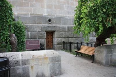
Another, more distant view, of the historical marker situated very near the east side entrance to Brock's memorial monument.
Photographed by Dale K. Benington, July 27, 2011
4. Brock's Monument - Queenston Heights Battlefield Marker
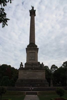
A distant view of the north side of General Isaac Brock Memorial Monument, with the historical marker being situated out of our field of vision, on the east (left) side of the monument.
Photographed by Dale K. Benington, June 10, 2012
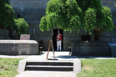
5. Brock's Monument - Queenston Heights Battlefield Marker
Another view of the historical marker situated very near the east side entrance to Brock's memorial monument with a view of a War of 1812, English soldier, reinactor, standing at the entrance.
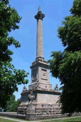
Photographed by Dale K. Benington, June 10, 2012
6. Brock's Monument - Queenston Heights Battlefield Marker
A distant view of the southwest side of General Isaac Brock Memorial Monument, with the historical marker being situated out of our field of vision, on the east (right) side of the monument.
Credits. This page was last revised on November 10, 2025. It was originally submitted on February 2, 2012, by Dale K. Benington of Toledo, Ohio. This page has been viewed 1,216 times since then and 76 times this year. Last updated on August 19, 2025, by Kevin Westell of St. Catharines, Ontario. Photos: 1, 2, 3, 4. submitted on February 3, 2012, by Dale K. Benington of Toledo, Ohio. 5, 6. submitted on June 29, 2012, by Dale K. Benington of Toledo, Ohio. • Devry Becker Jones was the editor who published this page.
