South Pittsburg in Marion County, Tennessee — The American South (East South Central)
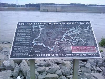
The TVA System of Multipurpose Dams
Nickajack Dam
| — | Built for the people of the United States of America | — |
Photographed by Lee Hattabaugh, August 8, 2011
1. The TVA System of Multipurpose Dams Marker
The Tennessee River has its headwaters in the mountains of Tennessee, Virginia, North Carolina and Georgia. The main stream forms at Knoxville, where the Houston and the French Broad Rivers join.
The valley, 41,000 square miles in area, receives an average of 52 inches of rain a year. In terms of water discharged into the Ohio and Mississippi, the Tennessee River is about equal in size to the Missouri.
The Tennessee Valley Authority has harnessed the river with a multi-purpose system of dams and reservoirs which regulates floods, improves navigation, and generates electric power.
High dams on the tributaries create large storage reservoirs which hold back flood waters, releasing them when necessary to maintain navigation depths downstream, and at the same time generating electric power. The system also helps protect the lower Ohio and Mississippi Valleys.
The nine main river dams, with their locks, form a navigable channel 650 miles long, from Knoxville to the Ohio River, an important arm of the nation's inland waterway system connecting 20 states.
Having developed virtually all the river power resources, TVA has built huge
this page online
NICKAJACK DAM
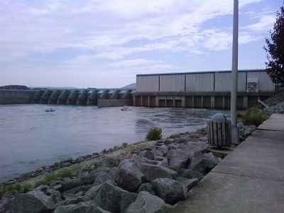
You are now at Nickajack Dam, a multipurpose dam on the main stream of the Tennessee River. It generates electricity and forms a 46-mile link in the Tennessee Waterway. Nickajack was built 1964-1968 to replace Hales Bar Dam 6 miles upstream. Completed in 1913, Hales Bar was built on leaking limestone foundations and had to be demolished.
Erected 2008 by Tennessee Valley Authority.
Topics. This historical marker is listed in these topic lists: Man-Made Features • Waterways & Vessels. A significant historical date for this entry is November 1, 1913.
Location. Marker has been reported missing. It was located near 35° 0.167′ N, 85° 37.367′ W. Marker was
Photographed by Lee Hattabaugh, August 8, 2011
2. Nickajack Dam
downstream side and power plant (to the right)

Regionally, this marker was in the American South, specifically in the Upper South, in Appalachia, and specifically in Southern Appalachia. Globally, it was in North America, the Western Hemisphere, the Western World, and the Anglosphere. Historically, it found itself in what was once the territory of the Mississippian Culture, one of the Confederate States of America, and the Antebellum South.
Other nearby markers. At least 8 other markers are within 5 miles of this location, measured as the crow flies: Love's Ferry (approx. 0.8 miles away); Civil War in Tennessee (approx. 4 miles away); Fort McCook (approx. 4.2 miles away); Ebenezer Church / The Gordon Family (approx. 4½ miles away in Alabama); Federal-Georgia Road
Photographed by Lee Hattabaugh, August 8, 2011
3. Nickajack Dam
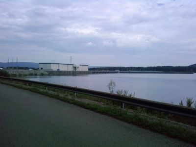
upstream side
Another marker is no longer nearby. Nickajack Cave (was approx. 3.9 miles away but has been confirmed missing).
Related markers. Click here for a list of markers that are related to this marker.
Credits. This page was last revised on September 7, 2025. It was originally submitted on August 9, 2011, by Lee Hattabaugh of Capshaw, Alabama. This page has been viewed 1,223 times since then and 75 times this year. Last updated on August 21, 2025, by Edward Troxel of Creal Springs, Illinois. Photos: 1, 2, 3. submitted on August 9, 2011, by Lee Hattabaugh of Capshaw, Alabama. • James Hulse was the editor who published this page.
