Joshua Tree National Park in Riverside County, California — The American West (Pacific Coastal)
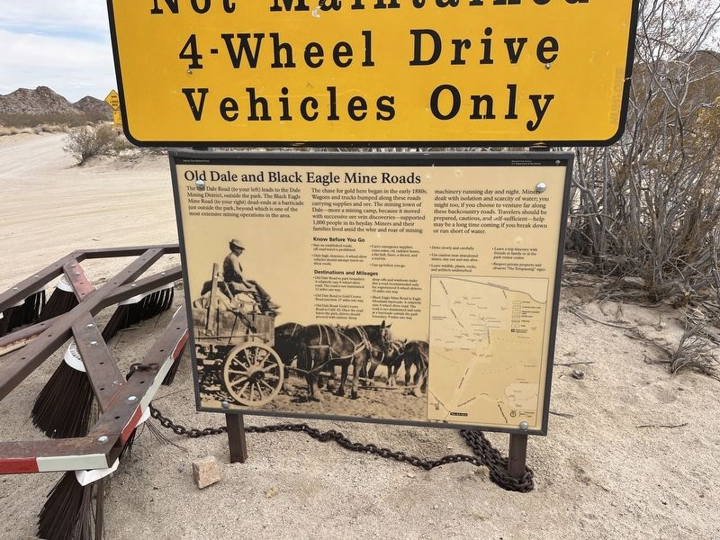
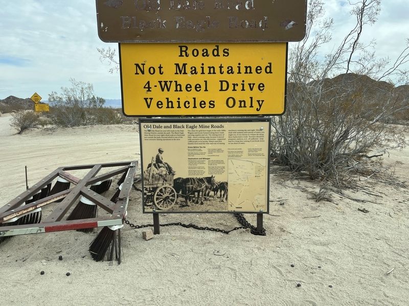
Old Dale and Black Eagle Mine Roads
Photographed by Adam Margolis, March 28, 2025
1. Old Dale and Black Eagle Mine Roads Marker
The chase for gold here began in the early 1880s. Wagons and trucks bumped along these roads carrying supplies and ore. The mining town of Dale-more a mining camp, because it moved with successive ore vein discoveries-supported 1,000 people in its heyday. Miners and there families lived amid the whir and roar of mining machinery running day and night. Miners dealt with isolation and scarcity of water; you might too if you choose to venture far along these backcountry roads. Travelers should be prepared, cautious, and self-sufficent-help may be a long time coming if you break down or run short of water.
Erected by National Park Service.
Topics. This historical marker is listed in these topic lists: Industry & Commerce • Parks & Recreational Areas • Roads & Vehicles • Settlements & Settlers.
Location. 33° 49.695′ N, 115° 45.531′ W.
this page online

Regionally, this marker is in Greater Los Angeles and in the Peninsular Ranges. It is also in the American Southwest. Globally, it is in North America, on the Ring of Fire, on the Pacific Rim, in the Western Hemisphere, in the Western World, and in the Anglosphere. Historically, it finds itself in what was once New Spain and also Mexico’s Alta California.
Other nearby markers. At least 8 other markers are within 12 miles of this marker, measured as the crow flies: Where Are The Joshua Trees? (approx. 6.7 miles away); Barren or Bountiful (approx. 8½ miles away); Young Divisional Camp (approx. 11½ miles away); California-Arizona Maneuver Area (approx. 11.7 miles away); Coachella Valley Recipients (approx. 11.7 miles away); The Desert Training Center (approx. 11.7 miles away); a different marker also named Desert Training Center (approx. 11.7 miles away); Camp Young Airstrip (approx. 11.7 miles

Photographed by Adam Margolis, March 28, 2025
2. Old Dale and Black Eagle Mine Roads Marker
Photographed by Adam Margolis, March 28, 2025
3. Old Dale and Black Eagle Mine Roads Marker
Credits. This page was last revised on August 24, 2025. It was originally submitted on August 21, 2025, by Adam Margolis of Mission Viejo, California. This page has been viewed 120 times since then and 45 times this year. Photos: 1, 2, 3. submitted on August 21, 2025, by Adam Margolis of Mission Viejo, California. • Andrew Ruppenstein was the editor who published this page.
Editor’s want-list for this marker. Closeup photo of the marker. • Can you help?
