
Glen Arbor Township in Leelanau County, Michigan — The American Midwest (Great Lakes)
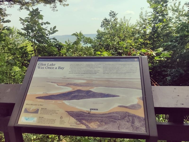
Glen Lake Was Once a Bay
Photographed by John Ridley, August 9, 2025
1. Glen Lake Was Once a Bay Marker
Eventually, the glaciers thawed, turning their deep tracks into large lakes of meltwater. One of these, Lake Nipissing, gradually became Lake Michigan as its water level fell.
Meanwhile, waves were eroding beaches and bluffs. Currents carried sediment along the shore to form sandbars. By about 2,000 years ago, these currents had deposited enough on either side of an island (that we now know as Alligator Hill) to landlock Glen Lake. Over time, grasses and trees took root. Today, this forested sandbar is where you'll find the town of Glen Arbor–and a beach of ancient sand.
Erected by National Park Service.
Topics. This historical marker is listed in these topic lists: Environment • Natural Features.
Location. 44° 52.08′ N, 86° 2.826′ W. Marker is in Glen Arbor, Michigan, in Leelanau County. It is in Glen Arbor Township. It is
this page online

Regionally, this marker is in Northern Michigan Lower Peninsula, in the Grand Traverse Bay Region, and in one of the Lake Michigan Shore counties. It is also in the American Midwest. Globally, it is in North America, on the Great Lakes, in the Western Hemisphere, in the Western World, and in the Anglosphere. Historically, it finds itself in what was once the Northwest Territory.
Other nearby markers. At least 8 other markers are within 3 miles of this marker, measured as the crow flies: D.H. Day's Million-Dollar Plan (a few steps from this marker); Pierce Stocking (approx. half a mile away); Sand and Ice (approx. one mile away); The Moving Dune (approx. 1.1 miles away); Mother Bear Is Migrating (approx. 1.2 miles away); Of Wrecks and Water Trails (approx. 1.2 miles away); The Legend of the Manitou Islands and the Sleeping Bear (approx. 1.2 miles away); Early State Parks (approx. 2.6 miles away). Touch for a list and map of all markers in Glen Arbor.
Credits. This page was last revised on August 24, 2025. It was originally submitted on August 23, 2025, by John Ridley of Chelsea, Michigan. This page has been viewed 85 times since then and 16 times this year. Photo 1. submitted on August 23, 2025, by John Ridley of Chelsea, Michigan. • Andrew Ruppenstein was the editor who published this page.
