Bloomingdale in DuPage County, Illinois — The American Midwest (Great Lakes)
Bloomingdale's Farming History
Photographed by Sean P. Flynn, August 23, 2025
1. Bloomingdale's Farming History Marker
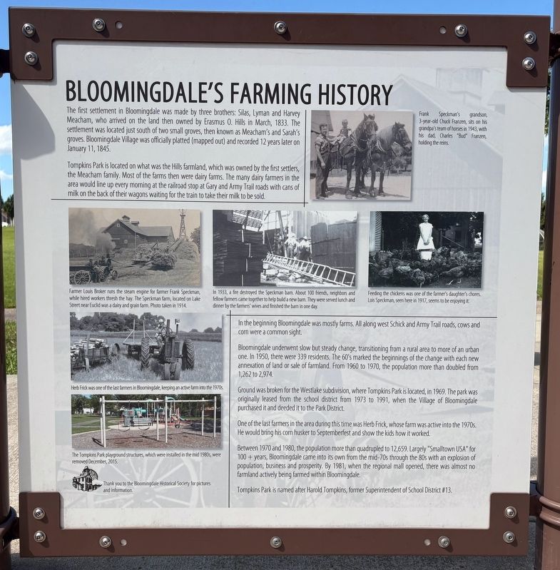
Tompkins Park is located on what was the Hills farmland, which was owned by the first settlers, the Meacham family. Most of the farms then were dairy farms. The many dairy farmers in the area would line up every morning at the railroad stop at Gary and Army Trail roads with cans of milk on the back of their wagons waiting for the train to take their milk to be sold.
In the beginning Bloomingdale was mostly farms. All along west Schick and Army Trail roads, cows and corn were a common sight.
Bloomingdale underwent slow but steady change, transitioning from a rural area to more of an urban one. In 1950, there were 339 residents. The 60's marked the beginnings of the change with each new annexation of land or sale of farmland. From 1960 to 1970,
this page online
Ground was broken for the Westlake subdivision, where Tompkins Park is located, in 1969. The park was originally leased from the school district from 1973 to 1991, when the Village of Bloomingdale purchased it and deeded it to the Park District.
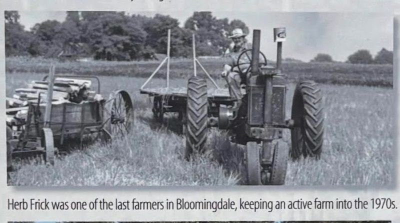
One of the last farmers in the area during this time was Herb Frick, whose farm was active into the 1970s. He would bring his corn husker to Septemberfest and show the kids how it worked.
Between 1970 and 1980, the population more than quadrupled to 12,659. Largely "Smalltown USA" for 100 years, Bloomingdale came into its own from the mid-70s through the 80s with an explosion of population, business and prosperity. By 1981, when the regional mall opened, there was almost no farmland actively being farmed within Bloomingdale.
Tompkins Park is named after Harold Tompkins, former Superintendent of School District #13.
[Photo captions:]
Top photo:
Frank Speckman's grandson, 3-year-old Chuck Franzen, sits on his grandpa's team of horses in 1943, with his dad, Charles "Bud" Franzen, holding the reins.
Middle-left photo:
Farmer
Photographed by Sean P. Flynn, August 23, 2025
2. Bloomingdale's Farming History Marker in Tompkins Park
Middle-center photo:
In 1933, a fire destroyed the Speckman barn. About 100 friends, neighbors and fellow farmers came together to help build a new barn. They were served lunch and dinner by the farmers' wives and finished the barn in one day.
Middle-right photo:
Feeding the chickens was one of the farmer's daughter's chores. Lois Speckman, seen here in 1917, seems to be enjoying it.
Second photo from bottom:
Herb Frick was one of the last farmers in Bloomingdale, keeping an active farm into the 1970s
Bottom photo:
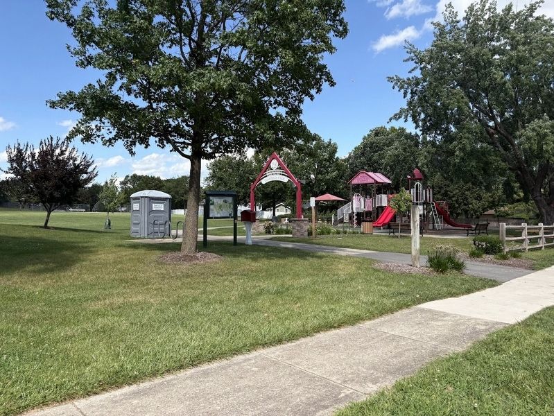
The Tompkins Park playground structures, which were installed in the mid 1980s, were removed December, 2015.
Topics. This historical marker is listed in these topic lists: Agriculture • Parks & Recreational Areas • Railroads & Streetcars • Settlements & Settlers. A significant historical month for this entry is March 1833.
Location. 41° 56.747′ N, 88° 4.514′ W. Marker is in Bloomingdale, Illinois, in DuPage
Photographed by Sean P. Flynn, August 23, 2025
3. Herb Frick
Close-up of the photo of Herb Frick that is on the sign.

Regionally, this marker is in Greater Chicago. It is also in the American Midwest. Globally, it is in North America, on the Great Lakes, in the Western Hemisphere, in the Western World, and in the Anglosphere. Historically, it finds itself in what was once the territory of the Mississippian Culture and also the Northwest Territory.
Other nearby markers. At least 8 other markers are within 3 miles of this marker, measured as the crow flies: Bloomingdale's Holstein Mill (here, next to this marker); Labyrinth Fun Facts (approx. 0.4 miles away); Veterans Memorial (approx. 0.9 miles away); Heaven's Brigade Memorial (approx. 1.1 miles away); Maple Lake Makeover (approx. 1.1 miles away); Ukraine Holodomor Memorial (approx. 1.1 miles away); Holodomor (approx. 1.1 miles away); Roselle-Bochnia Sisters Cities Peace Pole (approx. 2½ miles away). Touch for a list and map
Photographed by Sean P. Flynn, August 23, 2025
4. Tompkins Park playground
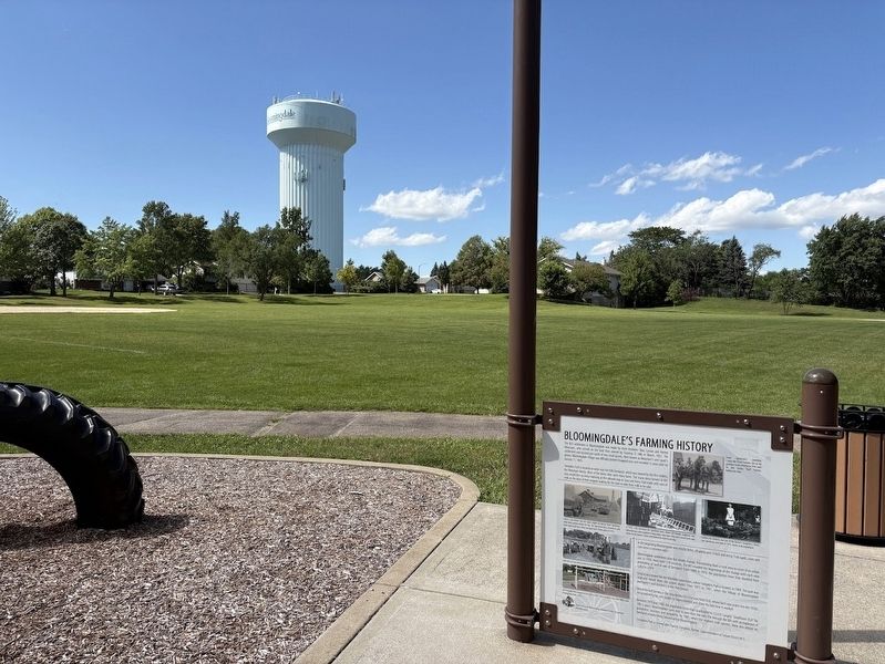
Two back-to-back historical markers about Bloomingdale's agricultural past can be found near the playground.
More about this marker. Another marker about Bloomingdale's Holstein Mill is on the rear of this one.
Also see . . .
1. Bloomingdale History. From the Village of Bloomingdale
Excerpt: "The Village of Bloomingdale can trace its founding to the Meacham family. In 1833, the Meacham brothers, Lyman, Silas, and Harvey Meacham started farming an area of 1,200 acres of land, which is an area now known as Medinah."(Submitted on August 24, 2025, by Sean P. Flynn of Oak Park, Illinois.)
2. Tompkins Park. From the Bloomingdale Park District (Submitted on August 24, 2025, by Sean P. Flynn of Oak Park, Illinois.)
Credits. This page was last revised on March 5, 2026. It was originally submitted on August 24, 2025, by Sean P. Flynn of Oak Park, Illinois. This page has been viewed 194 times since then and 111 times this year. Photos: 1, 2, 3, 4. submitted on August 24, 2025, by Sean P. Flynn of Oak Park, Illinois.
