
Goderich in Huron County, Ontario — Central Canada (North America)
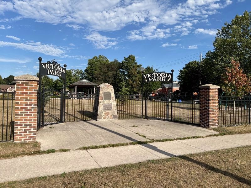
The Canada Company Burial Ground

Photographed by Tim Boyd, August 22, 2025
1. The Canada Company Burial Ground Marker
By 1863 the 33rd Huron Battalion had erected a drill shed on the site, and the Agricultural Society held its fairs here. St. Patrick's Ward-School was rebuilt in 1875. In October 1902, a fire destroyed these structures. The following spring, Town Council created Victoria Park.
Though all individual grave markers are long gone, there are believed to be pioneer interments-remaining in the park. Spare a thought for those who rest here, and for history.
Topics. This historical marker is listed in these topic lists: Cemeteries & Burial Sites • Parks & Recreational Areas • Settlements & Settlers. A significant historical year for this entry is 1827.
Location. 43° 44.759′ N, 81° 42.455′ W. Marker is in Goderich, Ontario, in Huron County. It is at the intersection of Victoria Street North
this page online

Regionally, this marker is in the Huron-Perth-Waterloo-Wellington Area and in Southwestern Ontario. It is also in Central Canada. Globally, it is in North America, on the Great Lakes, in the Western Hemisphere, in the Western World, and in the Anglosphere. Historically, it finds itself in what was once a British colony, the Viceroyalty of New France, the Haudenosaunee (Iroquois) Confederacy, and Rupert’s Land.
Other nearby markers. At least 8 other markers are within walking distance of this marker: Hotel de Wereld (about 90 meters away, measured in a direct line); Huron County Gaol (approx. 0.4 kilometers away); Goderich Public Library Renovation and Expansion (approx. 0.6 kilometers away); Goderich Dominion Post Office and Customs Office (approx. 0.6 kilometers away); Tornado 2011 (approx. one kilometer away); Canada Company Headquarters (approx. one kilometer away); Thomas Mercer Jones, 1795-1868 (approx.
Photographed by Tim Boyd, August 22, 2025
2. The Canada Company Burial Ground Marker
The lower of the two on the cairn
Credits. This page was last revised on August 27, 2025. It was originally submitted on August 25, 2025, by Tim Boyd of Hamilton, Ontario. This page has been viewed 141 times since then and 41 times this year. Photos: 1, 2. submitted on August 25, 2025, by Tim Boyd of Hamilton, Ontario. • Andrew Ruppenstein was the editor who published this page.
