Allanburg near Thorold in Niagara Region, Ontario — Central Canada (North America)
The Old Welland Canal
Le Vieux Canal de Welland
Photographed by Dale K. Benington, June 11, 2012
1. The Old Welland Canal Marker

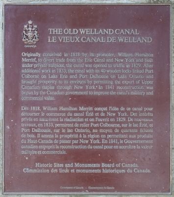
Originally conceived in 1818 by its promoter, William Hamilton Merritt, to divert trade from the Erie Canal and New York and built under private auspices, the canal was opened to traffic in 1829. After additional work in 1833, the canal with its 40 wooden locks linked Port Colborne on Lake Erie and Port Dalhousie on Lake Ontario and brought prosperity to its environs by permitting the export of Upper Canadian staples through New York. In 1841 reconstruction was begun by the Canadian government to improve the canal's military and commercial value.
Dès 1818, William Hamilton Merritt conçut l'idée de ce canal pour détourner le commerce du canal Érié et de New York. Des intérêts privés en assurèrent la réalisation et on l'ouvrit en 1829. De nouveaux travaux, en 1833, permirent de relier Port Colbourne, sur le lac Érié, et Port Dalhousie, sur le lac Ontario, au moyen de quarente écluses de bois. Il amena la prospérité à la région en permettant aux produits de Haut-Canada de passer par New York. En 1841, le Gouvernement canadien entreprit la reconstruction du canal pour en accroître la valeur militaire
this page online
Erected by Historic Sites and Monuments Board of Canada.
Topics and series. This historical marker is listed in these topic lists: Colonial Era • Industry & Commerce • Waterways & Vessels. In addition, it is included in the The Welland Canals series list. A significant historical year for this entry is 1818.
Location. 43° 4.585′ N, 79° 12.683′ W. Marker is near Thorold, Ontario, in Niagara Region. It is in Allanburg. It is on Hwy 20 (Lundy's Lane) just east of Holland Road, on the right when traveling east. This historical marker is located on a stone cairn, in a small roadside park, at the west end of the bridge carrying Hwy 20 (Lundy's Lane) over the Welland Canal. Touch for map. Marker is at or near this postal address: 3330 Hwy 20, Thorold ON L0S 1A0, Canada. Touch for directions.

Regionally, this marker is on Ontario’s Golden Horseshoe and in Niagara Canada. It is also in Central Canada. Globally, it is in North America, on the Great Lakes, in the Western Hemisphere, in the Western World, and in the Anglosphere. Historically, it finds itself in what was once a British colony,
Photographed by Dale K. Benington, June 11, 2012
2. The Old Welland Canal Marker
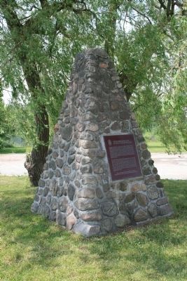
View of the historical marker affixed to a stone cairn.
Other nearby markers. At least 8 other markers are within 5 kilometers of this marker, measured as the crow flies: Celebrating 200 Years of the Welland Canal (here, next to this marker); Allanburg United Church 1876 (approx. 0.3 kilometers away); Allanburg Village Cemetery c.1813 (approx. 0.4 kilometers away); The Beaverdams Church 1832 (approx. 3.3 kilometers away); Bouk Family Homestead 1855 (approx. 3.4 kilometers away); Old Beaverdams Burying Ground (Smith Cemetery) 1801 (approx. 3.4 kilometers away); Robert Ross House (approx. 3.9 kilometers away); Camp House (approx. 4 kilometers away). Touch for a list and map of all markers in Thorold.
Another marker is no longer nearby. Griffiths House c. 1922 (was approx. 3.5 kilometers away but has been confirmed missing).
Also see . . .
1. The Old Welland Canals Field Guide. This is a link to information provided by the oldwellandcanals website. (Submitted on June 20, 2013, by Dale K. Benington of Toledo, Ohio.)
2. Abandoned Ontario: the old Welland Canals. This
Photographed by Dale K. Benington, June 11, 2012
3. The Old Welland Canal Marker
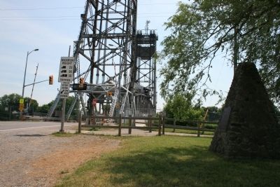
View, looking east along Canboro Road (Route 20), of the historical marker, with the bridge over the Welland Canal in the background.
3. Welland Canal. This is a link to information provided by Wikipedia, the free encyclopedia. (Submitted on June 20, 2013, by Dale K. Benington of Toledo, Ohio.)
Photographed by Dale K. Benington, June 11, 2012
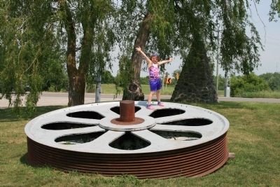
4. The Old Welland Canal, Roadside Park
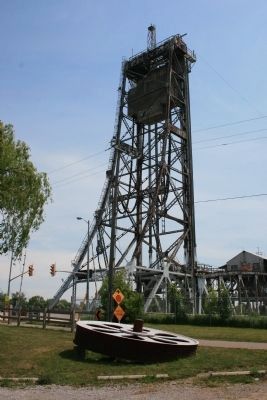
View of a giant pulley wheel (with the canal bridge in the background) that is part of the roadside display where the historical marker is located.
Photographed by Dale K. Benington, June 11, 2012
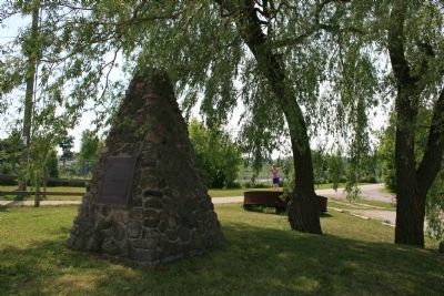
5. The Old Welland Canal Marker
View of the historical marker in the background of the roadside park display piece.
Photographed by Dale K. Benington, June 11, 2012
6. The Old Welland Canal Marker
View of the historical marker with the roadside park display in the background and a portion of the Welland Canal in the distant background.
Credits. This page was last revised on October 12, 2025. It was originally submitted on June 20, 2013, by Dale K. Benington of Toledo, Ohio. This page has been viewed 1,030 times since then and 36 times this year. Last updated on August 29, 2025, by Kevin Westell of St. Catharines, Ontario. Photos: 1, 2, 3. submitted on June 20, 2013, by Dale K. Benington of Toledo, Ohio. 4, 5, 6. submitted on June 21, 2013, by Dale K. Benington of Toledo, Ohio. • Andrew Ruppenstein was the editor who published this page.
