
Near Garrison in McLean County, North Dakota — The American Midwest (Upper Plains)
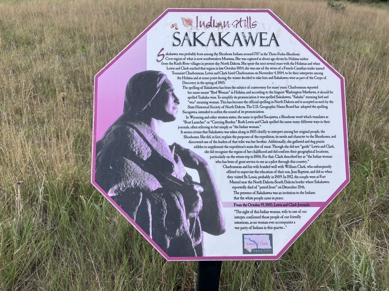
Sakakawea
Indian Hills
Photographed by Barry Swackhamer, July 23, 2025
1. Sakakawea Marker
The spelling of Sakakawea has been been the subject of controversy for many years. Charbonneau reported her name meant "Bird Women" in Hidatsa, and according to the linguist Washington Mathews, it should be spelled Tsakaka-wias. To simplify it pronunciation it was spelled Sakakawea, "Sakka" meaning bird and "wea" meaning woman. This has become the official spelling in North Dakota and is accepted as such by the State Historical Society of North
this page online
In Wyoming and other western states, the name is spelled Sacajawea, a Shoshone word which translates as "Boat Launcher" or "Carrying Burden." Both Lewis and Clark spelled the name many different ways in their journals, often referring to her simply as "the Indian woman."
It seems certain that Sakakawea was taken along in 1805 chiefly to interpret among her original people, the Shoshones. She did, in fact, explain the purposes of the expedition, its needs and character to the Shoshone and discovered one of the leaders of the tribe was her brother. Additionally, she gathered and dug prairie edibles to supplement the expedition's main diet of meat. Though she did not "guide" Lewis and Clark, she did recognize the region of her childhood and did confirm their geographical locations, particularly on the return trip in 1806. For that, Clark described her as "the Indian woman who has been of great service to me as a pilot through this country."
Charbonneau and his wife bonded well with William Clark, who subsequently

Photographed by Barry Swackhamer, July 23, 2025
2. Sakakawea Marker
The presence of Sakakawea was an invitation to the Indians that the white people came in peace.
Erected by Indian Hills Resort.
Topics and series. This historical marker is listed in these topic lists: Exploration • Indigenous Peoples and Communities • Women. In addition, it is included in the Lewis & Clark Expedition series list.
Location. 47° 35.901′ N, 102° 5.765′ W. Marker is near Garrison, North Dakota, in McLean County. It can be reached from the intersection of 73rd Avenue NW and 14th Street NW. The marker is located on the Nux Baa Ga (meansing “All the People” in Arikara) Trail. Touch for map. Marker is in this post office area: Garrison ND 58540, United States of America. Touch for directions.

Regionally, this marker is in North Dakota’s Mandan, Hidatsa, and Arikara Nation, in the Standing Rock Sioux Tribe, in the Drift Prairie, and on the Missouri Plateau. It is also in the American Lewis & Clark Corridor, on the prairies, and on the Northern Plains. Globally, it is in North America, the Western Hemisphere, the Western World, and the Anglosphere. Historically, it finds itself in what was once Rupert’s Land and also the Louisiana Purchase.
Other nearby markers. At least 8 other markers are within walking distance of this marker: Lake Sakakawea (a few steps from this marker); Lewis & Clark (within shouting distance of this marker); Contemporary Towns (about 400 feet away, measured in a direct line); Encampments (about 500 feet away); Nightwalker's Butte (about 500 feet away); a different marker also named Nightwalker's Butte (about 500 feet away); Four Bears Bridge (about 700 feet away); Geology (approx. 0.2 miles away). Touch for a list and map of all markers in Garrison.
Credits. This page was last revised on September 22, 2025. It was originally submitted on August 31, 2025, by Barry Swackhamer of Brentwood, California. This page has been viewed 107 times since then and 23 times this year. Photos: 1, 2. submitted on August 31, 2025, by Barry Swackhamer of Brentwood, California.
