Walden in Jackson County, Colorado — The American Mountains (Southwest)
Northwest Colorado
Heritage Journeys: roam with a view
| — | Boundless Landscapes & Spirited People | — |
Photographed by Cosmos Mariner, July 29, 2025
1. Northwest Colorado Marker
(north side)
(north side)
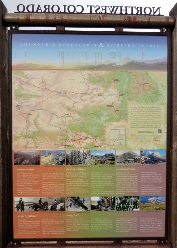
Unrelenting forces of nature have carved immense yet intimate landscapes in the remote northwest region of Colorado. Spanning 14,918 square miles, the area encompasses expansive areas of public lands — canyons and rivers, forests and wilderness, parks and peaks, mesas and plateaus.
The map denotes Heritage Journeys created by “locals” who know the less direct, more adventurous trails for exploration. Discover the region’s legacy of timeless places where you can roam with a view.
Canyons & Rivers
Irish Canyon Journey:
Rock art sites abound in the canyon of this 1,000-foot deep dry gorge.
Canyon Pintado Journey:
The striking rock art of the Fremont people in the “Painted Canyon,” dates back to 1200 BC.
Browns Park Journey:
Appearing much as it did one hundred years ago, this high desert valley was a favored Ute Indian wintering area — and given its access to three state borders, outlaws. Browns Park National Wildlife Refuge offers you wildlife viewing and scenic solitude.
Journey through Time:
The first Powell Expedition in 1869 ran the Green River in oak boats. Today, in Dinosaur National Monument you can raft the river or hike
this page online
Mesas & Plateaus
Mesa Journey:
Travel to Battlement Reservoir, a chain of lakes carved out by horse-drawn equipment in the 1890s. This pristine setting offers fishing and hiking.
Mesa Journey:
Along this route, Theodore Roosevelt hunted bear and lynx in 1905.
Rifle Falls Journey:
A scenic loop featuring a trio of side by side cascading waterfalls and limestone caves.
Whitehouse Mountain Journey:
Trek to Marble where, at 9,500 feet, marble was cut from the mountain and hauled over a three mile wagon road.
Forests & Wilderness
65 Million Years in 65 Miles Journey:
Explore geological time — from fossils and coal deposits to hot springs.
White River Ute Journey:
Through the ancestral home of the Ute Indians, this trail traces the history of conflict over land and ways of life.
Heritage Ranch Journey:
This loop passes ranches listed on local, state, and national registers of historic places.
Elkhead Journey:
Take a day-long trek through stunning California Park to Slater, a ranching town, and then to historic mines.
Cradle of Wilderness Journey:
Trappers Lake offers
Photographed by Cosmos Mariner, July 29, 2025
2. Northwest Colorado Marker (north side)
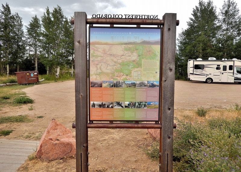
Looking south; Colorado Highway 14/125 crosses in the background - behind the marker.
Gore Pass Journey:
A stage route from Steamboat Springs to historic mining and railroad towns.
Mountains & Parks
Buffalo Pass Journey:
Rarely open before July 4th, this Continental Divide journey provides remarkable scenic vistas as the pass climbs over 3,000 feet. While in North Park don't miss Arapaho National Wildlife Refuge. Created in 1967, the Refuge provides habitat for waterfowl and moose. Bring your camera and take the six-mile self-guided tour to learn about the wildlife and habitats in the Refuge.
Hahns Peak Gold Journey:
After the gold bust, Hahns Peak became a mining ghost town, yet over time timber harvesting brought people back into the area. Today, Hahns Peak is a quiet historic village.
North Park Journey:
From Walden to Lake John, a remote 656-acre high plains lake, you travel across the Continental Divide to unique recreational opportunities.
Energy Trail
Douglas Pass Energy Trail:
Paralleling the Canyon Pintado Journey, this trail reveals the story of oil in Colorado. In the 1930s, oilmen drilled over a mile down to a vast pocket of trapped oil measuring ten miles long and five miles wide.
Roan Plateau Energy Trail:
The world's largest known source of oil shale was deposited 50 million years ago in an area north of Rifle. It is estimated that 1.8 trillion barrels of oil exists within the shale of the Roan Cliffs area.
Axial to Yampa River Energy Trail:
Traveling north on Hwy 13 to Craig you enter coal mining territory. This “black gold” enticed miners to the region beginning in the 1870s. Today, coal still supplies the state's energy needs as do the oil fields just south of the town of Milner.
North Park Energy Trail:
Glacial meltwater carved rock terraces and faults in the North Park basin, which trapped oil. The first oil well was drilled in the 1920s west of Walden. Named McCallum Field, this drill site has accounted for more than half the oil production in North Park.
[photo captions]
• Powell’s Second Expedition, Lodore Canyon, 1871
• Green and Yampa River from Harpers Corner
• On the trail to Trappers Lake, ca. 1900
• Trappers Lake and The Amphitheater
• Hahns Peak village celebrating the Fourth of July, 1907
• Hahns Peak in winter snow
• Theodore Roosevelt hunting in Garfield County, 1905
• Vast body of oil shale, ca. 1910
• Drilling near Rangely
• Garfield County’s Union Mine Workers, 1913
• Battlement reveals geological layers
Erected by History Colorado.
Topics. This historical marker is listed in these topic lists: Exploration • Indigenous Peoples and Communities • Parks & Recreational Areas • Settlements & Settlers.
Location. 40° 43.619′ N, 106° 17.189′ W. Marker is in Walden, Colorado, in Jackson County. It can be reached from Main Street (State Highway 14/125) just west of Grant Street, on the right when traveling west. The marker is in the interpretive wayside on the north side of Colorado Highway 14/125. Touch for map. Marker is at or near this postal address: 32677 Colorado Highway 14, Walden CO 80480, United States of America. Touch for directions.

Regionally, this marker is in the Colorado High Rockies and on the Continental Divide. It is also in the American Mountain West. Globally, it is in North America, the Rocky Mountains, the Western Hemisphere, the Western World, and the Anglosphere.
Other nearby markers. At least 7 other markers are within 3 miles of this marker, measured as the crow flies: A different marker also named Northwest Colorado (here, next to this marker); Hunting in the "Bull Pen" (approx. 2.9 miles away); Fur Hat: The Opening of North Park (approx. 2.9 miles away); Ranching: An Enduring Legacy (approx. 2.9 miles away); Riches From the Earth (approx. 2.9 miles away); Timber: A Growing Need (approx. 2.9 miles away); The “Iron Horse” Comes to North Park (approx. 2.9 miles away).
Related markers. Click here for a list of markers that are related to this marker. Northwest Colorado
Also see . . . Explore Northwest Colorado’s Boundless Landscapes, and Discover Ways of Life – Past and Present.
Excerpt: Through collaboration, interpret the vast heritage of Northwest Colorado and impart the legacy and stories of the region and its communities in order to generate economic vitality.(Submitted on September 1, 2025, by Cosmos Mariner of Cape Canaveral, Florida.)
Credits. This page was last revised on September 1, 2025. It was originally submitted on September 1, 2025, by Cosmos Mariner of Cape Canaveral, Florida. This page has been viewed 110 times since then and 31 times this year. Photos: 1, 2. submitted on August 31, 2025, by Cosmos Mariner of Cape Canaveral, Florida.
