Fonthill in Niagara-on-the-Lake in Niagara Region, Ontario — Central Canada (North America)
Navy Hall
Photographed by Dale K. Benington, July 27, 2011
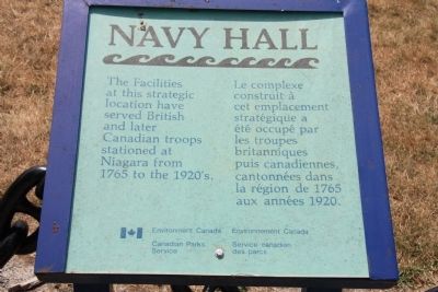
1. Navy Hall Marker

The facilities at this strategic location have served British and later Canadian troops stationed at Niagara from 1765 to the 1920's.
Erected by Canadian Parks Service.
Topics. This historical marker is listed in these topic lists: Colonial Era • War of 1812 • War, US Revolutionary. A significant historical year for this entry is 1765.
Location. 43° 15.138′ N, 79° 3.539′ W. Marker is in Niagara-on-the-Lake, Ontario, in Niagara Region. It is in Fonthill. It is on Ricardo Street 0.4 kilometers south of Melville Street, on the left when traveling south. This historical marker is located on the grounds of the Navy Hall, between the site of Fort George and the Niagara River, nearest to the Niagara River. Touch for map. Marker is at or near this postal address: 305 Ricardo Street, Niagara-on-the-Lake ON L0S 1J0, Canada. Touch for directions.

Regionally, this marker is on the Golden Horseshoe and in Niagara
this page online
Other nearby markers. At least 8 other markers are within walking distance of this marker: Later Years / Après la guerre de 1812 (here, next to this marker); The Early Years / Les premières décennies (here, next to this marker); John Graves Simcoe (within shouting distance of this marker); a different marker also named John Graves Simcoe (within shouting distance of this marker); Sir Isaac Brock's First Burial Site (about 210 meters away, measured in a direct line); The Battle of Fort George (approx. 0.3 kilometers away); a different marker also named Fort Niagara (approx. 0.3 kilometers away); a different marker also named A Strategic Site (approx. 0.3 kilometers away). Touch for a list and map of all markers in Niagara-on-the-Lake.
Other markers no longer nearby. Fort Niagara (was approx. 0.3 kilometers
Photographed by Dale K. Benington, July 27, 2011
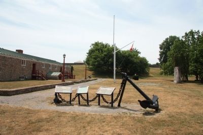
2. Navy Hall Marker
View of featured historical marker with a group of markers, on the grounds of Navy Hall, with a view of Navy Hall in the left background.
More about this marker. The Navy Hall is located on the Canadian side of the Niagara River, just a short distance upstream from Fort Niagara which is located on the United States side of the River. Because the Navy Hall was located within the range of the cannon situated at Fort Niagara, its structures ended up being destroyed by American artillery fire during the War of 1812.
Also see . . .
1. Navy Hall. This is a link to information provided by a web site that is Administered by Parks Canada. (Submitted on November 15, 2011, by Dale K. Benington of Toledo, Ohio.)
2. Navy Hall. This is a link to information provided by Wikipedia, the free encyclopedia. (Submitted on November 15, 2011, by Dale K. Benington of Toledo, Ohio.)
Photographed by Dale K. Benington, July 27, 2011
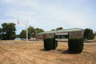
3. Navy Hall
View of Navy Hall with the Niagara River in the background.
Photographed by Dale K. Benington, July 27, 2011
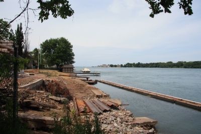
4. View of Fort Niagara
View from the grounds of the Navy Hall, looking north along the Niagara River towards Fort Niagara and Lake Ontario beyond the fort.
Photographed by Dale K. Benington, July 27, 2011
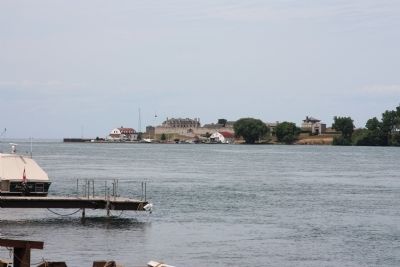
5. View of Fort Niagara
Another view from the grounds of the Navy Hall, looking north along the Niagara River towards Fort Niagara.
Credits. This page was last revised on November 10, 2025. It was originally submitted on November 13, 2011, by Dale K. Benington of Toledo, Ohio. This page has been viewed 674 times since then and 25 times this year. Last updated on September 2, 2025, by Kevin Westell of St. Catharines, Ontario. Photos: 1, 2, 3, 4, 5. submitted on November 20, 2011, by Dale K. Benington of Toledo, Ohio. • Devry Becker Jones was the editor who published this page.
