Gunnison in Gunnison County, Colorado — The American Mountains (Southwest)
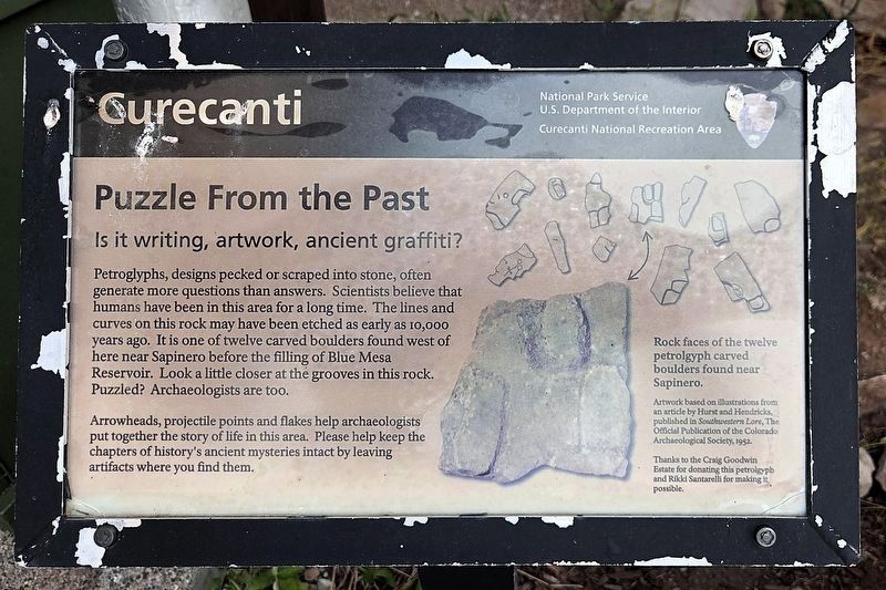
Puzzle from the Past
Is it writing, artwork, ancient graffiti?
| — | Curecanti National Recreation Area | — |
Photographed by Cosmos Mariner, July 21, 2025
1. Puzzle from the Past Marker
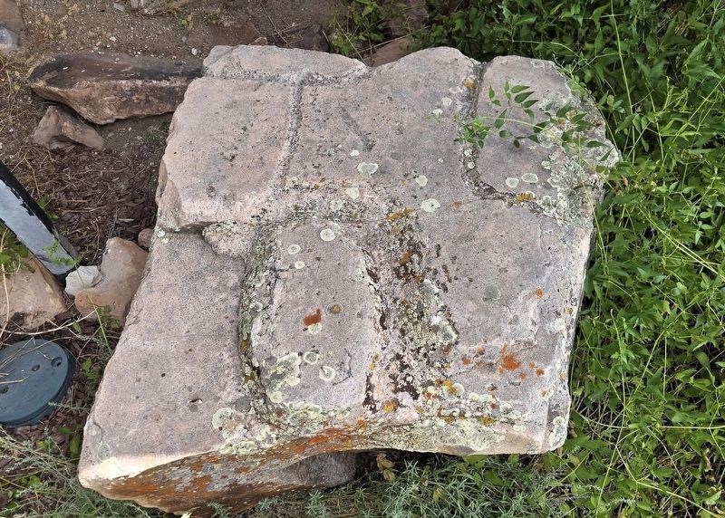
Petroglyphs, designs pecked or scraped into stone, often generate more questions than answers. Scientists believe that humans have been in this area for a long time. The lines and curves on this rock may have been etched as early as 10,000 years ago. It is one of twelve carved boulders found west of here near Sapinero before the filling of Blue Mesa Reservoir. Look a little closer at the grooves in this rock. Puzzled? Archaeologists are too.
Arrowheads, projectile points and flakes help archaeologists put together the story of life in this area. Please help keep the chapters of history's ancient mysteries intact by leaving artifacts where you find them.
Erected by National Park Service, United States Department of the Interior.
Topics. This historical marker is listed in these topic lists: Anthropology & Archaeology • Indigenous Peoples and Communities.
Location. 38° 28.015′ N, 107° 9.954′ W. Marker is in Gunnison, Colorado, in Gunnison County. It can be reached from Elk Creek 0.3 miles south of U.S. 50, on the right when traveling south. The marker is located
this page online

Regionally, this marker is in the Colorado High Rockies. It is also in the American Mountain West. Globally, it is in North America, the Rocky Mountains, the Western Hemisphere, the Western World, and the Anglosphere.
Other nearby markers. At least 8 other markers are within 10 miles of this marker, measured as the crow flies: Trains and Trout (approx. 2.4 miles away); a different marker also named Trains and Trout (approx. 3.2 miles away); Forming a Pinnacle (approx. 5.3 miles away); If You Only Knew (approx. 5.3 miles away); Wayne N. Aspinall (approx. 7.4 miles away); Crossing the Canyon (approx. 7.4 miles away); Riverfront Recreation (approx. 8.1 miles away); Storage Units (approx. 9.7 miles away). Touch for a list and map of all markers in Gunnison.
Also see . . . Curecanti National Recreation Area: History & Culture (National Park Service).
Excerpt: Human occupation of this area dates(Submitted on September 5, 2025, by Cosmos Mariner of Cape Canaveral, Florida.)to at least 10,000 years ago. Archeologists have uncovered evidence of prehistoric hunting and gathering camps around present day Curecanti. Peoples from traditionally associated tribes moved seasonally between the mountains and present-day Montrose and Grand Junction. They were attracted here by the abundance of game in the dry hills and river valleys, and by the vegetation in the canyons and on the mesas.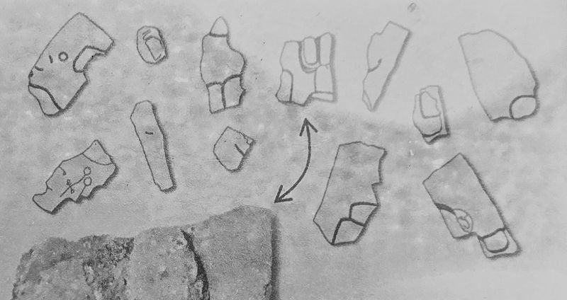 2. Marker detail: Rock faces of the twelve petroglyph carved boulders found near SapineroArtwork based on illustrations from an article by Hurst and Hendricks, published in Southwestern Lore, The Official Publication of the Colorado Archaeological Society, 1952.
Thanks to the Craig Goodwin Estate for donating this petroglyph and Rikki Santarelli for making it possible.
Fur traders and miners blazed the northern branch of the Old Spanish Trail from Santa Fe to Los Angeles. This trail first linked the Utes to Anglo and Spanish commerce. As mining operations sprung up in the mountains of Gunnison County, homesteaders built farms and ranches along the Gunnison River.
Photographed by Cosmos Mariner, July 21, 2025
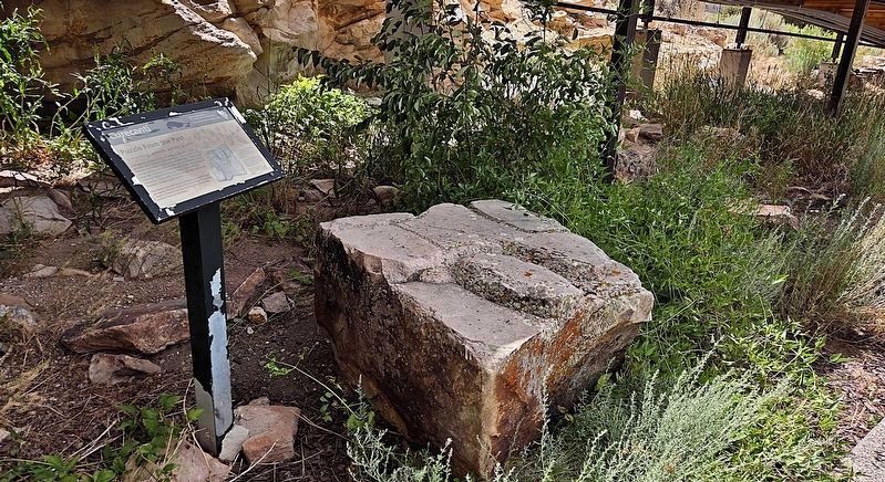
3. Puzzle from the Past Marker
Elk Creek Visitor Center is in the background.
Photographed by Cosmos Mariner, July 21, 2025
4. Puzzle from the Past — Petroglyph
Photographed by Cosmos Mariner, July 21, 2025
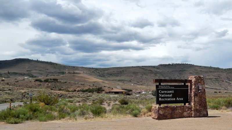
5. Curecanti National Recreation Area
Turn south here from US Highway 50 to access the Elk Creek Visitor Center.
Credits. This page was last revised on September 5, 2025. It was originally submitted on September 3, 2025, by Cosmos Mariner of Cape Canaveral, Florida. This page has been viewed 101 times since then and 30 times this year. Photos: 1, 2, 3, 4, 5. submitted on September 5, 2025, by Cosmos Mariner of Cape Canaveral, Florida.
